THE RESERVE
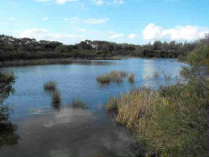
Balnarring Beach Foreshore is a 70ha nature
reserve bordered by Merricks Creek and Western Port Bay. It forms part of the Western Port Biosphere, an internationally recognised
Ramsar site (wetland) and is managed for conservation.
The
historical landscape of the Reserve was dominated by coastal banksia with an understorey of coast teatree. The foreshore would
have been dominated by vast dune systems protecting the inland landscape and coastal vegetation.
In most places, the Reserve is adjacent to private freehold properties
or roads of the Balnarring Beach Township. Beyond the housing to the north lies cleared farmland. On the north side of the
Merricks Creek is the Coolart Wetlands and Homestead Reserve, managed by Parks Victoria. The Reserve adjoins the Somers
Foreshore Reserve to the east which is also managed
by Parks Victoria and the Merricks Foreshore
Reserve (managed
by the Merricks Foreshore Reserve Committee of Management) to the west.