|
|
 |
|
This page contains a selection of my own photos taken in 2011
|
|
|
|
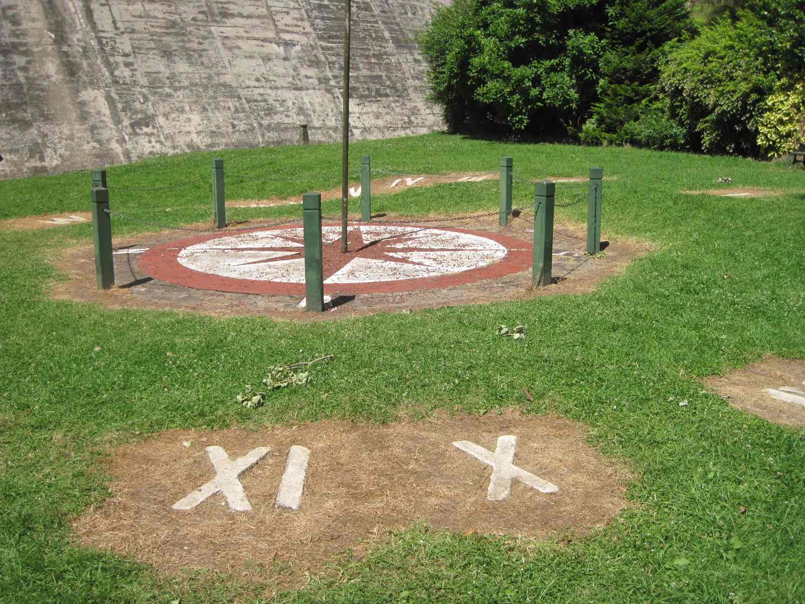
| Floral Sundial |
|
|
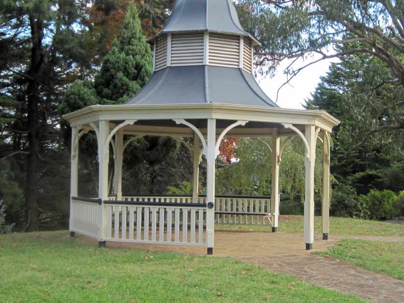
| Rotunda at top of dam wall |
|
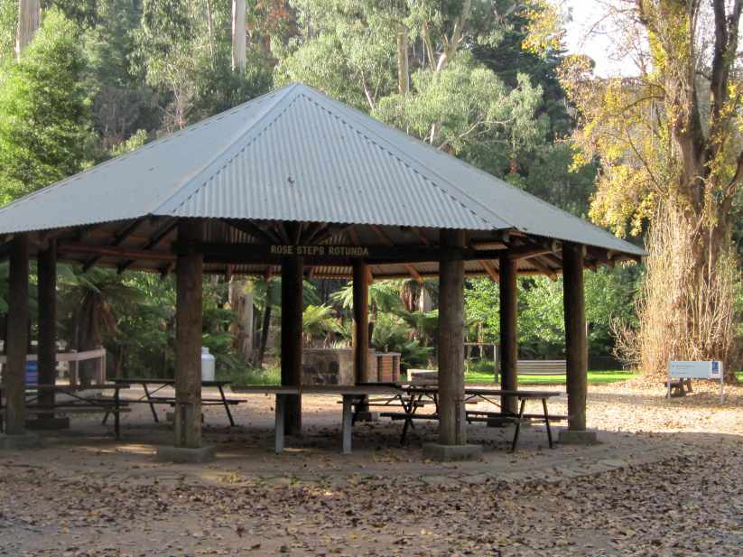
| Rotunda at foot of dam wall |
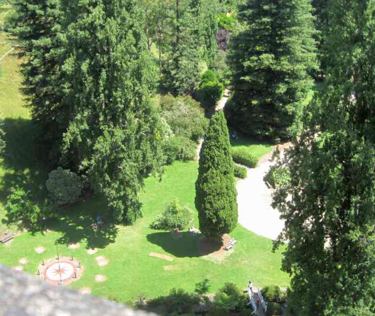
The Reservoir Park occupies about 2 ha at the base of the Maroondah dam wall and spillway. It consists of a series of curvilinear
roads and pathways down the side of the valley from Maroondah Highway, through formal garden and lawns to the flat valley
floor utilised for carparking and picnic facilities. There are several distinctive features in the park, described as follows:
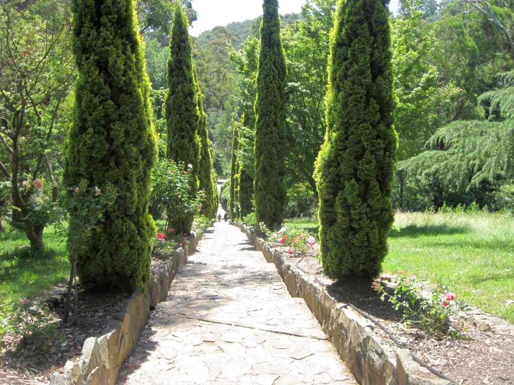
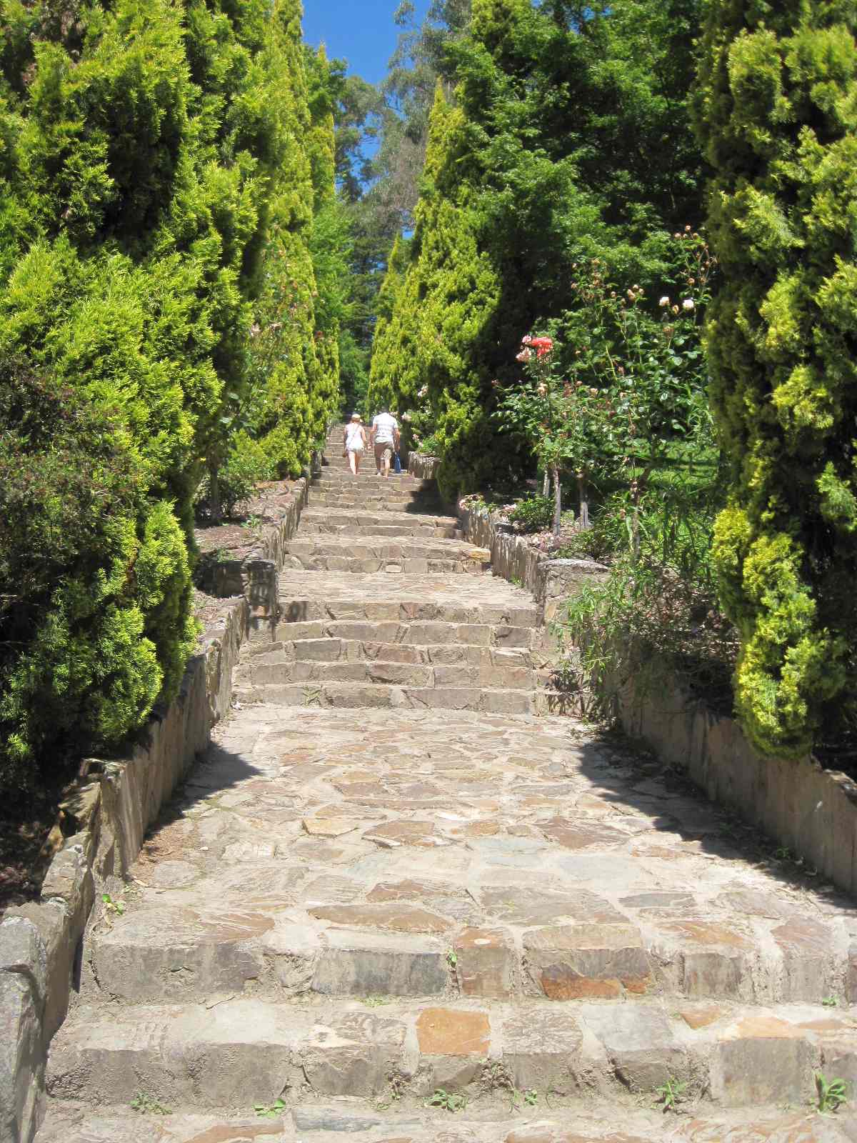
The "rose steps" is a set of concrete steps leading from near the base of the Maroondah dam wall up the embankment to a
higher terrace. The stairway is currently lined with pencil pines, although the park management plan recommends replacement
with standard rose bushes as originally used.
Two domed concrete valve houses are located near
the base of the dam wall. The hydraulically-operated safety valves provide for the control of water flow from the reservoir
into the Maroondah aqueduct, and are associated with a compensation channel lined with stone pitchers (no longer in use).
They are connected to the Maroondah Aqueduct via a tunnel (Echo Tunnel). A new valve house has been built on the northern
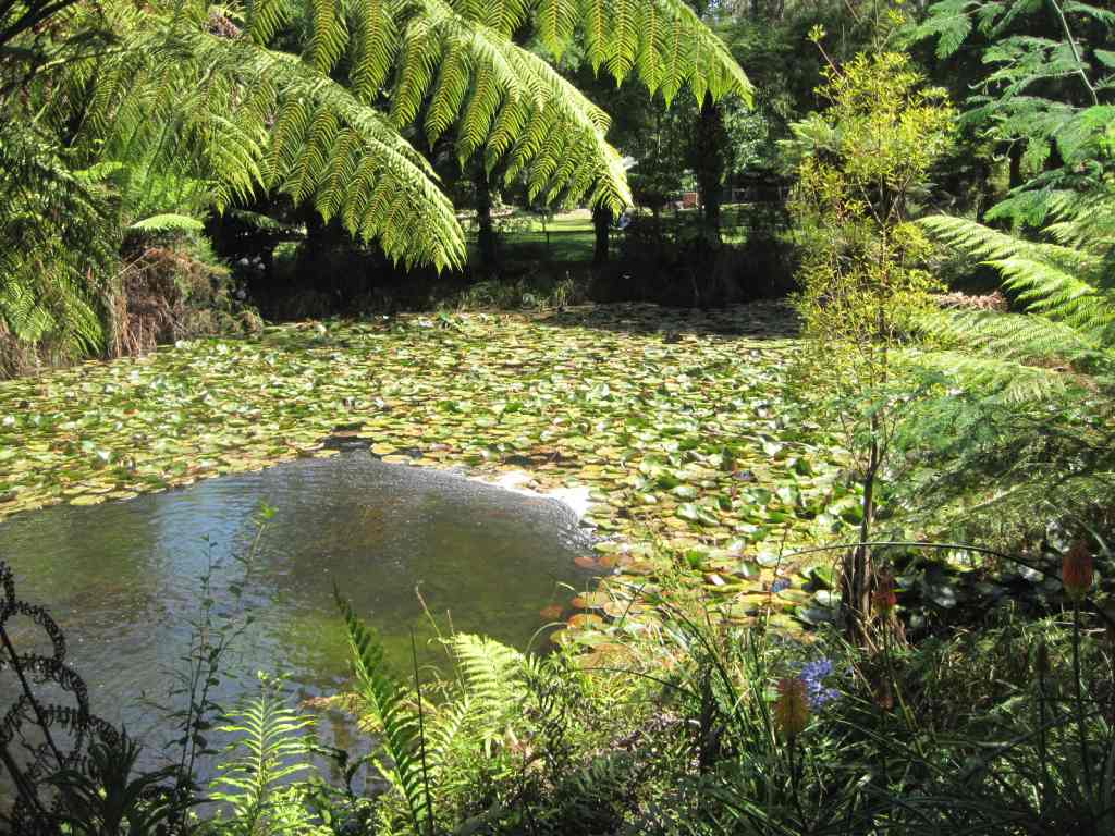
side of the Watts River, using a new valve system. The compensation channel now used is called the "lily pond", and is a depression
resulting from scouring which occurred when the valves were opened at one time. The released water flows back into the Watts
River at this point. A foot bridge provides access over the compensation channel to the viewing point at the base of the spillway.
A sundial consisting of "MMBW" and Roman numerals I to VII with a central pole is located adjacent
to the valve houses at the bottom of the dam wall. It has apparently been designed without the number VIII, apparently because
the location of the dial does not allow sunlight to penetrate at that time. A weather cock on top of the pole has been dismantled
because of vandalism.(Lindsay Bergin: pers.comm.) The clock is best viewed from the walkway along the top of the dam wall.
|
|
| Lily pond |

|
| Palm grotto |
two rotundas constructed between 1946-1948 are located in the park, one near the base of the slipway, and the other near
the kiosk along McKenzie Avenue. They employ a central upright support with poles radiating from the centre to form the roof
structure, and upright poles supporting the roof around the perimeter. The upright supports and roof timbers were cut from
nearby trees, and the original split timber shingles have been replaced with treated pine shingles.
A
caretaker's house, constructed in red brick, is located at the eastern end of the park, fenced off from the park and in its
own garden setting. Two toilet buildings along McKenzie Avenue are constructed of similar materials.
The
formal plantings of exotic trees and shrubs line the main entrance driveway (McKenzie Avenue) and extend over the lawns to
the base of the dam wall. In the western half of the park, indigenous trees tend to predominate. The introduced species include
Californian Redwood and Oregon trees, presumably dating from the period after the dam's construction (1927). A eucalyptus
tree, planted by the Governor, Sir William Slim in c. 1950, stands next to the Californian Redwood near the "rose steps".
Some of the pathways and the stone edging and guttering along the pathways at the base of the dam wall were laid in the 1946-1948
period.
The entrance gates, roadway and perimeter fence form distinctive elements of the park.
The gates are of wrought iron and "Maroondah Dam" is shaped in iron above the gate. McKenzie Avenue curves through the lawns
and formal plantings down the valley slope to the main visitors' facilities near the bottom of the valley. The fence almost
encircles the Reservoir, and features concrete posts with barbed wire. Some of the original posts remain, featuring an indented
section recalling the concrete pillars along the dam walkway. The replacement posts are plain. The fence most noticeably defines
the boundary of the park along the Maroondah Highway
|
|
| Pathway |
|
| Looking down from top of dam wall |
The formal plantings of exotic trees and shrubs line the main entrance driveway (McKenzie Avenue) and extend over the lawns
to the base of the dam wall. In the western half of the park, indigenous trees tend to predominate. The introduced species
include Californian Redwood and Oregon trees, presumably dating from the period after the dam's construction (1927). A eucalyptus
tree, planted by the Governor, Sir William Slim in c. 1950, stands next to the Californian Redwood near the "rose steps".
Some of the pathways and the stone edging and guttering along the pathways at the base of the dam wall were laid in the 1946-1948
period.
The entrance gates, roadway and perimeter fence form distinctive elements of the park.
The gates are of wrought iron and "Maroondah Dam" is shaped in iron above the gate. McKenzie Avenue curves through the lawns
and formal plantings down the valley slope to the main visitors' facilities near the bottom of the valley. The fence almost
encircles the Reservoir, and features concrete posts with barbed wire. Some of the original posts remain, featuring an indented
section recalling the concrete pillars along the dam walkway. The replacement posts are plain. The fence most noticeably defines
the boundary of the park along the Maroondah Highway
|
| Terraced Stairway in Rose Garden |
|
|
|
|
|
|
|
|
|
|
|
|
|
|
|
|


