|
|
|
| Brady Rd Picnic Area, c1976 (Landvic) |
HISTORICAL Brady Rd extends from Gladstone
Rd in the west, to Baden Powell Drive in the east. The Section east of Greenbanks Avenue is closed to private vehicular
traffic.
1880s - Survey Plans showed
the future alignment of the road, but the exact starting date is not known. Land subdivision was between Gladstone
and Stud Rds took place in the late 1880s.
The name
is that of an early landowner of the 1860s whose properties were
located in the area now bounded by Stud, Heatherton and Brady Rds and the
Dandenong Creek.
1928 - the road was extended from Stud Rd to the Dandenong Creek.
1963 - it was extended to Baden Powell Drive, as part of
the road additions for the 7th Australian Scout Jamboree which took place in the
area over the New Year period of 1964/65. The present day bridge over the Creek
was built at that time.
1964 JAMBOREE USAGE
The Scouters' Car
Park was located on the north side of the road, between the Jamboree Main Arena and the Dandenong
main drain. After the Jamboree ended, the car park land reverted to bushland. In 1976 it was rehabilitated and is
now the large grassy area used for public recreation. Regrowth bushland remains on both sides.
1965 - in January the Jamboree concluded.
1972 - the road was closed off for private vehicles east of the Creek at
Greenbanks Avenue by a barrier gate. A council tip was located on the site
of the former Jamboree public car park, on the south side, just past the Bridge,
until it closed down in 1978.
|
|
|
| Picnic ground, former Info Board c.2012 (Parks Vic) |
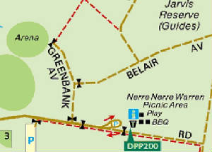
POST JAMBOREE
1974 - the Picnic area and associated car park and turning circle were opened, which were
on the site of the former Jamboree "Shopping and Exhibition Area". A toilet block, BBQ area, gravelled walking paths.
directional signage, and a playground were built in the picnic ground. The signed gravelled Woodland Walk
loop track was opened, starting at the northern end of the picnic ground - this followed an old unformed track dating back
to the Jamboree era. The road between the Bridge and Picnic Ground was resurfaced. Barrier gates (open only during daylight
hours) were placed across Brady Rd at the junction of Greenbank Avenue, and at the end of the Picnic Ground car-turning
circle. 1976 - the large open areas
formerly used for the Jamboree Main Adrena and the Assembly Point, just past the bridge, were converted into two ovals and
play space, for public recreation, soccer, model aircraft flying, golf practice and cricket. 1978 - the Dandenong Softball Association facility
was opened on the south side, next to the former tip, and the barrier gate was removed. 2010 - private vehicle access to the Picnic Ground and the associated car park was closed for the
full 24-hrs. Removable bollards were placed across Brady Rd East at the junction of Baden Powell Drive - these still
exist today. These were to prevent private vehicle access to/from the Picnic Ground.
2012 - In the Picnic area, the playground was dismantled, the toilet block closed, and
the vandalized Information Board was removed.
2017
- the sign at the eastern end of the Picnic Ground indicates opening and closing hours. This is no longer valid, as
the area is now accessible for cyclists and pedestrians for the full 24-hrs.
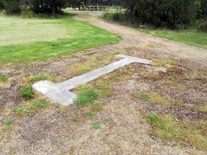
Note1: The remains of the Picnic Ground
car park wooden spacers are still visible (Nov 2017), as rotting timbers protruding next to the toilet block. See
picture below.
There is no drinking water available in the picnic ground.
|
| Foundations of former Info Board in Picnic Area (author, Nov 2017) |
|
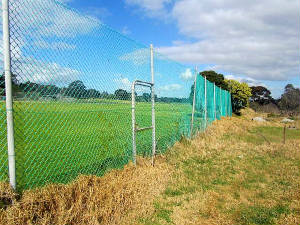
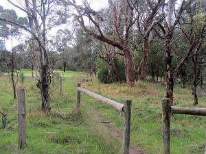
| Western fence of Softball Centre, off Brady Rd author, September 2017) |
|
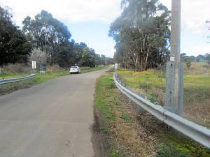
| Site of Jamboree public carpark in Brady Rd, (author,September 2017) |
|
|
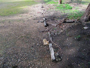
| Timber remains of car park spacers (author Aug 2017) |
|
| Site of former WIA radio transmitter off Brady Rd (author, Aug 2017) |
|
|
| Barrier gate at picnic ground car park (author, Aug 2017) |
|
|
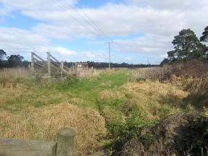
| Remains of old roadway, formerJamboree Exhibition area (author, Aug 2017) |
|
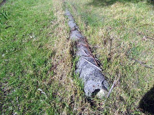
| Old water pipe used for the Jamboree, on south side of Brady Rd (author, September 2017) |
|
| Site of main gate to Jamboree, Brady Rd (author, September 2017) |
|
(Above) Earth view of Brady Rd East, Picnic area at bottom
right, playing fields at left, Baden Powell Drive at right. (author 2017).
|
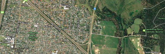
(Above) Earth view of Brady Rd, western section, from Brady Rd Picnic ground
to Gladstone Rd, Stud Rd in centre. (Author, 2017)
|
|


