|
|
 |
|
| Yarra Valley from O'Shannassy Aqueduct Trail |
Henderson Hill Track (85 km E). This Track starts and ends at the information board at the Henderson Picnic Ground, in
the Maroondah Reservoir Park, east of Healesville. It winds its way up through tall forest, with views through the trees of the surrounding peaks and valleys. Some steep pinches.
At the summit, there is a wooden seat. (1 hour, 4 km, December 2006)
Photo Album | Map
Condon's and Henderson Hill Tracks - Maroondah
Reservoir Park. (65 km E). This walk starts at the junction of Donnelley's Weir Rd and gated
Condon's Track (Road 15), north of Healesville. Follow Road 15 to junction with Henderson Hill Tk - this is a high point,
ascending from 115 m to 203 m. Return to start. Pleasant forest environment, birds, good
views towards Mt Riddell and Mt Juliet. (1 hr, 4 km, March 2008).
Photo Album | Map
Summit Track - Maroondah Reservoir Park. (85 km E). Maroondah
Highway, Healesville, Maroondah Reservoir Park. Follow signed track uphill to Lookout and return. Forest
environment, excellent views of the reservoir, Mt Riddell and Mt. Juliet. (2 km, 1 hr, August 2008)
Photo Album | Map
Morley's Track (Fernshaw Sector) (85 km E).
Start and finish at Fernshaw Picnic Ground, past Healesville, on B360. This is the Fernshaw Sector
of the long walk (q.v.) which terminates at the Dom Dom Saddle Picnic Ground. It passes through
fern gullies and forests, adjacent to the Melbourne Water catchment area. The turnaround point is about
2 km from Fernshaw. (4 km, 1 hr, January 2008)
Map| Photo Album
Morley's Track - Dom Dom Sector. (95 km E). Maroondah Highway,
Healesville, to Dom Dom Saddle carpark/picnic area. Ascend gated/signed Morley Walking Track - this is "Road 8". Continue
along ridge to the turn-off from Road 8, and return. (The Track continues to Fernshaw - see the other walk). Superb views to Lake Mountain and pine plantations from the ridge. (6 km, 1.5 hrs,
January 2008).
Map| Photo Album
Mt Dom Dom and Heritage Tracks (two walks). (90 km E).
Access: Maroondah Highway, through Healesville, to Dom Dom Saddle carpark/picnic area.
Walk 1: Ascend Mt Dom Dom Rd, to a turnabout point 1 km from start. Return
to junction with steep foot-track to the right (near the carpark). Descend this track to junction with Heritage
Track. Turnaround and return to carpark.
Walk 2: Drive down from Dom Dom picnic area along Maroondah Highway to small
carpark on right, near the Hermitage Guesthouse. Descend the "Hermitage Track" (signposted), reaching the junction
with the foot-track leading up to Dom Dom Saddle picnic area. Turnaround, return to start.
Both walks offer pleasant hiking in tall forests.
These two walks could be combined as a circuit, starting and finishing at the Dom Dom carpark, but would
require walking along the busy Maroondah Highway, which has no shoulders. (4 km total, 1 hr, July 2006).
Graceburn Weir Walk (80 km E). Access: Maroondah Highway, through Healesville, to small car park at Melbourne
Water pumping station. Proceed along the gated Graceburn Aqueduct management track (open to walkers) until the Weir is reached.
The walk passes through interesting tall forest, ferns,
and pine trees. Access past the Weir is prohibited. Return to start. The weir and aqueduct were built in 1892 and are part of Melbourne's water supply network. (3
km, one hour, June 2008)
Narbethong Forest Walk (90 km E). Narbethong (the
local name for St. Fillans) is on the Maroondah Highway, about 10 km from Marysville. The circuit walk
is in the 95 acres Narbethong Forest Reserve, on the east side of the highway, next to the CFA
facility.It passes through interesting remnant forest and over a (dry) creek. Wildflowers
appear in spring. The Track is indistinct in places, and markers are pink ribbons tied to trees! Care is needed when negotiating
fallen branches and tree roots(2 km, 1 hr, October 2006)
Lyrebird Track - Badger Weir Park
(85 km E). Access is from Healesville, along Don Rd and Badger Weir Rd to the excellent picnic ground and carpark.
The signposted Track starts at the eastern end of the picnic area, and passes through dense
fern gullies and forest, and lyrebirds may be seen! The return walk follows the Slip
Creek Track to the carpark. (3 km, 1 hr, April 2009)
O'Shannassy Aqueduct
Walking Track
This is 19 km, following the old maintenance road (Road 18) linking the Don Rd (Launching Place)
with Cement Creek Rd. Extensions easterly to the O'Shannassy Reservoir (7.6 km) and westerly to Parrot Rd (4 km) are proposed.
As at June 2008, the section from Cement Creek to the Reservoir Gate was not yet officially open, but walkers may use it!
When complete, the Track will be 30.7 km. I consider it to be amongst the best Tracks
in the Yarra Ranges National Park, and it may be hiked as a step-on, or step-off walk. The main access point, with a small
car park, is at Yuonga Rd, off the Acheron Way, East Warburton.
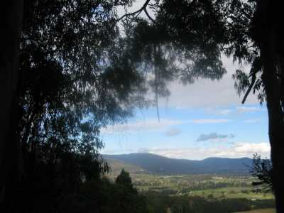
O'Shannassy Aqueduct Trail - Walk 1 (100 km E). Start/finish
at the junction of Road 18 and Mt. Donna Buang Rd. After 200 m, turn left at the Melbourne Water gate.
This is "Road 18". The above-ground section of the disused Aqueduct (built 1928, decommissioned
in 1997) is reached after about 1 km. Road 18 is the former maintenance track for the Aqueduct, originally
owned by Melbourne Water and now managed by Parks Vic for walkers. The route is along
the foothills of Mt. Victoria and Mt. Donna Buang, through tall
timber and moist fern gullies, with partially obscured views to the south over the Upper Yarra Valley,
towards the Starling Gap and Powelltown region. Open spaces adjoining the track to the south are private property. Return
to starting point after approximately 2 km. Road 18 continues to past Cement Creek, ultimately reaching the O'Shannassy Reservoir.
(5 km, 1.5 hrs, easy gradients, July 2006)
Photo Album | Map
O'Shannassy Aqueduct Trail - Walk 2 (100 km E). Start/finish at junction of Martyrs
Rd (Warburton) and the Donna Buang Walking Track (at top of golf course). Cross creek, reach Aqueduct Track, proceed easterly,
cross Young's Rd, then to the gate marking the Melbourne Water prohibited area. Return to start. Good views across Upper Yarra Valley and Warburton. (Easy, 4 km, July 2006).
O'Shannassy Aqueduct Trail - Walk 3 (100 km E). Start/finish
at end of the Dee Rd (West Warburton). Go past Melbourne Water gate, continue along Aqueduct for approximately 1.5 km, then
return. Good views across Upper Yarra Valley towards Mt. Little Joe and the Ranges near
Big Pat's Creek. On return to the Dee Rd crossing, continue west for about 1.5 km, passing the
former aqueduct maintenance cabin and skirting Ben Cairn. Return to Dee Rd. (Easy, 3 km, July 2006, one hr)
Map | Photo Album
O'Shannassy Aqueduct Trail - Walk 4 (100 km E).
Start/finish at Dee Rd crossing, near Millgrove, access from Warburton Highway. Follow track west past the former Maintenance
Cabin, to its terminus near Don Rd. Aqueduct disappears underground at that point. Note control mechanisms and valves.Return
to start. Interesting views across Valley. White
posts every 1 km show distances from the start of the Aqueduct, 32 km to the NE! (10 km, 2.5 hrs,
July 2006)
O'Shannassy Aqueduct Trail - Walk 5 (100 km E).
Start/finish at Dee Rd crossing, near Milgrove, access from Warburton Highway.Follow track east until junction with Mt. Donna
Buang Track is reached, then turn around, and return to start. Excellent views across the
Upper Yarra Valley. Several interesting Aqueduct artefacts are on this sector, including the Trestle
Bridge, maintenance hut used by workers, small bridges into the forest, blue-stone walls, slip-pipe, water
tanks, valves, and control mechanisms. (8 km return, 2 hrs, August 2006).
O'Shannassy Aqueduct Trail - Walk 6. (100
km E). Take the Cement Creek Rd, 7 km E of Warburton on the Wood's Point Rd. This track is suitable
for 2WD vehicles, but can be muddy! Park at the gates at the junction of Roads 18 and 3, about 3 km from Wood's Point
Rd. Walk along Road 18 (past the gate) to the west, which meets the open-channel O'Shannassy Aqueduct after
about 1 km.
This is the point where the open channel sector disappears into pipes under Road 18. Continue
on, passing the former Track Maintenance Cottage, the old Syphon, bridge over West Cement Creek, old stone steps to the
Syphon, artefacts and control mechanisms. Good views across the Upper Yarra Valley,
but obscured in parts by tall trees. Turnaround at a point about 4 km from the start and return.
(8 km, 2 hours, September 2006) (Note: This walk is a variation of the Cement Creek
Plantation walk (see below).
O'Shannassy Aqueduct Trail - Walk 7.
(100 km E). Take the Cement Creek Rd, 7 km E of Warburton on the Wood's Point Rd. This
track is suitable for 2WD vehicles, but can be muddy! Park at the gates at the junction of Roads 18 and 3, about 3 km
from Wood's Point Rd. Proceed through gate on Road 18 to the east, past the former Maintenance Huts, which are open to
walkers! Continue to a point 2 km from the Huts, then return to start. Note: As
at April 2008, this section of the Aqueduct Trail was not officially open to walkers, but this is expected to change by year's
end. Magnificent tall timber. (4 km, 1 hr, March
2007)
Map | Photo Album
O'Shannassy Aqueduct Trail - Walk 8. NEW SECTION!
(100 km E). Start at the small car park at the Yuonga Rd access point, off the Acheron Way, East Warburton.
A large map of the Trail is here. Follow the track easterly, reaching Acheron Way. Carefully cross Acheron Way, follow shoulder
north to a turn off at the right, proceed through gate for about 1 km. This section of the Track ends here, where the open
aqueduct disappears underground. Return to car. (The Track may be picked up again a short
distance up Acheron Way, at the signpost indicating "Road 18", where the aqueduct reappears from the tunnel.)
Excellent views across the Upper Yarra Valley, magnifient tall timber, birds.
Cement Creek Plantation (100 km E). This multi-walk explores the historical Cement
Creek Pine Plantation, the adjacent Picnic Reserve, and nearby management tracks.
Take the Cement Creek Rd, 7 km E of Warburton on the Wood's Point Rd. This track is suitable for 2WD vehicles, but can be
muddy! Park at the gates at the junction of Roads 18 and 3, about 3 km from Wood's Point Rd. Walk along Road 18
(gated) to the west, which meets the open-channel O'Shannassy Aqueduct after about 1 km.
Turn around and return to the gate. Walk back on Cement Creek Rd for about 1 km to the collapsed access gate into the Pine
Plantation. Explore the Plantation via various tracks. Return to the car. There is a small picnic
reserve on the Yarra River, at the bridge, on Cement Creek Rd. (3 km, 1 hr, Aug
2006)
Tall Timber Track and Yarra Rapids. (100 km E).
Warburton, Wood's Point Rd, Cement Creek Rd, to small car park at junction with an unnamed fire access jeep
track, opposite the old pine plantation. Ascend this track on foot, through tall timber and bushland, to a turnaround point
about 1 km from the start. This track is not gated, and is within the National Park. Return to car park. Walk down Cement
Creek Rd, enter the catchment area (walkers permitted) at an old gate, then on to the foot-track on the banks of Yarra. Inspect
the rapids. Tall timber, river scenes, good views towards Mt Donna Buang and Mt Victoria.
(4 km, one hour, May 2007).
Condon's
Track Circuit. (65
km). Walk starts at Donnelley's Weir Picnic ground, off Mt St Leonard's Rd, 5 km north of Healesville. Follows Maroondah
Aqueduct Trail, joining Condon's Track (park management vehicles and walkers only), continuing past Sawpit Gully Creek
to turning point 2 km further on. Return via same route, but bypasssing Aqueduct Trail and continuing to junction
of Condon's Track and Donnelley's Weir Rd.Then back to Picnic Ground. Track follows the first sector of the 6000 km Bicennential
Trail, and ultimately links with the Mt Monda Track. Forest and lush fern gully environment,
steep in parts. (8 km circuit, 2 hrs, June 2006)
Mt. Donna Buang Summit Explorer (100 km E). Start/finish:
Mt.Donna Buang summit car park, follow walking track signed as "10 Mile Car Park", reach junction with another track leading
to Mt. Victoria, turn and return to the start. Steep downhill section at start, then flat, passes through nice sub-alpine forest and ferns. Higher section of track may not be accessible during snow
season. (Altitude 1250 m, 3 km, 1 hr, June 2006)
Mt. St Leonard's Track - Southern Section
(85 km E). Start and finish at the Donnelley's Weir Picnic Ground carpark, reached from the
St Leonard Rd (also known as Myers's Creek Rd), 5 km north of Healesville. Follow Road 12, reaching Road 11, then to junction
with Road 20 (gated - prohibited entry - water catchment area). Proceed uphill to a sign "VP Q". This is "Viewpoint
Q", then continue short distance to the Water Point (dam). Turnaround, return to a junction with a foot-track which splits
off to the right. Follow this uphill for about 200 m - this is Bingley View Hill - Continue down, joining
Road 11 after about 200 m. Return to start. Good views towards Mt Monda from the View
Point. (8 km, 2 hrs, August 2008). (Note: Road 11 is the main walking track
to Mt. St Leonard).
Mt. St Leonard Summit Walk. (85 km NE). Maroondah
Highway, Healesville, Myers Creek Rd, turn right into steep Monda Rd, reach cleared area at gate. Go through gate to summit
and lookout, and return. The views are marvellous on a clear day! (4
km, 1 hr, February 2008)
Rainforest Gallery - Mt. Donna Buang (100 km E).
Interesting shorter loop walk, along the world-famous elevated walkway
high above the rainforest canopy and Cement Creek. Start/finish at carpark, at the junction of the Acheron Way and Mt. Donna
Buang Rd, 15 km east of Warburton.(1 km, 30 mins, March 2008)
Map| Photo Album
Big Peninsula Tunnels - McMahon's Creek (80 km E). Warburton,
Woods Pt Rd, to car park at Big Peninsula. Descend track toYarra, cross river on large fixed stepping stones. Follow signed
track to Big Peninsula Tunnel viewpoint. Return to car park, then descend
on the other side of the peninsula to picnic area, view tunnel, return. Drive about 1 km west along Woods Pt Rd to Little Peninsula Tunnel car park- follow signed walking track to tunnel viewing area
and picnic area and return. (2 km, 1 hr, Jan 2008)
Photos | Map - Rooftops: Yarra Valley - Western Gippsland
Mt. Victoria Summit Track.
(90 km E). Warburton, Acheron Way, Donna Buang Rd, car park at 10 Mile Turntable. Ascend signed track to Mt Victoria
Summit (at communications towers). return to start. Tall forest, interesting scenery along
ridge, former logging area. Warning: This track reaches an altitude
of 1160m, and snowfalls may occur during the winter months at any time. ( 7 km, 2 hrs, October 2005)
Photos | Map - Rooftops: Yarra Valley - Western Gippsland
Boobyalla Saddle Walk.
(90 km E). Warburton, Acheron Way, Donna Buang Rd, to summit car park. Follow signed Boobyalla Track, climbing Mt Boobyalla,
to Boobyalla Saddle and return. Pleasant forest environment, Boobyalla Trees.
Some steep sections. Note: This Track is closed
in winter, due to snow cover. (5 km, 1,5 hrs, November 2005)
Photos | Map - Rooftops: Yarra Valley - Western Gippsland
Mt. Riddell Summit Walk.
(85 km E). Maroondah Highway, Healesville, Mt Riddell, small car park. Follow gated track to Summit and return. Excellent views across Maroondah Reservoir to Mt. Monda and beyond. (6 km, steep,
2 hrs, July 2005)
Photos | Map - Rooftops: Yarra Valley - Western Gippsland
Ben Cairn Summit (90 km E). Healesville, Don Rd,
Mt Donna Buang Rd, to small car park at signed "Ben Cairn". Follow foot-track to Summit, explore the big boulders and
return. Limited views due to extensive regrowth after the 1939 fires.
(1.5 km, 45 mins, January 2008). Excellent views are obtained from the Hang Glider Launching Platform, about
5 km further on towards the 10 Mile Turntable junction. Note: The Ben Cairn Road is closed during winter
due to snow cover.
Photos | Map - Melways
Maroondah Aqueduct Walk. (65 km E). Walk starts
at Donnelly's Weir Picnic ground, off Myers Creek Rd, 5 km north of Healesville. Follow signed track next to aqueduct,
reaching junction with Condon's Track. Return to start. Forest environment, flowing
aqueduct. (4 km, 1 hr, Jan 5, 2008)
Photo Album | Map
Mt Juliet Track - Western Sector. (85 km E). Maroondah
Highway, Healesville, to small car park signed "Mt Juliet Track", about 2 km past the Graceburn Weir. Go around gate,
follow management track, which is "Road 3". Continue for about 2 km, reaching a junction with "Road 4" and a sign "Mt Juliet
Summit - 4.8 km". This is the end of this section of the walk. Return to car, inspecting the dam and bridge at the water
point about 1 km from the gate. Note: The ascent to the summit frik the junction
of Road 4 is steep and arduous, with a change in altitude of about 800m. There is a stone cairn at the top,built in the
late 1800s to mark a geodetic survey point, but no views, due to extensive regrowth from the 1939 fires. This sustained
ascent requires a high level of fitness and stamina and would not be undertaken alone. This
walk is within the Maroondah Catchment Area of Melbourne Water, and off-track walking is prohibited. Tall
forest, ferns, dam, birds. (4 km, 1 hr, May 2008)
Photos | Map - Rooftops: Yarra Valley - Western Gippsland
Monda
Track - southern sector. (80 km E). Maroondah Highway, Healesville, to Dom Dom Saddle picnic ground/car
park. Cross Highway, go up past water tank, reaching the Old Black Spur Rd. Follow track up hill along old wide firebreak.
Reach junction with Melbourne Water Road 9 - follow this Road for about 2 km, to the base of Archer Hill. Return to car. Road
9 joins Monda Rd, and continues a further 15 km to the Myer's Creek Rd. Limited views of the Alps towards the east, obscured
by extensive regrowth from the 1939 fires. This was once a logging area - old stumps remain, with sawcuts still visible. The
entire Monda Rd is a 20 km firebreak and is the boundary between the Yarra Ranges NP and the Toolangi State Forest.
Public foot access along Melbourne Water roads, except Road 9, is prohibited - the area is within the Maroondah Catchment area. Tall forest, ferns, some views, grassy track, some steep sections, many
birds (Carrowaries). (6 km, 1.5 hrs, May 2008)
Photos | Map - Rooftops: Yarra Valley - Western Gippsland
Around Mt St
Leonard - Road 11. (85 km NE). Maroondah Highway, Healesville, Myers Creek Rd, turn right into steep
Monda Rd, leave car at start of signposted Road 11. Do not drive down this road as there is a locked gate at the botttom
and no space to turn! Walk this road, go through gate, continue past junction with the steep foot-track which leads up
to the Mt St Leonard summit. Go past the water tank for about 500m. This is the turnaround point, return to car. Excellent tall forest, ferns, limited views, former logging road. (4 klm, 1
hr, May 2008)
Photos | Map - Rooftops: Yarra Valley - Western Gippsland
|
|
|
|
Distances to the start of walks, from Melbourne, are in brackets against
their descriptions
|
|
|
|

