|
|
 |
|
|
| Yea River Wal;k - Toolangi |
Yea River
Walk (60 km NE). Healesville, Chum Creek Rd, Toolangi. Loop walk starting
at the Toolangi Visitors' Centre, passing through regrowth forest (1939 fires) and along theYea River. Interesting
interpretative signs describe many features of the forest, including the early logging activity and its impact on the Aboriginal
peoples. The Centre has a good display of tools used by the early timber-cutters.
(4 km, one hour, May 2008)
Sculpture Walk (60 km NE). Healesville, Chum Creek
Rd, Toolangi. Loop walk starting at the Toolangi Visitors' Centre. Passes large internationally recognised
hardwood sculptures made by local artists, with many interpretative signs. There is a good
viewpoint of the Yarra Valley about half-way.
(3 km, 45 mins, July 2006)
Photo Album | Map - Rooftops
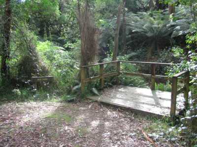
Wirra Willa Rainforest Walk. (60
km NE). Healesville, Myers Creek Rd, Sylvia Rd, to small car park at entrance to Rainforest Walk. Follow signed circuit
track. Excellent rainforest, creeks, bridges, boardwalks. (2 km,
1 hr, December 2005).
Photos | Map - Rooftops
Dunstan's Track (60 km NE). Healesville, Myers Creek
Rd, to car park at junction of Monda Rd. Follow gated signed track to Sylvia Creek Rd and return. This
is a seldom visited track, along a former logging route, passing through magnificent forest and fern gullies. (2 km,
1 hr, February 2008)
Photos | Map - Rooftops
Blue Mountain Ascent (60 km NE). Healesville, Chum
Creek Rd, to car layoff junction of Weasel Creek Tk. Follow track to left, reaching the Potato Farm. Turn right, past farm
perimeter, to open space on the summit. Return to transport. Good views across Yarra Valley.
Weasel Ck Tk is a former logging route, winding its way through interesting forest. Rise in altitude from 320m to 650m.
(6 km, 1.5 hrs, April 2008).
Photos | Map - Rooftops
Xanthorrhoea Track (60 km NE). Healesville, Chum Creek
Rd, to car layoff junction at Xanthorrhoea Tk. Ascend track, reaching high pointm, past Ray's Tk, and return. Tk passes
through grass trees (Xanthorrhoea Australia) and Banksias. Rise in altitude from 300m to 450m. Return to transport. Good views across Chum Creek Valley. (1.5 hrs, 4 km, April 2008)
Photos | Map - Rooftops
Old Tanglefoot
Track - southern section. (60 km NE). Healesville, Myers Creek Rd, Monda Rd, to car park at signed
"Tanglefoot Rd". This is the gated southern end of the old Tanglefoot Rd, a former logging track, which continues 8 km to
the north at Sylvia Creek Rd. Follow track to the base of Mt Tanglefoot and return, passing old logging coupes. Track follows
ridgeline, at about 980m. Views to the east, towards the Victorian Alps, extensive regrowth.
(6 km. 1.5 hrs, May 2008).
Photos | Map - Rooftops
NEW TANGLEFOOT
WALKING TRACK
This is a recently opened 20 km loop route, and may be undertaken
as a single long walk, or as shorter step-on, step-off sections. The main access points, with car parking, are at the Tanglefoot
Car Park (Sylvia Creek Rd), the Wirrawilla Rainforest Reserve (Sylvia Creek Rd), and Mt
St Leonard (Monda Rd). The route follows the Myrtle Gully Track, Quarry Rd, and the new Tanglefoot Track.
Tanglefoot Walking Track - Walk 1 - Mt. Tanglefoot
Boardwalk (60 km NE). Healesville, Myers Creek Rd, Sylvia Creek Rd, to the Myrtle Creek
car park. Follow signed Myrtle Creek Tk to junction, then proceed downhill along the Tanglefoot Track, reaching the newly
constructed Boardwalk. Return to car. Excellent rainforest, Mountain Ash timber, fern
gullies. The Boardwalk was opened in March 2008 and has a covered picnic area, seats, and drinking water. (4 km, 1 hr, March 2008)
Photos | Map - Rooftops
Tanglefoot Walking Track - Walk
2 - Myrtle Gully Walk (60 km NE). Healesville, Myers Creek Rd, Sylvia Creek Rd,
to the Wirrawilla Rainforest car park. Go through gate on Quarry Rd, then proceed on the signed Myrtle Gully Walk. Ascend tk
to junction with Tanglefoot Tk and return to car. There is a change in altitude from 697m to 852m. Excellent
rainforest, Mountain Ash timber, fern gullies. This tk runs parallel with the Tanglefoot
Tk in the next valley. (6 km, 1.5 hrs, March 2008).
Tanglefoot Walking Track - Walk 3: Southern Sector
(60 km NE). Healesville, Myer's Ck Rd, Monda Rd, passing Mt St Leonard gate, to open space at entrance to the signed
Track. Descend tk, reaching the newly constructed boardwalk and return. Forest environment,
footbridges, fern gullies, birds. Restricted views to Ranges. Change in altitude from 944m to 801m
- some steep sections.(6 km, 1.5 hrs, April 2008).
Photos | Map - Rooftops
Tanglefoot Walking Track - Walk 4: Tanglefoot Walking Track - Northern Link
(60 km NE). Healesville, Myer's Ck Rd, Sylvia Ck Rd, to Mt Tanglefoot picnic ground. Follow signed Tanglefoot Walking
Track to Myrtle Ck car park and return. Old logging track, forest environment, birds.
(3 km, 1 hr, February 2008).
Photos | Map - Rooftops
Tanglefoot Walking Track - Walk 5: Quarry Rd - North. (60
km NE). Healesville, Myers Creek Rd, Sylvia Rd, to small car park at entrance to Wirrawilla
Rainforest Walk. Go through gate signed "Quarry Rd", proceed past old quarry, then north along Quarry Rd. Pass a side-track
to the left, signed "Tanglefoot Loop" - this is a new link to the Tanglefoot Track to the east, which is not
shown on the Rooftops map. A map showing this Link Track is on the noticeboard nearby. Ignore this, continue for about 2 km
to a turnaround point. Return to car. Quarry Rd may also be reached at the end of the Wirrawilla Rainforest Walk. Excellent tall timber, ferns, creeks, birds. (5 km, 1.5 hrs, June 2008)
Photos | Map - Rooftops
Tanglefoot Walking Track - Walk 6: Quarry Rd - South. (60 km NE). Healesville, Myers Creek Rd, Monda Rd,
past Mt St Leonard lookout gate, to open space adjacent to signed "Quarry Rd". Go through gate, descend into the
gully for about 2.5 km - this is the recommended turnaround point. Return
to car. Excellent tall forest. ferns, birds, gully, creek. (5 km,
1.5 hrs, June 2008)
Photos | Map - Rooftops
Blowhard Range Walk (60 km NE). Healesville,
Chum Creek Rd, Toolangi, leave car at junction of Spragg's Rd and Blowhard Rd. Walk up Blowhard Rd, reaching the dam,
and return. The road is used by log trucks, and follows the Blowhard Range. Excellent views
across the Toolangi farms towards Mt Sugarloaf and the Dandenong Ranges. Blowhard Rd continues to the
Sylvia Creek Rd, near the Tanglefoot car park. There is an altitude increase
from 502m to 630m. (6 km, 1.5 hrs, April 2008)
Photos | Map - Rooftops
Cole's Creek Track - Northern Sector. (60 km NE).
Healesville, Myers Creek Rd, Sylvia Creek Rd, to car layouff at signed Coles Creek Track, near the Wirrawilla Rainforest Reserve.
Descend Coles Creek Track for about 2 km, then return. Track follows the Yea River Gully. Note: This
is an ungated fire management road and public vehicular access is permitted. Not advised for conventional 2WD vehicles,
due to fallen branches and leaf litter. Change in altitude from 663m to 546m. Excellent
forest environment, ferns, birds. (4 km, 1.5 hrs,
April 2008)
Photos | Map - Rooftops
Cole's
Creek Track - Southern Sector. (60 km NE). Healesville, Myers Creek Rd, Sylvia Creek Rd to
small car layoff at start of Coles Creek Track. Follow this track for about 2 km, reaching a short track to the
fence of private property, where there is a large dam, then return. Track follows the Yea River Gully. Note:
This is an ungated fire management road and public vehicular access is permitted. Not advised for conventional 2WD vehicles,
due to fallen branches and leaf litter. Change in altitude from 663m to 546m. Excellent
forest environment, ferns, birds, logging region, views towards Toolangi farms.
(4 km, 1.5 hrs, May 2008)
Photos | Map - Rooftops
Cockpit Track - Eastern Sector). (60 km NE). Healesville, Myers Creek Rd, Sylvia Creek Rd, to
small car park at start of Yea Link Rd, just past the Wirrawilla Rainforest Reserve. Follow this road, reaching Cockpit
Creek Tk. Go through, or around) gate, descend steeply to the Yea River crossing. Return to start. Old
logging track, forest environment, birds, ferns. Caution: This track is steep, and very slippery during or after wet weather. At the time
of the visit, DSE was upgrading it. It continues to Blowhard Rd. (4 km, 1.5 hrs, May 2008)
Photos | Map - Rooftops
Monda
Track - Dugout Section. (60 km NE). Healesville, Myers Creek Rd, Monda Rd, past Mt St Leonard lookout
gate, to small car park adjacent to gated track on south marked "Australian National Trail". Go through gate, ascend
track steeply, (this is part of the Monda Track firebreak, continue past the high point, then descend to the Monda Dugout
on Monda Rd. Return to car. The high point is one of the highest areas on the Monda Track
- good views to the Mt Murrindindi region and pine plantations to the north. Caution: The final descent
to the Dugout ios very steep and slippery! The Dugout is signed and is an old fire refuge underground, built into the side
of the hill, still in good condition.(3 km, 1 hr, June 2008)
Photos | Map - Rooftops
Mt
Monda. (60 km NE). Healesville, Myers Creek Rd, Monda Rd, past Mt St Leonard lookout gate, continue
to the junction of Hardy Creek Rd near the Monda Dugout. Leave car at this junction. Walk easterly along Monda Rd, reaching
the signed gate to Condon's Track (which is a very steep track down to the Maroondah Reservoir). This is near the Mt Monda
Summit, Return to car. Good views across cleared plantations north to Mt Tanglefoot
and Mt Murrindindi. Note: The summit of Mt Monda
is relatively flat. Monda Rd from the Dugout to the Condon's Track gate is stony, and slippery in wet weather. Not recommended
for 2WD vehicles - you will see more if you walk it! This walk is part of the long Monda Track. (4 km, 1 hr, June 2008).
Photos | Map - Rooftops
Rouch
Track - Narbethong. (80 km E). Maroondah Highway, Healesville, Dom Dom Saddle, turn left into small car park
at Rouch Rd, opposite the Black Spur Motel. Walk along this forest road, in the Hermitage Creek Gully, reaching gate at the
junction of Carson Track. Return to car. Former logging area, tall timber, creek, birds.
(3 km, 1 hr, June 2008)
Map | Photo Album
Paul's Range North Track - Toolangi. (60 km NE). Healesville,
Chum Creek Rd, Toolangi, Old Toolangi Rd, to small car park next at start of track next to Mill. Follow this unsigned track
steeply down the Gully and return. Tall forest, former logging area, birds.
(2 km, 45 mins, June 2008)
Photo Album ! Map - Rooftops
Wilhemina Falls - Murrindindi Scenic Reserve.(85
km NE). Yarra Glen, Melba Highway, Glenburn, Murrindindi Rd, to Wilhemina car park not far from the ranger station. Cross
river on the suspension bridge, then follow signed track to the Falls viewing platform, returning via Grassy Flats. An excellent walk through tall forest and ferns. The final stage of the track is stony
and steep, slippery in wet weather.Steel chain hand rails have been installed along some of the more difficult sections.
(4 km, 1.5 hrs, September 2008)
|Photo Album ! Map - Rooftops
|
|
|
|
Distances to the start of walks, from Melbourne, are in brackets against
their descriptions
|
|
|
|

