|
|
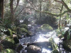
| Murrindindi Cascades |
Murrindindi River Walk - Tramway Section.
(100 km N). Access: Melba Highway, Glenburn, Murrrindindi Rd, Bull Creek picnic ground. Follow signposted track, past
restored tramway section, to Tratford Mill site and return. Excellent forest scenery, following
old timber tramway alignment. (4 km, August 2006, 1 hr)
Murrindindi Cascades (100 km N). Access: Melba Highway,
Glenburn, Murrindindi Rd, to Cascades car park. Follow signposted track to cascades and return. Good
views of the Cascades. (2 km, 30 mins, August 2006)
Photos | Map
|

