The Forests of Warburton - a Pictorial Heritage - 1853 to 2012

Home
Scope
1853 - Beginnings
1885 to present day - Dee Valley Mills
1889 to 1919 - Mills in the Wesburn and Old Warburton area
1890 - Roads to the Forests
1901 to 1964 - The Warburton Railway
1902 to 1906 - Anderson's Mill
1902 to 1939 - East Warburton and Onwards
1903 to 1907- Robinson's Mill No. 1
1905 to 1949 - Tramways of the Mills
1905 to 1928 - Parbury's Brookfield Mill
1906 - Wondwondah Estate and the Adventist Church
1907 to 1913 - Richards Mill
1907 to 1922 - Robinson's Mill No. 1
1908 to 1922 - Robinson's No 2 Mill (Cement Creek)
1909 to 1916 - Hermon's Mill (La La Estate)
1909 to 1949 - The Warburton Steam Railway
1911 to 1915 -The O'Shannassy Aqueduct and Weir
1915 to 1973 - Brimbonga Seasoning Works - East Warburton
1918 to 1925 - Sunnydale Mill, East Warburton
1919 to 1920 - Slocum and Walker's Mill
1920 - From the Bush to the Bungalow
1922 to 1932 - Enterprise Mill (La La)
1925 - Family Snow Trip to Mt Donna Buang
1932 to 1937 - Horner's Mill
1938 to 2000 - Tuckman's Mills
1950 - Welcome Back to Warburton
The Donna Buang Range
Timeline
Epilogue
Bibliography
The Author's Personal Websites

welcomewarburton.gif

collage_2012-09-05_14-41-55.p.jpg
Above Collage composed by the author, based on images shown in the Project

logs1920.jpg
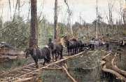
1920 - hauling logs at Warburton

1908tramtrack.jpg
1908 - timber tramway at Warburton

1851.jpg
1851 - The Proclamation of Victoria! (SMH archives)

new3yarra1917.jpg
1917 - Warburton "Highway" and Yarra!

About this Project

Compiled by Bob Padula, OAM, of Melbourne, this is a free on-line work, containing 32 chapters, which brings together hundreds of heritageimages, maps and drawings.

It 's supported by many of the author's personal photographs, dating back to 1951, depicting the evolution and development of the Warburton Forests, 66 km east of Melbourne, Victoria, and in particular its timber industry, between 1853 and 2012.

The work includes descriptive text, location maps, sound and video, identifying the actual sites of many of the sawmills, as far as can be reasonably determined, and linking these to the present-day environment.

General descriptive information about the history of important locations is also given.

The author maintains a continuing interest in bushwalking and touring in the Warburton Forests. He also has a personal interest in the Forests - his mother and maternal grandmother jointly managed a guest-house in the Powelltown area in the mid-1920s, which provided accommodation for timber workers, prior to the disastrous fires of 1925 /1926.

He is a member of the Australian Light Railway Research Society, Bushwalking Victoria, and the Great Dividing Trail Association.

Much of the content of this Study is based on his bushwalking forays into the forest regions, in investigating historical sites and locations, some of which are over 100 years old.

Navigation
Each major theme in this Study has its own Chapter, accessed from the Navigation Bar on each Page. The Chapters are arranged in chronological order, where appropriate.

Images
All images are thumbnailed. Cl
icking any image will produce  a full-sized display in a new browser window.

Search Engine 
There is a Search Engine at the top of this page! This will take the reader to a new window displaying the locations in this site for the search query. 

System Requirements
This website requires the following applications to be installed for full functionality: Adobe Flash Player (or similar), Javascript, and Windows Media Player (or similar). The site is optimised for Internet Explorer 9 - the use of other browsers may not yield satisfactory results. Cookies must be enabled. Font sizes may be changed by the user to suit individual viewing preferences.

Sources
Many images are out-of-copyright and sourced to publicly available sites on the Internet - accreditation is not given. A listing of principal research sources used may be found in the Bibliography. Photographs created by the author are indicated accordingly. The Study is listed under a Creative Commons License.

Advertising
Targeted adverts are displayed on the site via AdSense.

Publication
This Project is published in September 2012 - it is a once-only Study and will not be updated.

Enjoy your journey through the Forests!
mypic.jpg
The author at Warrandyte State Park - May 2012

bigtreend.jpg
Early 1900s - tree felling at Warburton

About the Author

This Heritage Study is a work by Bob Padula, OAM, of Mont Albert, Victoria, Australia.

Bob is a Chartered Professional Commiunications Engineer, holding the rank of Life Member, Institution of Engineers (Austraiia), providing specialized technical consultancy services and authorship in the field of international high frequency broadcasting

He also has a keen interest in hiking, bushwalking, coastal walking, and light railway history, and exploring the mountains around Melbourne, activities which support his involvement in amateur photography. 
 
*** His on-line autobiography may be viewed at  "Looking Back - 1939 to 2011"

The author also maintains several free Photo Websites dedicated to his travels. He has published a number of free Pictorial Victorian Heritage Research Projects. Links and descriptions are at The Author's Personal Websites

His latest on-line Engineering Research Study is "The History of Short wave Broadcasting in Australia"


warby1910.jpg
1910 - colored view of Warby

Creative Commons License
The Forests of Warburton - a Pictorial Heritage - 1853 to 2012 by Robert J.Padula, OAM is licensed under a Creative Commons Attribution-NonCommercial-NoDerivs 3.0 Unported License.
Based on a work at https://bpadula.tripod.com/warburtonforests.

Australian Heritage Directory

Visitors to this site are invited to make a small financial donation (eg: AUD/US$5) via PayPal to assist with site hosting charges. Thank you!

Visitors to this site!

vBulletin tracker

Contact Bob Padula