New
content was added to this site on March 2 2021
Jan 2017 - author at Jells Park
ABOUT THIS WEBSITE This
Website has been developed by Bob Padula, OAM, of Mont Albert, Victoria, Australia.
It 's a directory of free, on-line, Research Projects compiled by the author, about
the history, development and evolution of selected places and major engineering projects of heritage interest in Victoria,
Bob is a Chartered Professional
Communications Engineer, holding the rank of Life Member, Institution of Engineers (Austraiia), providing specialized technical
consultancy services and authorship in the field of international high frequency broadcasting
He also
has a keen interest in hiking, bushwalking, coastal walking, water supply systens, and light railway history, and exploring
the mountains around Melbourne, activities which support his involvement in amateur photography.
His affinity for research
into the history of the Forests, Timber Mills, and Water Supply Systems to the east of Melbourne is reflected in his authorship
of these Research Projects in this DIrectory
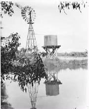
This Project describes the history, evolution, development and features of the Ringwood Lake Park , from
1850 until the present.
Additional content examines the
long-gone Ringwood Antimony Mine, Walking and Cycling Trails, and the continuing emergence
of Ringwood as an important residential and commercial community.
The
purpose of this Project is to describe the
history and evolution of the principal hotels in the original districts of
Doncaster, Templestowe and Bulleen, now part of present-day Manningham Council,
in Melbourne's outer east.
The project spans
the years from 1840 to the present.
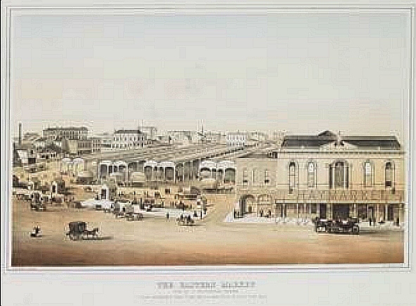
Melbourne's Eastern Market - long gone but not
forgotten!
(Published January 2020)
The Eastern
Market, also known as
'Paddy's Market', was one of the three markets established in
Melbourne, Victoria in the 1840s. It operated from 1847 on a
two-acre Reserve until the demolition of its buildings and sale of the site in
1960. The luxurious Southern Cross Hotel, opened on the ste in 1962. In 1995
it closed and was partly demolished - the hotel
tower remained standing and vacant until its subsequent demolition in 2003.
The Market occupied the land bounded
by present
day Bourke, Exhibition and Little Collins Sts.
The project is amply illustrated,, with maps,
reproductions of early imagery from the 1840s, videos, and contemporary
history. Some anecdotes of my visits to the Market in the 1950s, as well as my
work as a (PMG) Telecom Technical Officer at the Hotel in the 1960s, are
included.
This is a journey, through space and time, chronicling the
history,
heritage and evolution of the Nunawading Migrant Hostel, 30 km east of
Melbourne, which operated from 1952 until closure
in 1987.
This is a journey, through space and time, chronicling the
history, heritage and evolution of the Dandenong Police Paddocks and the Churchill
National Park, 30 km south east of Melbourne.
The Project includes many public-domain out-of-copyright images,
copies of etchings and photographs (dating back to the 1830s), maps, audio/visual content, supplemented
by recent on-site imagery taken by the author.
The
textual content and articles describe the events
and activities depicted in the photographs.
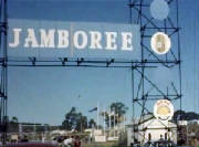
There
are several Chapters devoted to the 7th Australian National Scout Jamboree held
over nine days in the 1964-65 New Year Holiday period, attended by 16,000 scouts.
THE BALNARRING COAST - PICTORIAL HISTORY - 1873 to 2017
This Project describes
in words and pictures the history,
geomorphology, heritage and evolution of the Balnarring Coast, extending from
Somers to Point Leo and nearby areas, centred on Balnarring Township, 80 km
south of Melbourne, located on Westernport Bay.
The Project includes many public-domain out-of-copyright images, drawings,
maps, engravings and photographs, dating back to the 1870s, supplemented with
recent photos and videos taken by the author.
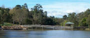
This Pictorial Heritage Research Project, describes
the history, development and evolution of the Parklands of the Yarra Valley in
Melbourne's east.
It is a step-on, step-off journey of discovery through time and space. Like
the Parklands themselves, readers and travellers may stop and appreciate these
magnificent reserves, views, scenes and waterways!
The diverse landscapes provide for a widerange of recreational
pursuits and
contain significant natural and cultural values. The parklands are vital in
contributing to the health and well-being of the community and the character of
the local and regional landscape.
Each Park is listed alphabetically and includes a
Map, a description, historical notes, places of interest, directions, walking
tracks, and images.
Video,
audio, and static/slideshow images, illustrate the Project. It may be viewed at
THE PARKLANDS OF THE YARRA
VALLEY - Published April 2015
Containing 32 chapters, it describes the history and evolution of the Yarra
River Parklands, extending from Ivanhoe to Warrandyte, a distance of some 17
km.
It’s a step-on, step-off journey of discovery through time and space. Like
the Parklands themselves, readers and travellers may stop and appreciate these
magnificent reserves, views, scenes and waterways!
Yarra Valley Parklands are one of the most significant expanses of public
open space in metropolitan Melbourne, covering 1700 hectares. They are
characterised by a diverse array of landscapes including pockets of Australian
bushland, open paddocks and floodplains, aboriginal sites, an old apple orchard
and remnants from early white settlement linked by the iconic Yarra River. The
landscapes provide for a wide range of recreational pursuits and contain
significant natural and cultural values. The parklands are vital in contributing
to the health and well-being of the community and the character of the local and
regional landscape
Each Park is listed alphabetically and includes a scalable Map, a
description, historical notes, places of interest, directions, walking tracks,
heritage and contemporary static and slideshow images, audio and video
features. A comprehensive Bibliography is also included.
This
is a Pictorial Research Project, which examines the history, development, and evolution
of the leafy suburb of Mont Albert,12 km east of central Melbourne, from its beginnings
in 1830 until the present.
Much of the content has been derived from the author's first-hand knowledge of Mont Albert,
which has been his home since 1959, supported by interviews with long-time residents.
The present day suburb of
Mont Albert did not really begin until the early 1890s - prior to then, it
was part of Surrey Hills and Box Hill, and relevant background information about those suburbs
is included, as well as content about adjoining present-day Mont Albert North.
Describes the planning,
design, construction, and operations of this large reservoir, with special chapters about the Upper Yarra Conduit Network,
the history of McVeigh's Hotel, and Walking Tracks in the Reservoir Park. Contains 15 Chapters.
This Project describes the history, development
and evolution of the popular scenicMaroondah Reservoir, 65 km east of Melbourne, near the town
of Healesville.
Comprehensive additional
information is included - maps, and imaging, which include the history of Healesville, the famousYarra Track, Blacks’ Spur, the ReservoirPark, Walking Tracks, Railway proposals, the historical ghost-town of
Fernshaw, and the Maroondah Catchment area.
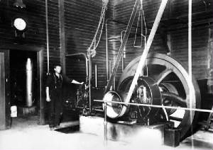
This Project
describes the history of the Maroondah Aqueduct Water Supply System, comissioned in 1891, which at the time was a major part
of Melbourne's major water supply system.
It examines the planning, design, construction, development, and operations of the Aqueduct, the Maroondah
(Watts) Weir. and the Maroondah Reservoir, which collectively represented a massive engineering
construction project of the time.
Additionally,
information is given about the development and evolution of the Preston Reservoir,(the western terminal of
the Aqueduct), the Graceburn Weir, the Yan Yean Reservoir System, and Donnelley's Weir
Chapters describing the public access Maroondah Aqueduct Trail (Healesville), the Maroondah
Aqueduct Trail (Eltham/Research) and theMaroondah Aqeduct Trail (Kangaroo Ground) are included.
This Project
is dedicated to the memory of the men and women who were involved in the building and operations of the System, some of which
remains operational to the present day.
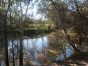
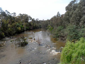
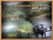
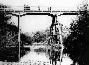
This Project contains 32 chapters, which bring together hundreds
of heritage images, maps and drawings.
It's supported by many of the author's
personal photographs, dating back to 1951, depicting the evolution and development of the
Warburton Forests, 66 km east of Melbourne, Victoria, and in particular its timber industry, between
1853 and 2012.
The Project includes descriptive text, location
maps, sound and video, identifying the actual sites of many of the sawmills, as far as can be reasonably determined, and linking these to the present-day environment.
General descriptive
information about the history of important locations is also given.
This :Project
is based on a collection of archived photographs, maps and reproductions of engravings, depicting the construction and evolution
of the Silvan Reservoir, 60 km east of Melbourne.
Substantial text and other
information link the graphiical content.
The Timeline begins in the 1880s, and continues to the present day, concentrating on the years 1917 to
1934 when the reservoir was under construction.
CENTENARY OF THE O'SHANNASSY AQUEDUCT WATER SUPPLY SYSTEM 1913-2013
This Project describes, in words and pictures, the history of the O'Shannassy
Aqueduct Water Supply System, comissioned in 1914, which was one of Melbourne's major water supply systems at that time.
It is published to commemorate the occasion of the Centenary of the System.
It examines the planning, design, construction, development,
and operations of the Aqueduct, the Weir, the Reservoir, and the Silvan Dam, which represented a massive engineering construction
project of the time.
The Aqueduct itself was decommissioned in 1997, and the Study
includes information about the transition and evolution of alternative underground forms of water delivery into Melbourne
from the O'Shannassy Catchment.
Chapters describing the O'Shannassy Aqueduct Trail and the
Mt. Evelyn Aqueduct Trail are included
This Project is dedicated to the memory
of the men and women who were involved in the building and operations of the System.
BRIGHT
1850-2011 This project traces the history,
evolution and development in words and pictures of the beautiful town of Bright, 350 km northeast of Melbourne, near the foothills
of the Victorian Alps.
The site is essentially a colllection of stories, linked to many out-of-copyright
images and maps from various sources, dating back to the 1850s, supplemented by photographs taken by the author in the years
1962 to 2011.
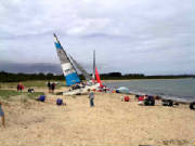
This Project describes in words and pictures the history and heritage of the coastal village
of Shoreham and nearby areas, 80 km south of Melbourne, located on Westernport Bay.
The
Project is esssentially a compilation of public-domain out-of-copyright images and photographs, dating back to the 1890s,
supplemented with photos taken by the author in the years 1952 to 2011.
There are three
Special Sections about the YMCA's Camp Buxton, at Shoreham, which operated
from 1925 to 1955. The author attended the camp in January 1952!
Shoreham Beach is a wonderful place at all times
of the year, If you happen to visit or reside in Melbourne, and haven't been to Shoreham recently, then why not go down there
- it's only 90 minutes drive from the CBD!
This Project is a compilation of images, maps, engravings, with textual information describing
the history and heritage of the Mt Donna Buang area and surrounding environment, over the years 1890 to 2011..
The mountain is within the Yarra Ranges National Park, 80 km east of Melbourne.
The Project is a collection of over 300 images and maps, tracing the heritage and evolution of the semi-rural
former gold-mining town of Warrandyte, 25 km east of central Melbourne, Victoria, Australia, with a time-line extending from
1839 to 2010.
Comprehensive original text articles by the author, and about 100 contemporary mages from his personal year-2010
collection, complement the Historical Galleries, and describe the many events depicted in them.
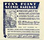
FOX'S POINT
SCENIC RAILWAY - KALORAMA - 1954 to 1961
This work is a free on-line dissertation, containing 12 chapters,
which brings together many heritage images, descriptive text, location maps and drawings, about the long-forgotten Scenic
Railway, Kalorama.
Images All
images in the Project Sites are thumbnailed. Clicking any image will produce a full-sized display in a new browser window.
Search Engine There is a Search Engine at the top of all Project
Sites. This will take the reader to a new window displaying the locations in the site for the search query.
System Requirements All Project
Sites require the following applications to be installed for full functionality: Adobe Flash Player (or similar), Javascript,
and Windows Media Player (or similar). The sites are optimised for Internet Explorer 9 - the use of other browsers may not
yield satisfactory results. Cookies must be enabled. Font sizes may be changed by the user to suit individual viewing preferences.
Sources Many images are out-of-copyright and sourced to publicly
available sites on the Internet - accreditation is not required or given. A listing of principal research sources used may
be found at the end iof each Project Site. This Site, and all
Project Sites are listed under Creative Commons Licenses.
Images Unless
otherwise indicated, all images in the Poject Sites tagged "2011, 2012" or "2013" are those by the author, from his many
visits to the locations mentioned.
Advertising Targeted
adverts are displayed on this Site and Project Sites via AdSense.
Publication
This Site is updated when new Heritage Projects are created.
GUESTBOOK
RECOMMEND
LAST UPDATED
Add your content here
Add your content here
Add your content here
Please donate a small amount to assist wth hosting charges for this site! Click the Pay Pal logo to donate.
A suggested amount is AUD$5. Thank you!