Silvan Reservoir Pictorial Heritage - 1880 to 2011

The abandoned Second Reservoir

Home
About this Research Project
Timeline 1880-2010
Historical Background from 1917
Construction 1926-1932
Aerial Ropeway
Aerial Cableway
Steam Tramway
Development after 1932
Modern Era
The abandoned Second Reservoir
Silvan Forest
Reservoir Park
Stonyford Forest Nature Trail
Maps
Acknowledgements
Contact the Author

silvandam2.jpg
Map showing proposed location (green shading) of the second Silvan Reservoir

In 1930, the Government has proposed to build a second reservoir, very close to the main reservoir, which was to be knowen as "Silvan Reservoir 2".

It was to augment the main reservoir

It would have been a lake of some 300 hectares, consuming about 800 hectares of forest, to occupy the area surrounding the Lyrebird Creek, Rifle Range Gully Creek, and the Olinda Creek.

A "tourist road" along the edge of the new reservoir was planned.

This would have requured the compulsory acqusition of private property and small farms adjacent to what is now the Olinda Creek Rd.

There was striong and sustained public resentment of the proposal, which was subsequently abandoned.
 

stonyford2011.jpg
Site of the original ford over Stonyford Creek

olindaarborertum.jpg
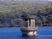
The Reservoir, from Woolrich Lookout 2011

Thanks for dropping by and taking a look at my Project!  I'd like to hear from you with any comments or reactions - please Email to  Bob Padula