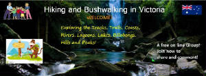
This is the INTERNET GUIDE TO SHORT WALKS IN VICTORIA!
Its author and creator is Bob Padula, OAM, of Mont
Albert, in the east of Melbourne.
I am a Professional Engineer, providing technical consultancy services in the area of
high-frequency broadcasting - I graduated from the Royal Melbourne Institute of Technology in 1967, and was employed by Telstra
Corporation until 1998.
I have been actively involved in bushwalking since 1954, and regularly undertake short walks around Greater
Melbourne and nearer country areas. I also have a passion for digital photography, 4WDing along unmade roads, and exploration
of parks, reserves, sanctuaries, coasts and mountains!
This Guide contains details of walks I have completed in the period from March 2005 until now, and most can be completed by anyone
with a moderate level of fitness. Some walks are suitable for persons with limited mobility.
Most walks described are located in the general area around Melbourne, but there are
many further afield!
In publishing this free Guide, and sharing my knowledge and experiences through the Internet, it is with
the hope that it will encourage readers to set aside some time to venture regularly into the Victorian countryside and enjoy
the beauty and scenery which it offers, and at the same time support the development and maintainence of an appropriate level
of fitness.
The starting points for all of the walks listed are easily reached
by conventional cars, including some over good unsealed gravel roads. They range from relatively short hikes of about an hour
or less, to more extensive half or full day adventures. Overnight walks are not included in this Guide.
Some walks are step-on, step-off shorter hikes, which are part
of longer multi-day trips. They include the:
I have also included accounts of many of the network of excellent
walks constructed by the Great Dividing Trail Association, based in the Daylesford district.
Several walks are along the nearer Coast, including trips around
Westernport Bay.
The Guide also covers many walks in the extensive Yarra River Parklands to the north east of Melbourne, and hikes in reserves and parklands in the outer east of Melbourne, including
the large Dandenong Valley Parklands.
Destinations.
Some of the hikes are to places which
are not often visited, which have been discovered from careful research of Melway's and other maps, personal observation,
perusal of the comprehensive Park and Track Notes issued by
Parks Vic and DSE, examination of hard-to-get publications, and contacts with Shire Councils, Bushwalking Clubs, activity-based
organizations. and social media
Site
Navigation.Clicking on the desired link on the Navigation Bar
at the top of this Front Page will take you to the selected Regional page, where you will find a listing of the walks
in that Region. The Navigation Bar appears on each page, and the headings there
are Rollover Links. Throughout the Guide,except the Navigation
Bar, text which is underlined is a clickable link to a URL, either internal or external.
Each
walk shows distance from Melbourne, length, duration, features, date completed, general notes. Some have links to Track
Notes (or Maps) issued by Parks Victoria or other agencies, and links to the relevant Photo Album
for that walk.
The Photo Albums have
detailed information about the Walks to which they refer, and the images may be viewed there as Slide Shows or individually.
APRIL 2018 - PLEASE NOTE
Many of the Photo links to the walks are no longer active. These were hosted by the Worldisround.com Photo
Storage service which was permanently closed down without notice by the administrator in mid-2014. That site had about
1 million images from several thousand subscribers, all of which have been irrecoverably lost.
Walks have been placed in the most appropriate
Geographical Region, which include National, State, or Local Parks. Several of the bigger Parks extend across
the geographical regions adopted in the Guide - they include several tracks in the Dandenong Ranges, the Lysterfield
Hills, and West Gippsland.
Sub-pages are provided for some Regions, where there are many walks.
All of the walks listed have been undertaken by myself in
the period from March 2005..
A word of caution:
some walks in the Dandenong Ranges National Park and the Kinglake National Park are steep and rocky, and care should
be exercised if undertaking those tracks during or after wet weather.
I have also included details of the 37 km Lilydale-Warburton Rail Trail, which I completed by bike in 2006 - there are many access points to this wonderful Trail, which is used
by walkers, cyclists, horses, ponies, joggers, prams and dogs!
Support Features. There are links on the Navigation Bar
to various features in the Guide, which you are invited to explore!
Though created for Walking, the Guide may of course be used alternatively for selecting interesting
destinations for non-walking activities, or sight-seeing! Visit Best Lookouts for a selection of special viewpoints!
New content or updating information will
be added to this Guide from time to time. I frequently visit many places to review previous walks,but
unless there has been substantial change, I do not describe these reviewed hikes in the Guide!
I hope that this Guide will have provided you with some interesting destinations to explore!(Bob Padula)
Bogong High Plains - early 1900s (SLV)
HIKING AND BUSHWALKING IN VICTORIA
Visitors to this Website may be interested in joining the (free) Facebook
Group "Hiking and Bushwalking in Victoria". The Group's main objective is to
provide a means of quick interaction, information and discussion between its
several hundred members about their hiking and bushwalking experiences in
Victoria.
A
new Website has been published, titled Victoria - a Pictorial Heritage, authored
by Bob Padula, OAM, of Mont Albert, Victoria, Australia.
It 's a directory of free, on-line, Research Projects compiled by the author, about the history, development
and evolution of selected places and major engineering projects of significant heritage interest in Victoria.
A Synopsis of each Project is described,
with an accompanying image and a link to the source URL.
When new Projects are published,
the Directory will be updated.
This Walks Guide receives several hundreds
of visits each month, and I would REALLY like to know what YOU
think of it! Please let me know - this only takes a few
moments using the "Sign my Guest Book" icon! Many
thanks in advance for your feedback! (Bob Padula)
DONATIONS!
Please consider a small one-time donation (A$5 - US$5) to help pay for hosting charges
for the site! Easy, secure and quick via PayPal! Click the Logo!
The Cathedtal - Mt Buffalo
Mt St Leonard - view from Market Garden Tk - Warrandyte SP
WHERE WOULD YOU LIKE TO GO? !!
Every place,destination, and location in this Guide
is stored in a database. Enter the word into the box, hit "find"and if it is the site, its page location(s) will
be displayed on a new screen! Use this feature as a quick "go to" for places and parks! Try it out! The database is updated
daily
Buffalo massif from Power's Lookout
Alps view from Mt Hotham
WHAT'S
NEW!
(Updated -
January 1, 2017
QUICK LINKS TO THE LATEST WALKS ADDED TO THIS GUIDE!
Australian Bushwalking Journal Hundreds of searchable entries, with selected images, location maps, in chronological order!
NOTE!
Many of the walks outside of the Melbourne Regionmay be linked to form longer overnight trips - there are printed Walks Books which you may purchase from booksellers, map retailers, activity shops and Parks Victoria, containing suggested
detailed itineries of those expeditions.
Longer walks are also arranged via Bushwalking Clubs and commercial tour companies.
Many walks commence from picnic grounds, or car parks at Lookouts.Whilst the Guide is intended essentially for walking activities, it may also be used as a "Drive
Guide" to interesting places, if it is not practicable to undertake the actual walks.
If you have suggestions, comments or ideas
about this Guide, please contact the author Bob Padula. Alternatively use the Reader Survey Feedback Form. All messages willl be acknowledged!!