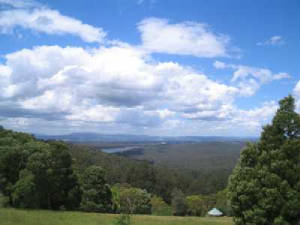
The Mt Dandenong Massif - an extinct volcano!
The Dandenong Ranges National Park will satisfy all levels of interests of bushwalking enthusiasts!
It is conveniently located on the doorstep of Melbourne, and over one million visitors are atttracted
to the Park each year, enjoying a variety of recreational opportunities, flora and fauna.
More than 300 million years ago, a large volcano erupted through the earth's crust, near the present township
of Olinda. The impact of weathering on the volcanic rocks by the water and wind contrasted with the softer sedimentary
rocks to form the Dandenong Ranges.
The Park has a rich Aboriginal heritage. the Wurundjeri Aboriginal people
lived in the area and were believed to have followed tracks through the foothills to hunting gronds in the Great Divide. They
had an intimate knowledge of the native plants and animals and this allowed them to obtain vegetable products, including roots,
leaves, stalks, fruits, gums and resins.
The highest peak is Mt Dandenong, at 633m, and the second highest point is nearby Mt. Cornhanwarrabul,
628m.
The park covers an area of about 3215 hectares, with some 250 km of walking
tracks. The Park perimeter is about 150 km.
Settlers moved to the foothills in the early 1850s and undertook widespread clearing of the forests for
agriculturall land and timber resources. In the late 1860s, the Dandenongs became the retreat of the wealthy and then
the general population with the introduction of the motor car. In 1882, land was reserved as a site for public recreation
and in 1927 the area was declared the Ferntree Gully National Park.
In the early days, travel was mainly by foot, bullock train, or coach and horses, and the first motor cars
appeared in the ranges about 1910. There was once a proposal to build a railway from Boronia to Olinda, but this was later abandoned.
Until the early 1950s, a tourist railway operated from the Mt Dandenong Tourist Rd, known as Fox's Point
Scenic Railway, situated between Montrose and Kalorama, but was decommisioned in the late 1950's.
The Park was proclaimed in December 1987, with the amalgation of the Ferntree Gully National
park, the Sherbrooke Forest and Doongalla Estate. The Olinda State Forest, Mt Evelyn and Montrose Reserve were formally added
to the National Park in 1997.
Many of today's walking trails were once logging or bullock tracks, and subsequently were converted into
fire management tracks when logging was phased out. They are now shared with walkers, cyclists, joggers, and horse/pony
riders.
The Park is divided into these five general administrative sections: