Centenary of the O'Shannassy Water Supply System - 1913 to 2013 - a Pictorial Heritage

2007 - O'Shannassy Aqueduct Trail - Overview

Home
Introduction
1803 - Beginnings
1892 - Surrey Hills Reservoirs
1911 - Design and Construction
1911 - The O'Shannassy Weir
1914 - Maintenance and Operations
1923 - Bushfires, Landslips, and Floods
1924 - Modifications and Enlargements
1927 - Silvan Dam
1927 - Mt Evelyn Aqueduct
1928 - The O'Shannassy Reservoir
1929 - Upper Yarra Conduits
1931 - Silvan Inlet Aqueduct
1996 - Decommissioning
2006 - Pigging Project
2007 - O'Shannassy Aqueduct Trail - Overview
O'Shannassy Aqueduct Trail - Parrot Rd to Don Rd
O'Shannassy Aqueduct Trail - Don Road to Dee Rd
O'Shannassy Aqueduct Trail - Dee Rd to Sussex St
O'Shannassy Aqueduct Trail - Sussex St to Yuonga Rd
O'Shannassy Aqueduct Trail - Yuonga Rd to Donna Buang Rd
O'Shannassy Aqueduct Trail - Donna Buang Rd to Cement Creek Rd
O'Shannassy Aqueduct Trail - Cement Creek Rd to the Weir
The Present
Epilogue
Timeline
Bibliography
The Author's Websites
2007 - O'Shannassy Aqueduct Trail - Overview

The official Parks Vic Website for the Trail is at

http://parkweb.vic.gov.au/__data/assets/pdf_file/0007/315628/Park-note-Yarra-Ranges-NP-OShannassy-Aquaduct-Trail.pdf

Now part of the Yarra Ranges National Park, the O'Shannassy Aqueduct Trail is a long, step-on, step-off 27 km walking/cycling/horse route starting at Parrot Rd, Launching Place, and ending at the O'Shannassy Weirr, about 80 km east of Melbourne, past the town of Warburton.

The Aqueduct was constructed between 1911 and 1915, and decommissioned in 1997. The maintenance track, known as Road 18, has been opened up progressively for walkers, horse-riders and cyclists, following transfer of land ownership from Melbourne Water to Parks Victoria.

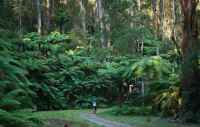
The Trail passes through magnificent Mountain Ash forest, past fern gullies, with excellent views across the Yarra Valley towards Mt Little Joe and the mountains near Big Pats Creek. It winds its way around the base of Mt Donna Buang, Mt Victoria and Ben Cairn, passing many aqueduct engineering works, bridges, syphons, huts, distance marker posts and old maintenance sheds.

New access gates for walkers and cyclists have been built at various locations along the route, with adjacent car parks, and some with picnic areas.

From west to east, the Sectors are:

Parrot Rd to Don Rd 4 km
Don Rd to Dee Rd 5.3 km

Dee Rd to Sussex St 4 km
Sussex St to Yuonga Rd 3 km
Yuonga Rd to Donna Buang Rd 2 km
Donna Buang Rd to Cement Creek 4.8 km
Cement Creek Rd to O' Shannassy Weir 7.6 km

Sadly, there has been massive encroachment of vegetation, fallen trees, branches, and weeds in sections of the Aqueduct.

The following Pages (click in Navigation bar at left!) offer a virtual tour easterly all the way to the Weir!

 
Points of Interest along the Trail
 
These are the most important features passed along the Trail, travelling from west to east.

Parrot Rd - car park
Footbridge Bridge over Don River
Staircase to Don Rd
 
Don Rd - car park
Pipe converts to channel
Platts Creek crossing
Frenchmans Creek crossing
Kenedys Creek crossing
McKechnies Creek crossing
Management Hut
Syphon
Dee River bridge
 
Dee Rd - car park
Harrisons Creek crossing
Walker Creek crossing
Stockdale property - entry
Dirty Gully Creek - crossing
 
Sussex St - small car park
Ythan Creek crossing
Brookfield/Parbury/Anderson Mill - bridge
Mt Victoria Track
Richards Mill bridge
Brisbane Creek crossing
 
Yuonga Rd - car park
Rocky Creek crossing
 
Donna Buang Rd - small car park
Robinson's Mill bridge crossing (sign shows "Pickersgills")
Pipe emerges as open channel - later converts to pipe
Syphon
Walkway (built 2012 over pipe route)
West Cement Creek crossing
Cement Creek Basin
 
Cement Creek Rd - car park
Cement Creek crossing
Management hut
Pipe converts to open channel
O'Shannassy Weir (no public car access)
Contact the Author