|
|
 |
|
|
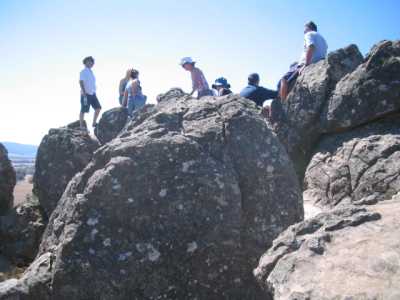
| The Summit of Hanging Rock - 2006 |
Mt. Alexander Regional Park. (100
km N). Calder Highway, Faraday, Sutton Grange Rd, to main car park on summit. Follow signed tracks to Shepherds
Flat and Dog Rocks. Other tracks start at the summit. Excellent panoramic views
across the ranges in most directions. (Note: Part of this walk follows the Great
Dividing Trail walk). (4 km, one hr, April 2006)
Hanging Rock Regional Park. (70 km N). Calder Highway, Hanging
Rock Rd, to main car park (admission fee). Follow signed track to summit and return. The final sector is a scramble up exposed
rock faces. The rewards are superb views across the plains! Other tracks
may be followed from the main car park.If you are having a Picnic, take special care... (3 km, 1 hr. March 2006)
Photos | Map
Macedon Regional Park. (70 km N). Calder Highway, Mt Macedon
Rd, to main carpark. Follow signs to these walks: Sanatorium Lake Eco Tour Track, Camel's Hump Track (steep), Memorial Cross.
These walks are a sample of several, which offer good views,
scenes, lakes and forests . (6 km total, 2 hrs, April 2005).
Photos | Map
Emu Bottom Wetlands Reserve and Homestead. (45 km N).
Tullamarine Freeway, Sunbury Rd, turn into Racecourse Rd in Sunbury, then 4 km to car park at signed Emu Bottom Wetlands Reserve.
Follow marked Platypus Walking Trail past Jackson's Creek, the Gorge, and Patto's Hill. There are three platypus viewing platforms
along the trail. Good views across the open Wetlands, Jackson's Creek, and the Gorge.
(3 km, 1 hr, October 2007). Option:
Visit Victoria's oldest Homestead about 1 km further on, nearby, built 1836.
Black Hill Summit Hike - Kyneton District. (80 km N).
Calder Freeway, Kyneton, Beresdale Rd, Ellis Rd, to car park at entrance to Black Hill Reserve. Follow signposted and marked
low circuit track to Northern Lookout, then along Ridge Tk to Eastern Lookout. Return the same way. (An
alternative return is via the high level track). Black Hill is an extinct volcano.The Lookouts are about 525 m
above sea level - 85 m above the surrounding plains. Bushland, excellent
views from both lookouts across the vast lava plains, huge granite boulders. (3 km, 1 hr, December
2007)
Photos | Map - see Melways
Conglomerate Gully Fauna and Flora Reserve - Riddle's Creek District.
(70 km N). Calder Freeway, Gisborne, Riddle's Creek, Wheelwright's Rd, to small car park at signed entrance to Reserve.Follow
marked circuit track through gate. Bushland, information board, ancient rock formations, cliffs,
rugged gully, viewing platform, log hut, wildflowers. Track is steep and stony in parts, with a change
of altitude of 100 m. This is an excellent walk, through a little known Reserve. (3
km, 1 hr, December 2007).
Photos | Map - Melways
Cobaw Ranges Forest. (65 km N). Calder Freeway, Woodend,
Newham, Egan Lane, Forest Rd, Blands Rd, to small car park at junction with Crozier's Rd. Walk up the steep winding 4WD Rudge
Rd to large bush camping area and return. Excellent views to the Macedon Ranges - forest envirnment.
(4 km, 1.5 hrs, Jan 2008).
Photos | Map - Rooftops Cobaw Ranges Forest Activities
|
|
|
|
Distances to the start of walks, from Melbourne, are in brackets against
their descriptions
|
|
|
|

