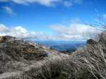
Melbourne's Mountains.
Melbourne is located in a vast basin, surrounded by a ring of mountains, many being the result of volcanic
activity millions of years ago. These mountains generally form part of the south-eastern tip of the Great Dividing Range.
Never fear, there is litttle likehood of any eruptions in the immediate future!
The extent of Melbourne's Mountains can best be appreciated from many splendid viewpoints
in the Dandenong Ranges and nearby hills, such as the
Skyhigh Observatory (Mt Dandenong)
Mt Lofty Lookout (Warrandyte State Park)
Bushy Park Summit (Vermont South)
Norton's
Park (Glen Waverley)
Shoppingtown (Doncaster)
arrandyte State
Park)
Sunset Track View Point - Lysterfield Lake Park
Woolrich Lookout (Olinda)
John's Hill Lookout (Kallista)
Kalorama Park Lookout
Burke's Lookout (near Mt. Dandenong)
Trig Point Lookout (Churchill National Park)
Mt Wise (Yarra Glen)
Plenty River Trail (Viewbank)
Wilson Botanic Park (Berwick)
Royal Botanic Gardens (Cranbourne)
Other excellent Lookouts further away from Melbourne, many of which are walk destinations
mentioned in this Guide, include those at
Mt Macedon
Mt. Speed (south of Trafalgar, Gippsland)
Mt Cannibal (Garfield North)
Malleson Lookout (Healesville)
Maroondah Lookout (Healesville)
Mt Alexander
Hanging Rock
Mt St Leonards
Ben Nevis
Flinders Peak (You Yangs)
Arthur's Seat Summit
Mt. Langi Ghiran
Mt. Lonarch
Ararat Regional Park Lookout
Seven Acre Rock (near Powelltown)
Mt Nelse (Bogong High Plains)
Mt Feathertop Trail
Mt Stapylton (Grampians)
Mt Sugarloaf (Mt Cole State Forest)
Mt Sturgeon (Grampians)
Mt. Abrupt (Grampians)
Boronia Peak (Grampians)
Snowy Point Lookout (Lake Mountain)
Mt Sugarloaf (Kinglake NP)
Mt Buangor Lookout
Mt Donna Buang Summit Lookout
Dom Som Saddle (Narbethong)
Macclesfield Rd Viewpoint (Macclesfield)
Doctor's Creek Lookout (Upper Yarra Reservoir)
Exploring the Tracks. When you go on the mountain tracks such
as in the Dandenong Ranges National Park, the Yarra Ranges National Park, the Kinglake National Park, and
the Mt Cole State Forest, remember that many of these were once logging or bullock tracks from the 1840s, and subsequently
converted into fire management tracks.

