|
|
 |
|
|
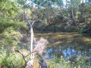
| Blue Tongue Bend - Warrandyte SP |
WARRANDYTE DISTRICT
WARRANDYTE STATE PARK (click for separate page!)
Other
walks in Warrandyte District:
Longridge Park Walk - Warrandyte.
(25 km NE). Access: Warrandyte-Heidelberg Rd, Alexander Rd, to gate opposite locked entrance to Longridge Camping Farm.
Walk downhill on fire access track to Yarra River. Follow a rough foot-track past the Camp and return to gate. Climb old fence
next to gate marked "Parks Vic - Management Vehicles Only" and continue up a hill along a ridge, through former cattle grazing
land, past revegation plantations. Continue until the end of the track is reached and return. Nice
views of the Yarra and rapids and across the valley. Note:
The adjacent Camping Farm is not accessible to casual visitors - a permit is required from Parks Vic for entry. (3 km,
1 hr, April 2007).
Photos | Map
Currawong Bush Park Walk - Warrandyte. (25 km NE). Access:
Springvale Rd, Reynolds Rd, to picnic ground. Follow signed trail along Mullum Mullum Creek to Orchard Grove, return via the
high level ridge track (take care, as indistinct in parts!) Follow signed
track to the lagoon and return. Visit the Wildlife Enclosure. Remnant bushland, part of
Park was formerly a cattle grazing property. (5 km, 1.5 hrs, Marcn 2007)
Photos | Map - see Melways
CHRISTMAS HILLS DISTRICT
Robert's Track. (60 km NE). Yarra Glen, Yarra Glen-Eltham Rd, Mt Wise Rd, Butterman's Tk, to small car park and gate. Go through gate,
reach unsigned Robert's Track on left, continue to gate at southern end of track at junction of One Tree Hill Rd and return.
This is a pleasant hike through bushland and around stud farms, nice views of the nearer
Ranges. (6 km, 2 hrs, Feb 2008)
Happy Valley Track
(Southern Sector) - Smith's Gully. (50 km NE).
Start and finish at small picnic ground signed "One Tree Hill Reserve", on Eltham-Yarra Glen Rd, near the Christmas Hills
Primary School. Pass through gate and cross ford, continue steadily upwards to the turnaround point about 3 km from start.
Track follows the Happy Vallley Creek and gully. There is a picnic table and seats just off the
Track about 2 km from start. On the return, identify a rough jeep track off to the left, proceed up this to the summit (about
1 km) through interesting bushland, then return to the main track.
(6 km, two hours, October 2006). (Note: the Track
continues to the junction of One Tree Hill and Mine Shaft Roads - this is a separate walk)
Happy Valley Track - Northern Section - Smith's Gully. (50
km NE). Access: Yarra Glen to Eltham Rd, One Tree Hill Rd, small car park next to concrete water tank at Mine Shaft Rd.
Pass through gate, noting old gold diggings, descend past disused mine and tunnel, to a turnaround point about 2 km. Return
to car park.Track follows the Happy Valley Creek. Pleasant fern gullies, forest, and
remains of gold diggings. (4 km, October 2006, 1 hr).
Photos | Map - see Melways
Ridge
Track - Smith's Gully.(50 km NE). Access: Yarra Glen to Eltham Rd, One Tree Hill Rd, to small car
park next to gate, opposite entrance of private property "no. 295". Go through gate, follow track along the ridge, then
descend to junction with O'Shea's Rd. Return to carpark. Very good views to the west from
the ridge top, passing through unusual bushland. (4 km, July 2006, 1 hr)
Photos | Map - see Melways
Wimbi Reserve Track - Panton Hill (50 km NE). Access:
Yarra Glen-Eltham Rd, Alma Rd, Long Gully Rd, to small car park at junction with Motschall's
Rd. Follow foot-track along east flank of Boomer's Creek, in bushland, adjacent to Wimbi Reserve, to junction with Howard's
Rd. Return to start. Track is in the old gold-mining region. (2 km, 45 mins, November 2006)
Photos | Map - see Melways
Boomer's Forest Reserve Tracks - Panton
Hill. (45 km NE). Access: Warrandyte, Warrandyte to Kinglake Rd, Panton Hill, St. Andrews Rd,
to signposted reserve at small car park. Several tracks may be explored, passing through regrowth forest in old gold mining region. (3 km, 1 hr, March 2007)
Photo Album | Map - see Melways
Yirrip (Red Ironbark) Hill Reserve - Panton
Hill. (30 km E). Eltham, Kangaroo Ground, Panton Hill, Couties Rd, to signed reserve on
south side. Park opposite gate. Explore the reserve. Excellent views to Kinglake Ranges
from the hilltop - 171 m. Remnant stands of Yirrip (Red Ironbark). The reserve extends downhill to the
south over scrubby terrain, where it becomes Koos Reserve, accessed from Kings Rd. (1 km, 30 mins, September 2007).
Photos | Map - see Melways
Rifle Range
Reserve Walk - Smith's Creek. (35 km NE). Access: Warrandyte, Panton Hill, Smith's Gully Rd, Salters
Rush Rd, Rifle Range Rd, to small car park at locked gate, adjacent to private property No. 205. Proceed up track, turn right
at first junction, continue along ridge reaching a view point at site of a former homestead. Return to start. Excellent views across the Christmas Hills, past old gold mining diggings, and to the Yarra Ranges in the
far distance. This region is in the newly proclaimed Kinglake-Warrandyte Nature
Conservation Reserve. (4 km, 1 hr, April 2007).
Photos | Map
Rifle Range Track - Rifle Range Reserve.
(40 km NE). Yarra Glen, Yarra Glen-Eltham Rd, Mt Wise Rd, Butterman's Tk, to small car park and gate. Go through
gate, ascend to summit, passing another track on the left, reaching junction with the ridge track, described in another walk
as Rifle Range Reserve Walk - Smith's Creek. Return
downhill to junction with track to right (southerly), known as Robert's Track, explore this track for about 1 km, then
backtrack to car park. This walk is in the recently proclaimed Warrandyte-Kinglake
Nature Conservation Reserve. Excellent forest environment, through
former logging region, views towards Kinglake Ranges. (6 km, 2 hrs, August 2007).
Photos | Map
Heritage Trail - Smith's Gully.
(35 km N). Kangaroo Ground-St. Andrew's Rd, Smith's Gully Rd, to car park at entrance to Trail, opposite the Historical Queenstown
Cemetery. Follow trail to Black Cameron Rd and return. Track is in the old mining region
- many interpretative signs and mining relics. (1 hr, 3 km, May 09)
Photos | Map - see Melways
Sugarloaf
Reservoir Park. (35 km E). Lilydale, Maroondah Highway, Yarra Glen, Eltham-Yarra Glen Rd, Simpson's
rd, to car park at main entrance. Follow signed track around reservoir
to summit of Mt. Graham. Excellent views across reservoir and surrounding hills. (5 km, 1 hr, Dec 2008).
Photos | Map
Oxley Forest Reserve - Bend of Islands (Kangaroo
Ground). (25 km E). Warrandyte, Warrandyte-Kangaroo Gd Rd, Eltham-Yarra Glen rd, Henley Rd, to small car park
signdd "Oxley Reserve" at junction with Catani Rd. Follow rough tk througn bushland to rugged north bank of Yarra - this is
opposite the Yarra Brae section of the Warrandyte State Park. Return. Nearby is the southern access tk to the recently
proclaimed Warrandyte-Kinglake Nature Conservation Reserve, at the Oxley Bridge.
Go through gate, follow "Walkers and Management Vehicles" tk alongside Watson's Ck for about 1 km and return. Bushland, Yarra River, Watson's Ck, good views from the high points on Henley Rd to the Sugarloaf Reservoir,
Yarra Ranges NP, Kinglake Ranges, and Dandenong Ranges NP. (3 km, 1 hr, October 2007)
Photos | Map - Melways
YARRA VALLEY REGION
Yarra Junction - Little Yarra Riverside Walk (60 km east)
Start at the crossing of the Lilydale-Warburton Rail Trail at Corduroy Rd, west of the town
centre. Follow this Trail to the Yarra Valley Museum. The signed Riverside Walk starts immediately behind the Museum
and follows the river for about 1 km. It passes the commemorative sculpture for the Meeting Place of the Manna Gum Aboriginal people. Return the same way. The Museum is only open on certain days, and a small admission
fee is charged. Good views of the river, and north across the Don Valley, to Ben
Cairn, the Warramate Hills, and Mt Toolebewong. (4 km, one
hour, August 2011).
Photo Album | Map - Melways.
Lilydale-Warburton Rail Trail. This is a magnificent 38 km multi-use trail for walkers, cyclists, horses, and dogs,
linking the outer suburb of Lilydale (34 km east of Melbourne) with the town of Warburton. It follows the former railway
line alignment. It is a "step-on, step-off" gravel trail, and there are many access points along it. It crosses
open farmland, through forests, and over creeks, bridges, passing through the old stations at the settlements of Mt. Evelyn,
Wandin, Seville, Woori Yallock, Launching Place, Yarra Junction, Wesburn and Millgrove. The
views to the ranges across the Yarra Valley are superb.
I
did this Trail by bike in mid 2006, spread over five main sectors, 76 km return!
Mt Evelyn-Wandin Photos
Wandin-Seville Photos
Seville-Launching Place Photos
Yarra Junction-Wesburn Photos
Wesburn-Warburton Photos
Spadoni's Nature Trail - Yering.
(50 km E).
This trail is located in the Spandoni
Reserve, at the end of Victoria Rd, 10 km north of the Maroondah Highway, Croydon North. The circuit walk passes
through interesting bushland on the river flats, along the banks of the Yarra, with good
views to the adjacent Christmas Hills. A rarely-publicised walk!
(3 km, one hour, January 2009)Photo Album | Map - see MelwaysYarrabridge
Reserve. (50 km E) Pleasant circuit nature trail,
start and finish at small car park at Yarra River bridge, on Healesville-Koo Wee Rup Rd, turn off at Woori Yallock.
Track passes alongside Yarra River and through Ti Tree and open grasslands. Good
views of the river and towards Mt. Toolbewong. A little-known walk!
(3 km, 1 hr, January 2008)
Photo Album | Map - see Melways
Warramate
Nature Conservation Reserve. (50 km E). Warburton Highway, Seville, Sunnyside Rd, Killara Rd, Yarraloch
Way, to small car park at entrance to Reserve. Follow track, ascend (very steep) jeep-track
to the fire access track, reaching Briarty Hill and communications towers. Return to car park. Bushland,
open woodland. Superb views of the Yarra Valley and the Ranges. This is a relatively unknown Reserve
of 256 hectares. (8 km, 1.5 hrs, April 2008).
Photos | Map - see Melways
Haining Farm - Launching Place. (55 km E). Lilydale,
Warburton Highway, Launching Place, Don Rd, to public picnic ground at corner of Dalry Rd. Explore the foot-tracks alongside
the Don River. Guided tours of this large working Farm may be arranged with Parks Victoria. River
frontage, bridge, views, ferns, bushland, barbecue. (1 hr, 1 km, September 2007).
Photos | Map - see Melways
PLENTY GORGE PARKLANDS
Hawkstowe Park Trail (25 km NE). This trail is
in the large Government-owned Hawkstowe Park, a former estate and homestead. Access: Lower Plenty Rd to South Morang, turn
off at Gordon's Rd. The walk circumnavigates the lake, the former orchard, and continues
to a Lookout with good views of the Gorge. Visit the old homestead (c1850), and the stables! (2 km,
one hr, Sepember 2006)Photo Album | Map
Yarrambat Park Walk. (25
km NE). Lower Plenty Rd, South Morang, Yan Yean Rd, car park at Yarrambat Park.Follow wide shared track to Plenty
River and return. Nice views of the River and surrounding hills. (4
km, 1 hr, September 2006). Photo Album | Map
Middle Gorge Walk. (25 km NE). South Morang, Middle Gorge Rd,
car park at Gorge. Follow foot-track along river bank to end, then return. Interesting views
of the Gorge and river. (2 km, 30 mins, September 2006).
Photo Album | Map
Yan Yean Walk (35 km NE). Lower Plenty Rd, Arthurs Creek Rd,
Recreation Rd, to main car park. Follow marked paths through tall pine trees, along dam wall to information board/lookout
and return. Inspect caretaker's cottage. Nice views across
the dam to surrounding hills. (3 km, 1 hr, September 2006).
Photo Album | Map
Yellow Gum Park - Plenty. (15 km NE). Greensborough,
Diamond Ck Rd, Yan Yean Rd, Memorial Dr, Goldsworthy La, to car park/picnic gnd. Follow circuit trail around Blue Lake. Gorge, bushland, views, Plenty River, Blue Lake, barbecue. (3
km, 1 hr, October 2007)
Photo Album | Map
POINT COOK COASTAL PARK
Homestead Circuit Walk (25 km SW). Access: Princes
Highway, Pt Cook Rd, to picnic ground at Pt Cook Costal Park. Proceed through picnic ground, then along beach easterly to
the Homestead grounds. Pass the former jetty, turn into large clearing, then turn right (east) at sign "Point
Cook". Go through wire fence (gate is padlocked!), follow track through stands of old pine trees. Pass the Pt Cook
Beacon and Trig Point (at left). Track becomes sandy - turn right past the Beacon - locate the sign "Point
Cook" - this is the actual "point". Return to the Homestead picnic grounds - if desired, inspect the beautiful
restored property (admission fee charged). Follow southern fence line along beach until a jeep access track
is reached. proceed along this track back to the picnic ground and carpark. (As at January
2007, this jeep track was proposed to form part of the Pt Cook sector of the long Bay West Trail, linking Williamstown
with Werribee). (6 km, 2 hrs, January 2007) (Note: See the other Walk in this Notebook, starting from Homestead
and taking in the Cheetham Wetlands and Observatory Tower).
Photos | Map
YARRA PARKLANDS
Banyule Flats - Viewbank. (15 km E). Lwr Heidelberg Rd, Rosanna
Rd, Banyule Rd, Somerset Rd, to car park at Banyule Flats Reserve.
Walk 1: Follow Main Yarra Trail easterly to Bond's Rd and return -
river views, bridges, farmland and bushland.
Walk 2: Follow Plenty River Trail
to high point on summit and return. Excellent
views across Yarra Parklands to Dandenong Ranges. (6 km total, 1.5 hrs, September 2007)Photos | Map
Banyule Swamp. (15 km E). Lwr Heidelberg Rd, Rosanna Rd, Banyule
Rd, Somerset Rd, to car park at Banyule Flats Reserve. Follow signed Main Yarra Trail, then on footrack to perimeter
of Banyule Swamp. Return. Bushland, wetlands, swamp, waterfowl, Yarra River, billabong.
(45 mins, 2 km, October 2007).
Photos | Map
Warringal Parklands. (15 km E). Lwr Heidelberg Rd, Rosanna Rd,
Heidelberg, Burgundy Rd, to car park at entrance to Parklands. Follow Main Yarra Trail to Sills Bend, then to Fannings Bend,
reaching Banyule Flats Reserve. Return. River views, beautiful old trees, historical features
in Sills Bend, wetlands, bushland, birdlife. (4 km, 1 hr, October 2007).
Photos | Map - Melways
Bolin Bolin Billabong Reserve - Bulleen. (15 km E). Eastern Freeway,
Bulleen Rd, to small car park at signed entrance opposite Melbourne Grammar School sports centre. Inspect map on Information
Board, follow circuit trail around the Reserve. The trail forms part of the Cultural Heritage Trail, linking Bulleen Park
with the Heite Museum of Modern Art. Bushland environment, views of the Billabong, birdlife.
Many of the old gums are fenced off. The area is of significant historical and cultural importance to Victorian Aboriginal
communities, and is also one of the few remaining natural billabong areas along the Yarra Flats. Extensive reforestation
is carried out by Manningham Shire and local organisations. The walk may also be accessed from Bulleen Park,
adjacent to the Veneto Club, where a colorful information board and map describe the Cultural Heritage Trail.
( 3 km, 1 hr, October 2007)
Photos | Map - Melways
Finn's Reserve to Westerfold Park - Lower Plenty, Lower Templestowe, Templestowe.
(15 km E). Thompson's Rd, Union St, to car park at Finn's Reserve. Cross footbridge over Yarra, follow Main Yarra Trail
east to Westerfolds Park and return. River views, bushland, birds, farmland, bridges.
(4 km, 1 hr, September 2007)
Photos | MapWesterfolds Park Circuit Walk - Templestowe. (15 km NE). Fitzimmons
Lane, Canoe Launch carpark. Proceed along foot-track westerly along river bank, join sealed Main Yarra Trail, then continue
uphill past the Manory, return to start. Good views of Yarra River, and the Park.
Variations of this circuit are unlimited! ( 5 km, 1.5 hrs, March 2007)
Photos | MapWesterfolds Park - Templestowe - Homestead Trail (15 km NE). Canoe
Launch carpark. Proceed along foot-track westerly, join sealed Main Yarra Trail. Locate start of Homestead Trail at Information
Shelter. Follow circuit Trail, passing interpretative signs, two footbridges, and a boardwalk.
Bushland environment. (2 km, 1 hr, March 2013)
Photos | MapCandlebark Park Walk - Templestowe. (15 km NE). Fitzimmon's
Lane, car park at bridge. Follow foot-track along Yarra banks, over boardwalk, through Candlebark Conservation Forest Area,
to perimeter of Petty's Antique Apple Orchard. Continue past Orchard to an information notice, then return to start. There
are many tracks in the Park! Interesting Candlebark Eucalyptus forest, mobs of Eastern Grey
Kangaroos. (6 km, 1.5 hrs, March 2007). Map | Photos
Mullum Mullum Creek Trail (Northern) - East Doncaster.
(20 km E). Access: Heidelberg-Warrandyte rd, car park at Mullum Mullum Bridge. Follow signed sealed Trail to Reynolds
Rd and return. Pleasant bushland environment adjacent to the Creek.
(4 km, 1 hr, April 2007).
Photos | Map - see Melways
Mullum Mullum Creek Trail (Southern) - Donvale. (15
km E). Springvale Rd, Reynolds Rd, to car park at Mullum Mullum Reserve. Follow trail south along west bank of Mullum
Mullum Ck, then return via the east trail. Bushland, creek views, waterfowls, birdlife,
bridges, boardwalk. (3 km, 1 hr, October 2007)
Photos | Map - see Melways
Birrarrung Park Walk - Lower Templestowe.
(20 km NE). Access: Templestowe Rd, picnic ground. Follow signed trail along river bank, through wetlands, woodlands
and the observation deck. Nice views of the river. (3 km, 1 hr,
March 2007).
Photos | Map
Sweeneys Flats Walk - Eltham. (20 km NE). Access: Eltham, Mt. Pleasant
Rd, Sweeneys Lane, to car park on river bank. Follow foot-track along river bank to Griffith Park and return. Superb views of river and Petty's Antique Orchard on opposite bank. (4 km, 1 hr,
July 2009)
Photos | Map
Tikalara Park Walk - Templestowe. (20 km
NE). Access: Heidelberg-Warrandyte Rd, small car park at gate next to Council Mulching Centre. Follow track to
junction with Main Yarra Trail, continue on this trail to Petty's Antique Orchard. Return to start. Trail passes through open country and woodland, to a nice Lookout at the confluence of the Yarra River and
Mullum Mullum Creek, with the old homestead "Kearney" nearby. (6 km, 1.5 hrs, March 2007)Photos | Map - see Melways
Banksia Park - Bulleen. (10 km NE). Manningham Rd, Bulleen
Rd, to large car park at main entrance. There are two main walking tracks: River View Loop and Cherry Blossom Loop, adjacent
to the Yarra River. Interpretative signs provide interesting information about the history,
Aboriginal heritage, and development of the Park and nearby areas. (4 km, 1.5 hrs, July 2007)
Photos ! Map - see Melways
Yarra Flats Park - East Ivanhoe. (10 km NE). Manningham Rd, Banksia
St, The Boulevard, to large car park and picnic ground. Follow Main Yarra Trail south to a point opposite Bulleen Park and
return. Then follow the Trail north, diverge on to a narrow foot-track to the Billabong and return to car park. The section
of the Main Yarra Trail through this Park is known as the Artists' Trail, with
interesting reproductions of the works of the Heidelberg Artists along the route. Views
of the Yarra, and cattle grazing! (6 km, 1.5 hrs, July 2007)
Photos | Map - see Melways
Lenister Farm Wetlands - Eltham. (20 km NE). Eltham, enter Lower Eltham Park, to
car park at entrance to Pony Club. Go through walking entrance, reaching end of Homestead Rd. Descend track
to Lenister Farm Wetlands, follow gravel pathway around Yarra past a birdhide to an Observation Deck. Return via Pony Club
area. Extra: (1) cross Yarra on new footbridge, turn left into Main Yarra Trail, follow Boardwalk through Candlebark
Park Conservation Area, then turn right uphill in a cleared area, follow narrow foot-track back to the footbridge. (2) at
Pony Club, follow Family Nature Trail along bank of Diamond Creek to the miniature railway and return to car. Excellent views of Yarra, Diamond Creek, bushland. (4 km, one hour, July 2009)
Photos | Map - see Melways
Lenister Farm Wetlands - Eltham - alternative route (20 km NE).
Start at Westerfold\s Park, follow lower track to footbridge. Cross bridge, enter Lenister Farm Wetlands, follow gravel
pathway around Yarra past a birdhide to an Observation Deck. Return over bridge, turn into Main Yarra Trail, follow Boardwalk
through Candlebark Conservation Reserve to Petty's Orchard, return to car along Main Yarra Trail. Excellent views of Yarra and bushland. (4 km, one hour, July 2010)
Photos | Map - see Melways
Henley Wetlands - Christmas Hills (35 km E). Maroondah Highway,
Deep Creek Rd, Jumping Creek Rd, Lower Homestead Rd, to car park at canoe launching ramp. Cross stile, go through gate, follow
formed track next to Yarra along the perimeter of the St John Golf Course, pass through another gate, then on private road,
over bridge, to entrance of Henley Course. Continue along 4WD fire-management track, adjacent to the Henley Golf Course, past
the billabongs and next to Yarra, reaching large area of open land and return. Good views
of the Yarra, mobs of grazing kangaroos, panoramas of Christmas Hills, viewing platform over Wetlands, bird-hide next to large
lake next to St John Course. (5 km, 1.5 hrs, August 2009)
Photos | Map - see Melways
NEARER HILLS (excluding Dandenong Ranges National Park)
Emerald Lake Park. (45 km E). Belgrave, Emerald, Emerald Lake
Rd, to main car park. Follow signed Tracks around Nobelius Lake and Lake Treganowan.
A beautiful park - ducks, fern gullies, forest, bridges, Wishing Well, amphitheatre,
water slide, pool, trout fishing, open spaces. (6 km, 2 hrs, August 2007). Photos | Map
Mt. Evelyn Aqueduct Trail - Mt. Evelyn Sector. (40 km E). Swansea
Rd to small car park at signed Trail. Ascend trail (steep), navigating via the trail markers, crossing busy York Rd at
Mt. Evelyn village, then Monbulk Rd, to Ormeau Rd. Return to start. Care needed when crosssing York and
Monbulk Rds. Trail follows the alignment of the old Aqueduct and
Pipeline. Bushland environment, ferns, birds, views to Mt
Dandenong. (6 km return, 2 hrs, October 2007). Note:
The SE section of the Trail runs between Hunter Rd and Priestly Crescent, Silvan, and is undertaken as a separate
walk.
George Tindale Gardens (Sherbrooke). (40 km E). Ferntree Gully,
Mt. Dandenong Tourist Rd, Sherbrooke Rd, to small car park at the signed Gardens. Various tracks and paths may be explored in these beautiful gardens, 4 ha. Admission
by donation, managed by Parks Victoria. (1 hr, September 2007)Photos | Map
Belgrave Lake Park. (35 km E). Belgrave, Belgrave-Hallam Rd, Judkins
Ave, to car park and picnic ground. Follow tracks through Park and around the Reservoir. Good
forest environment, footbridges, boardwalks, spillway, waterfowl, platypus, water rats, Monbulk Creek.
(3 km, 1 hr, August 2007).
Photos | Map - see Melways Karwarra Australian Plant Garden - Kalorama. (40
km E). Canterbury Rd, Mt Dandenong Tourist Rd, to Kalorama Memorial Reserve, then to adjacent car park at entrance to
Plant Garden. Small admission fee charged - follow the various walking tracks around the garden. Rock pools, bridges, tall timber, forest, views towards Silvan Reservoir, interpretative signs.
The Garden was created in the late 1960s, and occupies an area of 2 ha. (1 km, 1 hr, August 2007).
Photos | MapKalorama Park Nature Trail - Kalorama. (40 km E). Canterbury
Rd, Mt Dandenong Tourist Rd, to Kalorama Park car park/picnic ground. Follow Nature Trail to its eastern terminus at Greeve's
Avenue. Return via the lower level track crossing the creek. Superb rainforest, ferns, fern gullies, creek, interpretative signs, spring wildflowers, old orchards, plantings
from the original homestead, magnificnt views across the Olinda Forest and Silvan Reservoir. Note: The
Park adjoins the Dandenong Ranges National Park. (3 km, 1 hr, October 2008).
Photos | MapGembrook Bushland Walk. (54 km E). Access: Belgrave, Gembrook,
turn left in town centre, to picnic ground and car park. Follow signed circuit track, through
lush bushland and adjacent to creek. (2 km, 45 mins, March 2006)
Photos | Map - see Melways Butterfield Nature and Flora Reserve - Emerald.
(45 km E). Emerald, Emerald-Monbulk Rd, to picnic ground at Emerald Diggings. Go through gate at signed entrance to reserve,
follow foot-track to end, then return. Pleasant bushland setting, birds, through former
logging and gold-mining region. ( 3 km, 1 hr, March 2008)
Photos | Map - see Melways.
Wright Forest Walk - Cockatoo. (60 km E).
Burwood Highway, Belgrave, Cockatoo, Pakenham Rd, Bailey Rd, to signed car park. Follow Wright Track, to Wright Railway Station
(Puffing Billy line), return via Blue and Haileybury Tracks . Good hiking through a nice
forest environment. Other Tracks may be explored in this Forest!. (4 km, 1 hr, February 2006)
Photos | Map
Mt. Morton - Belgrave Heights. (35 km E). Belgrave, Belgrave-Hallam
Rd, Mt. Morton Rd, to small car park at Mt. Morton Reserve. Follow foot-track to lookout at summit, return via Chaundy
Rd. Good views across the ranges. (1 km, 30 mins, March 2006)
Photos | Map - Melways)
William Baluk Flora Reserve - Belgrave Heights.
(35 km E). Wellington Rd, Courtney's Rd, to small car park at signed William Baluk Reserve. Follow track
past gate (this is Orchard Rd) to barrier at Denham Rd and return. Pleasant woodland environment. (3 km, 1hr, March 2006)
Photos | Map - see Melways
Police Paddocks Walk - Endeavour Hills. (30
km SE). Access: Stud Rd, Brady Rd, to Nerre Nerre Warren Picnic area. Follow signed track to Narranjeri Wurundjeri Aboriginal
historical area and view point. Return via Woodland Walk. Track passes through remnant
woodland, wetland, along boardwalk, nice views to nearby Churchill NP. (3 km, 1 hr, March 2007)
Photos | Map
Ridge Road Reserve (John's Hill) - Kallista. (50 km E).
Belgrave, Belgrave-Gembrook Rd, Grantulla Rd, Ridge Rd, to carpark at John's Hill Reserve. Explore the Reserve, which
looks down on John's Hill Reservoir. Descend unsealed Ridge Rd to a gate, signed "Ridge Road Reserve". Follow
walking track down to another gate, then along an unsealed road to Avard Rd. Return to start. Excellent
panoramic views in most directions from the trig point lookout at John's Hill reserve. Nice views from the Track
across the farms and plantations. Note: The track is extremely
steep, with a change of altriude of 200m in 2 km! (5 km, May 2007, 2 hrs).
Photos | Map - see Melways
Dandenong
Ranges Tourist Track. (50 km E). This is a long track, 30 km return, which can be undertaken
as a single walk (!), but best spread over several outings, with entry at a number of points. It extends from Sassafras in
the west to Emerald in the east, following the Sassafras, Woori Yallock and Menzies Creeks. It passes through several
nice picnic grounds, forests, fern gullies and over creeks. The
Track was originally constructed in the year 1904 for excursionists from Melbourne. Information signs are located at
the main entry points. Parts of the Track are steep and stony.
I did the Walk spread over 12 shorter trips in January 2006
and followed up in February/ March 2008:
2006 Trips (km
are return)
Sassafras to Beagley's Bridge (6 km) Photos
Beagley's Bridge to Kay's Picnic Ground (5 km) Photos
Kay's Picnic Ground to Baynes Park Picnic
Ground (6 km) Photos
Bayne's Pk Picnic Grnd to Emerald Diggings
Picnic Ground (6 km) Photos
Emerald Diggings Picnic Ground to Avard
Rd (7 km) Photos
2008 Trips (km are return)
Avard Rd to Telopea Rd
(4 km) Photos
Beagley's Bridge to The Crescent (6 km) Photos
The Crescent to Sassafras township (2 km)
Kay's
Picnic Ground to Beagley's Bridge (4 km) Photos
David Hill Rd to Butterfield Rd
(4 km) Photos
Moxham's Rd to David Hill Rd
(6 km) Photos
Kay's Picnic Gnd to Moxham's Rd (6 km) Photos
Map - see Melways additionally
Emerald-Cockatoo Trail. (50 km E). This is a 15
km shared walking/cycling trail, running between Emerald and Cockatoo Railway Stations. It
may be undertaken in one long session (car shuffle important, or go one way on the Pufffing Billy narrow gauge train!), or
as separate short walks.
I did the Trail in four sessions, 30 km in all:
Cockatoo station to Wright Forest: Photos
Wright station to Emerald Lake: Photos
Wright station to Cockatoo: Photos
Emerald station to Emerald Lake: Photos
The Trail passes through nice bushland, fern gullies, along the sides
of creeks, over bridges, and through the Wight Forest. Watch out for the Pufffing Billy!
A detailed map and general information about this Trail may be downloaded from
Trail Map and Notes
Glen Fern Bushlands Reserve - Ridge and Fire Truck Tracks - Upwey.
(35 km E). Burwood Highway, Ferntree Gully, Glenfern Rd, New Rd, to small car park at gated entrance to Gilmour Park.
Cross Ferny Ck, follow foot-track through Archery Club, then through gate, continue along Creek Tk, turn right at large clearing,
then follow Depot Track to the quarry site. Return, but diverge along Loop Tk, which is adjacent to the creek, then rejoin
Creek Tk. Interesting remnant and regrowth bushland, birdlife, creek.
(3 km, 1 hr, August 27 2007)
Glen Fern Bushlands Reserve - Upwey - Creek and Depot Tracks.
(35 km E). Burwood Highway, Ferntree Gully, Glenfern Rd, New Rd, to small car park on Glenfern Rd. Follow Ridge Tk,
shared with walkers and cyclists, turn left at Fire Truck Tk, descend steeply to Ferny Creek. Return the same way. Remnant and regrowth forest, good views to Dandenong Ranges, creek, birdlife. (3 km,
1 hr, August 2007)
Gillmour Park - Upper Ferntree Gully. (30 km E).
Burwood Highway, Glenfern Rd, New Rd, to small car park at signed entrance to Park. Follow circuit foot-track around the Lake
and return to car park. Waterfowl, remnant forest, lake view, kookaburras.
(1 km, 30 mins, Aug 2007)
Photos | Map - see Melways
Birdsland Reserve Walk - Belgrave Heights. (35 km E). Burwood
Highway, Upwey, McNicol Rd, to large picnic ground. Follow signed track around the two lakes and return. Pleasant woodlands and wetlands environment. (4 km, 1 hr, March 2006)
Photos | Map
Birdsland Reserve Summit Walk - Belgrave Heights.
(35 km E). Burwood Highway, Upwey, McNicol Rd, to large picnic ground. Follow the upper level track uphill to the Summit
and return. Bushland environment, nice views towards Dandenong Ranges NP.
(3 km, 1 hr, August 2007)
Photos | Map
Aura Vale Lake Track - Menzies Creek. (45 km E). Wellington Rd,
Aura Vale Rd, to car park at Henley's picnic ground. Follow foot-track along the south side of the lake and return. Excellent views of the Lake and the Dandenong Ranges, canoeing, waterfowls. (1
km, 30 mins, August 2007).
Photos | Map
Bob's Park - Menzies Creek. (45 km E). Wellington Rd, Aura Vale
Rd, to gate at entrance to Park. Go through gate (closed to public vehicles), reaching picnic area, follow walking tracks
around Aura Vale Lake. Pleasant bushland setting, lake views, birds. (2
km, 1 hr.March 2008)
Photos | Map
Ward's Nature Sanctuary - Monbulk. (50 km E). Canterbury
Rd, Mt Evelyn, Mombulk Rd, Old Emerald Rd, Wards Rd, to car park at signed entrance to the Reserve. The Monbulk-Clematis
Adult Riding School and Pony Club occupies part of the Reserve. A sign at the north boundary of the Pony Club is the start
of a circuit walk. Follow this track, through bushland and passing a creek, reaching the east end of the reserve,
return to car. Preserved forest, birds, views to the east and north. (2 km, 45 mins, May 2008)
Photos | Map - Melways
Lyrebird Haunt - Monbulk.
(50 km E). Canterbury Rd, Mt Evelyn, Monbulk Rd, Monbulk, Monbulk-Olinda Rd, to junction with Holden Rd. Walk along
this road, the Lyrebird Haunt Reserve is on the right, but there are no tracks. Continue to junction with Upper Coonara
Rd and retrn to car Lyrebirds are occasionally seen - nice views towards Monbulk and The Patch. (2 km, 45 mins, May 2008).
Photos | Map - Melways
Waterfield
Rd - Ti Tree Creek. (50 km E). Canterbury Rd, Mt Evelyn, Monbulk Rd, Monbulk, Monbulk-Emerald
Rd, to car layoff at junction with unsealed Waterfield Rd. Follow this road to the Kallista-Emerald Rd and return. Pleasant bushland environment, adjacent to the Ti Tree Creek, birds. (3
km, 1 hr, May 2008)
Photos | Map - Melways
LYSTERFIELD HILLS (including Churchill NP and Lysterfield Lake Park)
Granite Track Circuit - Lysterfield Lake Park.
(40 km E). Wellington Rd, to small car park on south side of road near Locked Gate 17. Ascend Dargon Track, through
bushland, passing junction of Gully Track, reaching Granite Track. Follow Granite Track, past Monbulk Creek Lookout on summit,
descend to Wellington Rd. Return to car park along fire access track. Superb views to the Yarra
Ranges, across the Park, and you can't miss the huge granite boulders! (3 km, April 2007,
1 hr).
Photos | Map
Granite Track (shorter walk) - Lysterfield Lake Park. (40 km E).
Park in Lysterfield Rd opposite the Memorial, near the junction with Wellington Rd. Climb signed Granite Track, past
Monbulk Creekl Lookout at the high point. Continue to the junction with Dargon Rd, then return. Superb
views to the Yarra Ranges, across the Park, and you can't miss the huge granite boulders! (3
km, Aug 2008, 1 hr).
Photos | MapDargon Homestead Walk - Lysterfield Lake Park. (40 km E).
Wellington Rd, to small car park on north side of road near Locked Gate 19. Follow Gully Track, through bushland, then
ascend Dargon Track, continue past Granite Track. Follow Dargon Track to junction with Sunset Track and return via Dargon
Track to Wellington Rd. Excellent views, granite tors, relics of the
former Dargon Homestead site. (5 km, 1.5 hrs, April 2007)Photos | MapValley View Track - Lysterfield Lake Park. (40 km E). Heatherton
Rd, Hallam North Rd, to car park. Follow Valley View Track, then take the loop Rock Garden Track, and return to start.
Good views across the Valley, unusual rock outcrops along Rock Garden Track. Kangaroos
live here! (5 km, 1.5 hrs, April 2007).
Sunset Track - Lysterfield Lake Park. (40 km E). Wellington Rd,
to small car park on north side of road near Locked Gate 19. Follow Granite Track, ascend steeply, then along Abraham's Track
and Sunset Track. Reach Dargon rd, return to start. Excellent views across the Park to Dandenong
Ranges. (5 km, 1.5 hrs, April 2007).
Photos | Map
Sunset Track - Lysterfield Lake Park. (40 km E). Burwood Highway, Ferntree
Gully, McNicols Rd, Birdsland car park picnic ground. Follow track to end of the lakes, pass through gate along Dargon Tk,
then ascend steeply on Sunset Tk to Agraham's Tk and return to car park. This is an alternative route along Sunset Tk, as compared with the Wellington Rd walk (see above). Excellent views across the Park to Dandenong Ranges. (5 km,
1.5 hrs, August 2007)
Photos | Map
Circuit Walk - Lysterfield Lake Park. (40 km SE). Start at main car park/picnic area.
Follow signed circuit anti-clockwise, along Lake Track, Casuarina Track, Acacia Nature Track, Snipe Track, car park.
Scenic bushland, lake views, interpretative sections. (6 km, 1.5 hrs, May 2005).
Photos | Map
Lysterfield Lake Circuit - By Bike!
(40 km SE). Start at main car park/picnic area. This trip is in the opposite direction to the walk version. Go along
retaining wall, then Casuarina Track, Acacia Nature Trail, Shortcut Track, Circuit Track, returning to car park. Explore
the beach! Scenic bushland, lake views, interpretative sections.
(6 km, 45 mins, May 2007).
Photos | Map
Trig Point Lookout - Lysterfield Lake Park. (40
km E). Heatherton Rd, Hallam North Rd, to car park. Follow Valley View
Track, then Grassy Spur Track to the Summit. Return via Lysterfield Hills Track, meeting Valley View Track. The Summit offers arguably the best views in this section of the Park. Many kangaroos!
(6 km, 1.5 hrs, April 2007)
Photos | Map
Grassy Spur Circuit - Lysterfield Lake Park.
(40 km E). Heatherton Rd, Hallam North Rd, to car park. Follow Valley View Track, then Grassy Spur Track to
junction with Woodland Walk. Return down Grassy Spur Track to unsigned cycling/walking track near dam, follow this track along
the valley. Take a side excursion past an old fence and broken gate, crossing a dry creek bed, and return to Valley View Track,
then to car park. Many kangaroos, granite rocks, tors, good views from top of Grassy Spur
Track. (6 km, 1.5 hrs, May 2007)
Photos | Map
Tramline
Track - Lysterfield Lake Park. (40 km E). Heatherton Rd, Hallam North Rd, to car park. Follow West
Boundary Track, Cloverdale Track (side track to Lake), Tramline Track, to junction with Valley View Track. Continue along
Valley View Trk back to car park. Interesting bushland environment, good views of lake from
foreshore. (6 km, 1.5 hrs, April 2007)
Photos | Map
Boys Farm Heritage Walk - Lysterfield
Lake Park. (40 km E). Wellington Rd, to small car park on south side of road at gated Logan Park
Track. Follow Logan Park Track, Lambert's Track, Boys Farm Track, Boys Farm Heritage Track, return to car park
along East West Break and Logan Park Track. Interesting relics of the former Farm with interpretative
signs on the Heritage Track. (5 km, 1.5 hrs, May 2007)
Photos | Map
Ridge Track - Churchill
National Park. (40 km SE). Stud Rd, Bergins Rd, Churchill Park Drive, to main carpark. Follow
Kangaroo Track, Ridge Track, Boundary Track, to High Point. Return via Bellbird Track, and Channel Track. Good views from Ridge Track towards Melbourne. Kangaroos will entertain you! (5 km,
Aug 2008, 1 hr)
Photos | Map
Hill Circuit - Churchill National Park. (40 km E). Stud
Rd, Bergins Rd, Churchill Park Drive, to main carpark. Follow Army Rd, Channel Track, Link Track, SEC Lookout,
North Boundary Track to High Point. Return via Channel Track and Shelter Track. Excellent
panorama from SEC Viewpoint at end of Link Track, good views of the Park. Channel Track follows the old aqueduct. Link
Track is very steep and follows the high-voltage transmission lines firebreak. (4 km, 1 hr, May 2007)
Photos | Map
Lysterfield Hills Track. (40 km E). Stud Rd,
Bergins Rd, Churchill Park Drive, to main carpark. Follow Shelter, Bayview, Ridge, North Boundary, Lysterfield Hills tracks
to the Trig Point Summit. Return via Lysterfield Hills, Stonemason's, and Channel Tracks. Excellent
views at summit, unusual bushland, kangaroos! (Steep near summit, 7 km, 2 hrs, May 07)
Photos | Map
Donelan Historical Homestead - Lysterfield Lake Park. (40 km E).
Wellington Rd, to small car park on south side of road at gated Logan Park Track. Follow Logan Park, East West Break,
Poell's, Donelan Tracks to site of old homestead. Continue on Donelan, East West, Logan Park Tracks to car park. Historical site, nice views from the homestead summit, echidnas! (6 km, 1 hrs, May
2007)
Photos | Map
PARKS AND RESERVES
Candlebark Walk Reserve - Croydon Hills.(30 km E). Yarra Rd, Croydon Hills Drive, Yarrunga Community Centre car park. Follow
pathway past Lake, cross Croydon Hills Drive, cross footbridge, proceed along Candlebark Walk through bushland, passing more lakes
and the Information Board. This is a circuit walk around the lakes, which were formerly dams used to supply water for orchards
in the 1880s. Many ducks and water birds inhabit the lakes! (1 hr, 2.5 km, June 2013). Photos | Map (see Melways) Wurundjeri Walk - Blackburn. (17
km E). Canterbury Rd, Middleborough Rd, Fulton Rd, to small car park at entrance to signed Wurundjeri Walk. Follow shared
trail adjacent to Creek to Samuel Rd, then over bridge, through Orchard Reserve, around the dam, and then along north
bank of Creek to Wetlands. Return. Bushland, Creek views, dam, birds, wetlands, historical
area, former orchards. (1 hr, 3 km, October 2007).
Photos | Map - Melways
Ruffeys Lake Park - Doncaster.
(20 km E). Williamson's Rd, George Rd, Boulevard, to car park. Follow signed inner Walking Track (Heritage Trail)
around the Lake, passing several interpretative notice boards. Climb the Hill near the old Bullock Track, passing through
remnant forest. Return via the outer Walking Track. Excellent views of the Park, Lake
and Creek - the Lake is a protected bird-haven. (4 km, April 2007, 1 hr).
Photos | Map - see Melways
Organ Pipes National
Park - Keilor. (20 km N).
Signposted turnoff on the Calder Freeway, near the Calder Racetrack. Follow directions at carpark down steep sealed gated
road to Organ Pipes,Tasselated Pavement and other geological features.
Excellent views across Gorge from Lookout near carpark. Follow track along Campbell's Creek. (2 km, one hour, August 2006)
Map | Photo Album
Brimbank Park River Walk.
(15 km N). Access to the Park
is via the Calder Freeway, turn off at Calder Park Drive. Park at Area "B". Locate the interesting Australian
Plant Trail - follow this to the Park Office - proceed to the River Walk junction
- view the Ford and resident ducks - return to start. This walk is along a short sector of the 6 km River Walk,
which follows the Marybrinong River as it winds its way through the Park.(3 km - 1 hr - August 2006)
Photo Album | Map
Woodlands Historic Park. (20 km NW). Tullamarine Freeway,
Sunbury Rd, Oaklands Rd, to gated entrance to car park at Historical Homestead. Follow circuit walking track to Woodlands
Hill and return. Interesting remnant bushland, good views towards the west, kangaroos, forest.
Inspect the Homestead. There are other tracks in this large reserve - maps available at Homestead. (4 km, 1 hr,
March 2005).
Photos | Map
100 Acres Forest Reserve - Park Orchards. (25
km NE). Access: Ringwood to Warrandyte Rd, Falconer Rd, Knees Rd, to Reserve entrance next to sports oval. There are
many tracks in the Reserve, about 9 km total, including the Nature Trail. Refer to the large display map at entrance
for route choices. The scenic foot-track/fire
access Tracks are Candlebark Track, Ridge Track, High Track, Scout Track, and Tea Tree Track - all Tracks pass through remnant
bushland. The perimeter track is shared with horseriders. Most tracks descend from the perimeter
track to the centre of the Reserve, where Tadpole Dam may be found. Interpretative signs provide interesting information about
the flora, fauna, and history of the Reserve. Many tracks link with others. (3 hrs, 8 km, January 2007)
Photos | Map - see Melways
Braeside Park - Braeside. (25
km SE). Dandenong Rd, to signed entrance, drive to Telford Picnic ground car park. The Park has many interesting
walking tracks starting at the car park- they include the Wetlands Trail, Howard Rd Trail, Heritage Trail, and Heathland
Trail. Park contains many relics of its past usage: horse training centre, farm, water
treatment site, and Aboriginal artifacts. Cattle are still grazed here! (5 km, April 2007, allow
2 hrs).
Photos | Map - see Melways
Jell's Park Lake - Wheeler's Hill. (25 km E). Waverley
Rd, to main car park. Follow circuit track around Wildlife Lake. Birdlife, water fowls,
ducks, bushland, nice views to Dandenong Ranges. Dandenong Creek Trail passes through the Park. (4
km, 1 hr, May 2007)
Photos | Map
Cardinia Reservoir Park. (40 km SE). Wellington Rd,
Cardinia Reservoir Rd, to car park at Observation Lookout. Proceed on Tea Tree Walking Track, reaching Kangaroo Flat. Kangas
are usually there in early morning and late afternoons! Follow Messmate Circuit Track to junction with Tea Tree Track, and
back to car park. Good views of Park, Stringybark forest, bushland, creeks, bridges, wetlands,
boardwalks, interpretative signs. (4 km, 1.5 hrs, May 2007)
Map | Photos
Melbourne Water Retarding Basin - Boronia. (30 km E). Mountain
Highway, north along Liverpool Rd, to signed car park opposite Pavitt Lane. Follow the circuit track around the lakes and
return. Good views towards Dandenong Ranges. Many water fowls inhabit the lakes.
Dandenong Creek runs through the Reserve. (2 km, 1 hr, July 2007).
Photos ! Map - see Melways
Quinn's Nature Reserve - Mt. Evelyn (40 km E). Canterbury
Rd, York Rd, Clematis Rd, Marcus St, to small car park at junction with Quinn Crescent. Descend signed foot-track, reaching
Olinda Creek Falls viewing area, and return. The track actually continues past the Falls, following the old water race around
the perimeter of the Reserve, but is heavily overgrown and sections are poorly maintained. Interesting
views of Falls, dense forest. This reserve is a large gully, with the Olinda Creek at its southern end, and
is not part of the nearby Dandenong Ranges NP. (2 km, 45 mins, July 2007)
Photos ! Map - see Melways.
Hurstbridge Parklands. (30 km NE). Warrandyte, Warrandyte-Kangaroo
Ground Rd, Wattle Glen, Hurstbridge Rd, turn left Hurstbridge-Arthur's Ck Rd, enter Ferguson's Paddock Reserve car park. Follow
shared walking/cycling track around Reserve. Bushland, Diamond Creek views, ponds, wetlands,
bridges, rosellas, kookaburras, barbecue, picnic area. This track forms part of the Hurstbridge Heritage Trail, and the Peter Brock Trail to Diamond Creek. (2 km, 1 hr, September 2007).
Photos | Map
Lilydale Lake Park. (35 km E). Lilydale, Swansea
Rd, to large car park/picnic area. Follow Circuit Trail around Lake, and Heritage Trail past site of Mashin's Flour Mill.
Bushland, Olinda Creek, ponds, wetlands, boardwalk, bridges, barbecues, beaches, boat launching,
fishing, viewing platforms, waterfowl, good views to Dandenong Ranges. There are over 10
km of shared trails in this Park! (6 km, 2 hrs, October 2007)
Photos | Map
Olinda Creek Wetlands - Lilydale. (35 km E). Swansea
Rd, car park at Akarana Rd (part of Lilydale Lake Park). Follow circuit trail around Wetlands. Boardwalk, Olinda Creek, bridges, waterfowls. (2 km, 45 mins, October 2007).
Photos | Map
Picnic Hill Bushland Reserve - Wandin. (40 km E).
Lilydale, Warburton Highway, to small car park at signed entrance at Victoria Rd. Follow main circuit track to junction
with Boundary Rd and return. Remnant bushland, views towards Warramate Hills, spring wildflowers,
ferns, gully. (2 km 45 mins, October 2007).
Photos | Map - Melways
Karkarook Park - Moorabbin. (20 km SE). This large
newer Park is on the cnr of Warragul and South Rds, and is a reclaimed area, formerly an industrial site. Follow the Circuit
Trail around the Lake, and the Wetlands Trail. Fishing, wildlife, waterfowl, trails,
viewing platforms, bridges, boardwalks, barbecue, picnic area, interpretation signs, beach. A modernistic
walk-through Information Dome provides a visual display of the development of the Park. (3 km, 1 hr, October 2007).
Photos | Map
Bushy Park Wetlands - Glen Waverley. (20 km E). This
walk includes the Summit Lookout and the Dandenong Creek Trail. Acccess: Highbury Rd, park at signed entrance at Kingarthur
Drive. Follow walking tk north through bushland to Summit Lookout and return. Proceed along Dandenong Creek
Trail to High St Rd and return. Wetlands, cattle grazing, bird hide, waterfowl.
(4 km, 1 hr, October 2007).
Photos | Map - Melways
Shepherd's Bush and Norton's Park - Glen Waverley/Wantirna South.
(20 km E). Waverley Rd, to car park at signed entrance to Shepherd's Bush. Follow track to Norton's Lane and return.
Bushland, Dandenong Ck, bridges, boardwalks, wetlands, lily pond, barbecue, parkland, picnic
area, good views. (3 km, 1 hr, October 2007)
Photos | Map
Corhanwarrabul Wetlands - Wheeler's Hill. (25 km E).
Ferntree Gully Rd, Ashes Picnic area in Jell's Park South, follow shared Dandenong Creek Trail under Ferntree Gully Rd,
to Mulgrave Park. Return via the Wetlands Track, then via underpass to start. Bushland,
wetlands, views to Dandenong Ranges. (4 km, 1 hr, October 2007).
Photos | Map - Melways
Blackburn Creeklands. (17 km). Canterbury Rd, Middleborough
Rd, Janet St, to car park at rear of Laburnum Bowls Club. the Creeklands extends from Midddleborough Rd to Blackburn Rd, following
Gardiner's Creek, passing through Black's Walk, Kalang Park, and Furness Park. Bushland,
creek, many birds, ducks, large historic trees. (3 km, 1 hr, October 2007).
Photos | Map - Melways
Blackburn Lake Sanctuary. (17 km E). Canterbury Rd,
Blackburn Rd, Central Rd, to car park and picnic ground at main entrance. Follow well-marked walking trails - Lake Circuit
Tk, Eucalyptus Tk. Inspect the displays in the Visitor Centre. Creek, billabong, lake, wetlands,
bushland, birds. (4 km, 1.5 hrs, October 2007)
Photos | Map - Melways
Edithvale-Seaford Wetlands - Chelsea Heights. (30 km S).
Springvale Rd, Edithvale Rd, to small car park at signed entrance, adjacent to Environmental Education Centre and Birdhide.
Follow shared cycling/walking Long Beach Trail south to Ella Grove. Return, then cross Edithvale Rd and continue along Long
Beach Trail north to Atherton Close and return. Good views of the wetlands, Carrum
Lowlands, bridges, waterbirds, observation platforms. The Bird Hide is only open on weekends and leads
to an interpretative trail and boardwalk.(5 km, 1.5 hrs, October 2007)
Photos | Map - Melways
Wombolano Forest Park - East Ringwood. (30 km E).
Canterbury Rd, Pinewood Av, Rotherwood Av, to small car park at signed entrance to Park. Follow the Sensory and Perimeter
Trails and return. Bushland, wetland, ferns, birdlife, animals, interpretative signage.
Managed by Maroondah Shire.This is what the land east of Melbourne looked like prior to suburbanization! (2 km, 1 hr,
November 2007)
Photos | Map - Melways
Jells Park South - Wheeler's Hill. (25 km E). Ferntree
Gully Rd, to large car-park an signed entrance to Jell's Park South. Follow shared Dandenong Creek Trail to the Lake and return.
Wetlands, bushland, vewing platforms, beach,
ducks, lake. (3 km, 1 hr, Nov 5 2007).
Photos | Map
Yarran Dheran Reserve - Mitcham. (20 km E). Whitehorse
Rd, Mtcham Rd, Quarry Rd, to small car park at entrance to Reserve. Follow shared Nature Trail alongside Mullum Mullum
Creek to Schwerkolt Homestead historical precinct and return. Explore Wildflower and Fern Gully Tracks. Creek views, bushland, birdlife, native animals, historical artefacts at the Cottage Museum.
(4 km, 1 hr, Nov 2007)
Photos | Map - Melways
Damper Creek Bushland Reserve - Mt.Waverley. (25 km E).
Burwood Highway, Stephenson's Rd, to small car park at signed entrance to Reserve. Follow main walking trail to its end,
cross creek, and return to start via the alternative track. Bushland environment, creek,
bridges, birdlife, lagooons. (3 km, 1 hr, November 2007).
Photos | Map - Melways
Sweetwater Creek Bushland Reserve - Frankston (45
km S). Nepean Highway, to small car park at Liddesdale Avenue. This is the western end of the Bushland - the main signed
shared track starts here. Follow this track adjacent to the Creek, reaching Granites rock formation and Lookout - return to
start. Good views across the Reserve, waterfalls, creek, bushland environment, boardwalks,
stairway. There are other tracks which may be explored! (4 km, October 2009)
Photos | Map - see Melways
Gawa Wurundjeri Resource Trail - Panton Hills
The
Gawa Reserve is reached from a small carpark on the Eltham-Yarra Glen Rd, about 1 km east of Watson's Creek township. A 350
m circuit provides views of the Creek, and info signs describe the fauna and
flora - 30 mins. (November 2012)
Photos | Map - Melways
Plenty River Trail - Greensborough (17 km NE). Greensborough
Station, Whatmough Park, follow Trail past Partington's Flat, then to a lage flat picnic area under the Greensborough Highway
and return. Some hilly sections. Good views of the river. (3 km,
November 2012).
Photos | Map - see Melways
Plenty River Trail - Greensborough North - Pipe Bridge
(20 km NE). Plenty River Drive, Punkerri Cct, then down very steep concrete pathway to the Trail. This
is the end of the Trail! Follow Trail west, reaching the historical Maroondah Aqueduct
Pipe Bridge, the Heritage Apple Tree, and the Memorial Plaque, then return. Nice views
of the River. The Trail is very steep in sections - the concrete section ends just east of the Pipe Bridge.
(3 km, November 2012)
Photos | Map - see Melways
WERRIBEE REGION
Werribee River Regional Park (35 km south west),
This is a NEW PARK, opened in 2012. Access is from the Old Geelong Rd, Werribee township, then on Farm Rd, to turnoff
to the Western Treatment Plant. A signed road leads to a car park, which is the main entry point to the Park. From the car
park, proceed along a foot track, meeting the shared walking/cycling trail. Information boards and maps describe the
area.This trail may be explored - north through the extensive Werribee Mansion Historial Precinct,
and south to the cliffs at the junction of K Rd, adjacent to the river. Good views of the Werribee
River and cliffs. Return along a 4WD track on the top of the escarpment to the car park.The trail continues south
to the mouth of the Werribee River, on the west bank. (4 km. one hour, January 2012)
Photos | Map - see Melways
|
|
|
|
Distances to the start of walks, from Melbourne, are in brackets against
their descriptions
|
|
|
|

