|
|
 |
|
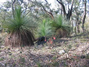
| Grass Trees in Kinglake NP |
Jehosophat Valley - Shelley Harris Walk (65
km NE). Start/finish at the Jehosophat Picnic Ground, well signposted, near Kinglake township. Follow the Laver's Circuit
Walk to junction with Shelley Harris Walk. Continue through lush fern gullies and forest,
crossing the Pinchgut Creek at a footbridge, until the Jerusalem Track
is reached. Turnaround and return to start. Care is necessary, as Track is rocky in parts, and slippery and muddy after rain,
and fallen trees need to be negotiated. (6 km, 90 mins, August 2006)
Toorourrong Reservoir Park Walk.
(65 km N). Access: Whittlesea, Whittlesea-Yea Rd, Jacks Creek Rd, to picnic area. Follow signed track uphill, steep
in parts, to view-point, then continue downhill and return to picnic ground. Good views of
the surrounding hills and Mt. Disappointment. (4 km, 1 hr, March 2006).
Running
Creek Track - Southern Section. (65 km NE). Access: Kinglake, Pheasant
Creek, National Park Rd, to Mason's Falls picnic area. Follow signed walking track past Falls, then proceed
down to the valley floor. Pass Ferny Nook and reach Hazel Glade. This is the turnaround point - return to start. Warning:
This is a very steep track and should not be undertaken in very hot weather or after heavy rain. Lush ferns alongside the Creek. (6 km, March 2007, 2
hrs).|
Map | Photo Album
Jehosophat Valley - Laver's Circuit Walk. (65
km NE).
This interesting and easy circuit walk starts from the Jehosophat Picnic
Ground, passing through dense forest and past lush fern gullies. The
Picnic Ground turnoff is off C724, near the Kinglake settlement and well signposted. Kangaroos and wallabies may
be seen in the Picnic area! (30 mins, 1 km, May 2006).
Mt. Jerusalem Track - Southern Sector. (65 km NE).
This is in the Everard Block. Access is via Yarra Glen > Eltham Rd > Steel's Creek Rd > Old Kinglake Rd >
Steel's Creek Picnic Ground, signposted. Track ascends through forest - first section steep - nice views to Mt. Slide. Turn around at Mt. Jerusalem. (1.5 hrs, 4 km,
July 2006)
Mt. Jerusalem Track - Northern
Sector (65 km NE). This is in the Everard Block. The signposted
start/finish point is about 1 km west of Kinglake, on the Kinglake-Hurstbridge Rd. Follow track, passing junction with Shelley
Harris walk, to the flank of Mt Jerusalem. Turn around and return to start. Good
views towards Mt. Slide from the ridge top. (The
Track continues to Steel's Creek - see description of the Southern Sector walk). (4 km, 1.5 hrs, July 2006)
Everard Track - Northern
Sector (65 km NE). This in the Everard Sector. Track
access is signposted at a small car-park about 1.5 km from Kinglake, on the Kinglake-Hurstbridge Rd. Follow track, steep
for first 1 km, past Mt. Beggary, then to the Mt. Everard Summit. There is an
interesting display-board at the summit, describing the history, fauna, and flora of the region. Return to start. Nice views from the ridge-line, with numerous grass-trees. (4 km, 1.5 hrs, August
2006)
Bundy Track. (65 km NE). This is in the Everard Sector.
Access is via Yarra Glen > Eltham Rd > Steel's Creek Rd > Old Kinglake Rd, to end of the public section of that road.
Start/finish at the gate (signposted). Follow the track steeply uphill, with good views to
Mt. Slide. Reach the Mt. Everard summit, and turnaround, return to the start.
Care is necessary on the section approaching the summit, being a very narrow foot-track, winding its
way down, with steep drops to the valley. (6 km, 1.5 hrs, July 2006).
Chandlers Ridge Track. (65 km E). Access: Yarra Glen,
Yarra Glen to Eltham Rd, Steels Creek Rd, Old Mt. Slide Rd, small car park at left adjacent to NP sign and gate opposite "Full
and Plenty Creek" property. Follow track uphill, passing old antimony mines and shafts. Continue along ridge top, through
stands of grass trees. Turn around at about 2 km from start and return to car park. Good views
across the adjacent hills and valleys. Care needed if off-track to avoid deep mine shafts sand diggings.
(4 km, 1 hr, February 2006).
Full and Plenty Track. (65 km E). Access: Yarra Glen,
Melba Highway, C724, turn left into Old Mt. Slide Rd opposite Gordon's Bridge Rd, to small car park and picnic area on left,
start of signed Full and Plenty Track. Follow track downhill, steep in parts, to a fenceline of private property. Track ends
here, at a steep creek gully, with no link to the Old Mt. Slide Rd. Return to car park. Good
views across the hills, through the forest. (4 km, 1 hr, February 2007)
Brock Spur (Western Section) and
Banksia Ridge Tracks. (75 km E). Brock Spur is a relatively new Section of the Park. Access: Yarra
Glen, Melba Highway, turn west at Mt Slide Junction along C724, to very small car park on left, signposted Brock Spur
Track. Follow track to junction, then along Banksia Ridge Track. This joins Brock Spur Track. Return to car park. Splendid views towards the Toolangi State Forest, Mt. St. Leonards and Mt. Monda. (7 km, steep
in parts, 2 hrs, February 2007).
Map | Photos
Brock Spur Track (Eastern Section).
(65 km E). Melba Highway, Yarra Glen, to small car park at perimeter of the Park. Go through gate, ascend the spur,
to junction with Banksia Ridge Track. Return to car park. Excellent views to Pauls Range,
Toolangi State Forest, Mt. St. Leonards, Mt. Monda, Blue Mountain. This route should not be attempted
after periods of heavy rain or in very hot weather - steep in parts, rough surface. (5 km, 1.5 hrs, February 2007)
(This walk may be combined with the Brock Spur Western Section/Banksia Ridge walk, but it is tough!)
Brock Spur Track - Southern Section. (65 km E).
Melba Highway, Yarra Glen, to small car park near Yarra Valley Conference Centre. The track entrance is gated. Follow the
track, steep and rocky in parts, reaching junction with the eastern part of Brock Spur Tk, go through gate, then up Acacia
Tk, continue to top of ridge and return. Good views across the valley towards Mt St Leonard
and nearby ranges. (6 km, 2 hrs, March 2008)
Map | Photos
Mountain Creek Track (shorter route).
(65 km NE). Yarra Glen, Melba Highway, Mt. Slide Junction, turn left at Gordon's Bridge Rd, then right into a small
car park/picnic ground adjacent to Mountain Creek. Go through gate, follow track towards Eucalyptus Rd, uphill to reach junction
with Dusty Millar Track. Return to start. Interesting bushland, through old logging forest,
kookaburras, rosellas, partial views to Brocks Spur to the south. Steep in parts. (5 km, 1.5 hrs,
February 2007)
Map | PhotosMountain Creek Track (longer route).
(65 km NE). Yarra Glen, Melba Highway, Mt. Slide Junction, turn left at Gordon's Bridge Rd, then right
into a small car park/picnic ground adjacent to Mountain Creek. Go through gate, follow track towards Eucalyptus Rd, uphill,
passing junction with Dusty Millar Track. Continue to end of tk at Eucalyptus Rd, return to car. Interesting
bushland, through old logging forest, kookaburras, rosellas, partial views to Brocks Spur to the south.
Steep in parts. (2 hrs, 7 km. February 2008)Mt. Sugarloaf Tracks. (65 km NE). Access: Maroondah Highway, Yarra Glen, Melba Highway,
Mt Slide Junction, Kinglake, Mt Sugarloaf Rd, to car park. Follow Ridge Track, cross Mt Sugarloaf Rd, descend Running Creek
Track to the Tryst. Return to start. Nice views from Ridge Track to Kinglake.
The Running Creek section should not be attempted after heavy rain as it becomes a bog. (6 km, steep sections, 1.5 hrs,
February 2007).
Photos | Map
Rifle Range Reserve Walk.
(65 km NE). Access: Maroondah Highway, Melba Highway, Yarra Glen, Yarra Glen to Eltham Rd, Mt. Wise Rd, Skyline Rd, Butterman's
Track, to small car park, signed. Go through gate, proceed along shared fire-access/walking track to top of ridge, and return.
Track passes old gold-mining shafts and mounds, through forest.
(3 km, one hr, February 2007).
Photos | Map
Mt Everard Summit Track (Southern Route
from Butterman's Track). (65 km NE). Access: Melba Highway, Yarra Glen, Yarra Glen to Eltham Rd,
Mt Wise Rd, Butterman's Track, Marshall Rd, to small car park at end of Marshall Rd. Follow signposted Track to Summit and
return. Steady gradient, steep in parts, rising 125 m. Good views towards Mt Sugarloaf.
(6 km, 2 hrs, March 2007)
Map | Photo Album
Watson's Creek Valley Mining Track. (65 km NE).
Access: Melba Highway, Yarra Glen, Yarra Glen to Eltham Rd, Mt. Wise Rd, Butterman's Track, to small car park on right, with
gate. Follow track, passing wide firebreak site of Gas Pipeline to creek. Return along firebreak track to start. Interesting bushland through old mine region. (3 km, 1 hr, March 2007)
Map | Photo Album
Watson's Creek Track. (65 km NE). Access: Melba Highway, Yarra
Glen, Yarra Glen to Eltham Rd, Mt.Wise Rd, Butterman's Track, Marshall's Rd, to small car park at Parks Vic sign. Follow Watson's
Creek Track through forest and along the ridge-top to its end and return. Good views to
Mt Everard, across the Watson's Creek Valley and towards the Yarra Valley. (6 km,
2 hrs, March 2007).
Map | Photo Album
Blackfish Way Track. (65 km NE). Melba Highway, Yarra Glen, West
Bridge rd, Eucalyptus Rd, to Island Creek Picnic area. Follow signed track to the Gums Picnic area and return. Track follows
the Island Creek, through old logging area, regrowth forest and fern gullies.
(4 km, 1 hr, March 2007).
Map | Photo Album
Wombelano Falls Walk. (65 km NE). Melba Highway, Yarra
Glen, Kinglake, Extons Rd, Captain Creek Rd, to Wombelano Falls car park. Follow loop track downhill to Falls Viewing Platform
and return. Best viewing during late morning during summer months. Forest environment,
Track infrastructure has been completed rebuilt since the terrrible bushfires of February 2006, extensive regrowth evident.
(2 km, allow 1 hr, April 2008).
Map | Photo Album
Old Kinglake Rd - Southern Sector.
(65 km NE). This is in the Everard Block. Access is via Yarra Glen > Eltham Rd > Steel's Creek Rd > Old Kinglake
Rd > Steel's Creek Picnic Ground. The walk follows the southern section of the closed Old Kinglake Rd. Ascend
through forest to the Girraween Picnic Reserve and return. Good forest environment, track follows
the Dry Creek gully. Views of Mt. Jerusalem. (4 km, 1 hr, June 2007)
Old Kinglake Rd - Northern Sector. (65 km NE). This
follows the northern section of the closed Old Kinglake Rd, in the Everard Block. Track access is through a gate at a small
car-park about 1.5 km south of Kinglake, on the Kinglake-Hurstbridge Rd. Follow track to the disused Girraween Picnic
Reserve. This is the turnaround point. Return to start. Track descends from 450m to 270m. Good
views across the Park to Mt. Jerusalem, Mt. Slide, Mt. St Leonards, Mt. Monda. Interesting forest environment, with many grass
trees.
Andrew's Hill Track (Southern Sector).
(65 km NE). Yarra Glen, Melba Highway, Mt. Slide Junction, turn left at Gordon's Bridge Rd, then right
into a small car park/picnic ground adjacent to Mountain Creek. Go through gate, follow Mountain Creek Rd, then uphill along
signed Andrew's Hill Track, reaching junction with Dusty Miller Track. The summit is heavily forested, with no distant views.
Return to car. Interesting bushland, through old logging forest, kookaburras, rosellas, partial
views to plantations to the east. Steep,
change in altitude from 357m to 628m. Andrew's Hill is the highest peak in the Wombelano Section
of the Park. (5 km, 1.5 hrs, April 2008)
Photos | Map
Silver Creek Circuit Track.
(65 km N). Melba Highway, Mt Slide Junction, Kinglake West, Whittlesea-Yea Rd, Silver Creek Rd, to small car park
and information board at the Silver Creek Buffer. Four color-coded walking tracks start here, mainly along management
roads - follow the "Red Track" circuit. Excellent
forest environment, viewpoint looking across Silver Creek catchment area. Walking off-track is not permitted,
as the location is within the Melbourne Water catchment area. (5 km 1.5 hrs, October 2008)
Photos | Map - Rooftops
|
|
|
|
Distances to the start of walks, from Melbourne, are in brackets against
their descriptions
|
|
|
|

