|
|
 |
|
|
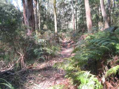
| Mortimer Nature Trail - January 2007 |
Tree Fern Walking Track.
(60 km E). Tynong North, Gembrook-Tonimbuk Rd, Triangle Rd, to small car parking space at start of Nichol Hut Track.
Follow this track to Tree Fern Walking Track, reaching Link Rd and return the same way. Superb tree
ferns, tropical jungle, former logging area, creek, footbridge. One of the best shorter walks in this section of the Park!
(4 km, 1 hr, March 2010)
Photos | Map
Mortimer Nature Trail. (60
km E). Ferntree Gully, Gembrook, Gembrook-Tonimbuk Rd, to Mortimer Picnic Ground. Follow signed Nature Trail
circuit walk. Tall timber, forests, echidnas, creeks, boardwalk, bridge.
Optional extra: visit the historical Tonimbuk Charcoal Kiln on Tonimbuk
Rd, nearby.(2 km, 1 hr, July 2009).
Photos | Map
Tonimbuk Bridle and Walking Track (60 km east).
Ferntree Gully, Gembrook, Gembrook-Tonimbuk Rd, to Mortimer Picnic Ground. Follow signed Nature Trail to junction
with Tonimbuk Bridle and Walking Track. Follow this track back to picnic ground, continue to its end at Tonimbnuk Rd
and return. Tall timber, forests, echidnas, creeks, boardwalk, bridges, birds.
(4 km, 1.5 hrs, March 2010)
Avard's Track (60 km E). Princes Highway, Tynong North
Rd, to small car park opposite gated signed entrance to Avard's Track. Ascend track through former logging regrowth forest
up to the ridge line, to an old firebreak to the north, and return. Good views westerly to
the Sandpit Ridge, and southerly across Pharoah's Gully. Track is in the Weatherhead Range. Steep in
parts, be alert for equestrians(5 km, 1.5 hrs, Jan 2009)
Photos | Map
Silvertop Ridge Track (60 km E). Ferntree Gully, Gembrook,
Gembrook-Tonimbuk Rd, to Mortimer Picnic Ground carpark. Ascend gated Triangle Track, reaching western end of unsigned
Silvertop Ridge Track. Follow track along ridgeline, passing water point, descend to a dam at the junction of Ferres
Walking Trail, and return. (Option: This walk can be undertaken in the reverse direction, starting/ending
at Link Rd.) Regrowth old logging forest, large granite boulders, ferns, limited
views north to the Black Snake Range and south across Diamond Creek Valley. Some
steep and rocky sections. (5 km, 1.5 hrs, January 2009)
Photos | Map
Ferres Walking Trail - Eastern Section. (60
km east). Princes Highway, Tynong North Rd, Camp Rd, west on Gembrook-Tonimbuk Rd, then along Link Rd,
to small car park at gated Silvertop Ridge Tk.Follow this track to a large water point/dam, then continue along signed
Ferris Walking Trail, reaching Silvertop Ridge Tk, then return to start. Track follows the
Diamond Creek gully, regrowth forest, former logging area. (3 km, 1 hr, February 2009)
Map Photos
Ferres Walking Trail - Western Section.
(60 km east). Ferntree Gully, Gembrook, Gembrook-Tonimbuk Rd, to Mortimer Picnic Ground carpark. Follow signed
Ferres Walking Track, reaching Silvertop Ridge Tk, then return. Fern Gullies, forest, boardwalks,
footbridges, creeks. Track follows the creek gully. Some steep sections. (4 km, 1 hr, July 2009)
Map Photos
Bald Hill Lookout. (60 km east). Princes Highway, Tynong North Rd, to small car park at gated Lupton's
Track. Ascend this track, reaching a nice viewpoint, then continue along the ridge for ahout 1km. Retirn to start. Excellent views across the Diamond Creek valley to the Black Snake and Blue Ranges. Regrowth forest, former
logging area. (3 km, 1 hr, January 2009)
Map PhotosButtongrass Nature Reserve. (60 km E). Princes Highway, Tynong
North Rd, Camp Rd, to picnic ground at start of gated Guide Track. Follw this Traxck to entrance to signed reserve, then on
to the circuit track. Distinctive buttongrass flora, interpretative signs, boardwalk, views
to hills, lagoon. (3 km, 1 hr, January 2009).Map Photos
Lawson Falls. (90 km E). Princes Highway, Labertouche
Rd, Lawson's Rd, Forest Rd, to Lawson Falls car park/picnic area. Walk up Forest Rd for about 100 m, reaching signed gated
track to the Falls. Follow Tk to Falls and return. Superb temperate rainforest, good
views of Falls. Note: This is part of a longer circuit walk, known as the "Discovery
Track", about 5 km, which ends at Tea Tree Tk, near the picnic ground. (2 km, 1 hr, September 2007).
Photos | Map
Cannibal Creek Track to Sandpit Ridge. (60 km east). Princes
Highway, Tynong North Rd, to car park at horse unloading area at gated Cannibal Creek Track. Ascend this track, reaching
the junction with Sandpit Ridge Track, then return to start. Steep in parts. Excellent
views to the Black Snake and Blue Ranges. Regrowth forest, former logging area. (4
km, 1 hr, Jan 2009)
Photos | Map
Weatherhead Plateau (Guide Track). (60
km east).. Princes Highway, Tynong North Rd, Camp Rd, to picnic ground at start of gated Guide Track. Follow this Track
past Buttongrass Reserve, then uphill (steep in sections) to junction with Luptin Track. Return to car..Spectacular views across the Park to the Black Snake Range (4 km, 1.5 hrs, July 2010).
Photos | Map
Weatherhead Hill Walking Track (60 km east). Princes Highway, Tynong
North Rd, Weatherhead Rd. At end of this road, follow unsigned Weatherhead Hill Walking Track to site of the old mill, and
return. Track follows southern boundary of the Park for some of the way, and is on the alignment of an early timber tramway
which carried logs from the mill to the rail siding at Tynong North in the period 1903 ro 1930. This is the Weatherhead Forest..Many stands of grass trees, views across farmland to Westernport Bay. (4 km, 1.5 hrs, July 2010)
Pyramid Rock (60 km east).
Prince's Highway, Tynong North Rd, Pooley's Rd (4WD dry weather road!),
to car park at gate to signed Sandpit Ridge Track. Follow Track to the ridge summit, then up a short unsigned foot-track to
Pyramid Rock. the rock is about 3 m high, surrounded by many other granitic
formations. Descend to Track, continue to junction with Cannibal Creek Track, then return to car. Excellent
views northerly from the ridge top across the Park to Black Snake Range, Some views to the south,
but obscured by tall timber. Former logging region; sand was once extracted from pits off Pooley's Rd, now being vevegetated
(4 km, 1.5 hrs, August 2010). Photos | Map
|
|
|
|
Distances to the start of walks, from Melbourne, are in brackets against
their descriptions
|
|
|
|

