|

|
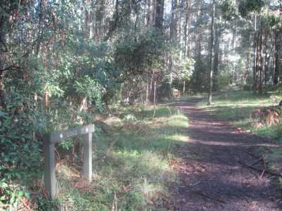
| Lloyd;s Track - June 2007 |
Clematis and Treefern Tks
(45 km E). Ferntree Gully, Mt Dandenong Tourist Rd, Sherbrooke Rd, Sherbrooke Lodge Rd, to small
car park at signed Clematis Tk. Descend tk to junction with Treefern Loop Tk, proceed on that track, return to car
park. The Clematis Track is very steep with a change in altitude from 486m to 363m; care needed as slippery in wet weather,
following the Clematis Ck gully. The track passes through very moist rainforest and tall
tree ferns - this is one of the very best treefern tall-forest regions close to Melbourne. Note:
the Tree Fern Track can be enjoyed as a short self-contained loop walk, starting at Grant's Picnic Ground
- see description elsewhere on this page.(4 km, 1.5 hrs, August 2007).
Map | Photos
Treefern Loop Walk. (45 km E). Ferntree Gully, Mt Dandenong
Tourist Rd, Sherbrooke Rd, to Grant's Picnic Ground at Kallista. The signed track starts directly opposite
the picnic ground, and passes through moist rain-forest and splendid tall tree-ferns.
(1 km, 30 mins, September 2007).
Map | Photos
Hardy Gully Nature Walk.
(45 km E). Ferntree Gully, Mt Dandenong
Tourist Rd, Sherbrooke Rd, car park at Grant's Picnic Ground. Follow signed Hardy Gully circuit track and return to start.
Big old logs, nice ferns, tall timber, rosellas (1.5 km, 45
mins, June 2007)
Map | Photos
Old Sherbrooke
Rd Walking Track (Sherbrooke). (40 km E). Ferntree Gully, Mt. Dandenong Tourist Rd, Sherbrooke Rd,
to small car park next to George Tindale Gardens. Descend (steepl) walking track, signed as "Old Sherbrooke Rd" to its
junction with Sherbrooke Rd and return. Tk is shared for fire management and walking
- good bushland environment, Mountain Ash, along perimeter of Sherbrooke Forest. (1.5 km, 30 mins, September
2007)
Map | Photos
Sherbrooke
Falls Circuit (30 km). Start/finish: Sherbrooke Car Park, off Sherbrooke
Rd. Follow Sherbrooke Track, O'Donohoue's Track, Link Track. Big old logs, nice ferns, tall
timber, Falls, rosellas (3 km, easy, 1 hr, Feb 2009)
Map | Photo Album
Sherbrooke Falls Loop.
(40 km E). Mt Dandenong Tourist Rd, Sherbrooke Rd, Sherbrooke Picnic Ground. Follow Sherbrooke Tk, Ridge Tk ,
cross Sherbrooke Falls at bridge, Hillclimb Tk, Link Tk, and return via Sherbrooke Tk to picnic ground. This is the best route to gain an appreciation of the forest, tall timber, ferns, and the Falls.
(3 km, 1 hr, November 2007).
Four Tracks Circuit (40 km
E). Start/finish: Sherbrooke Rd at junction with Lloyd's and Wattle Tracks. Follow Lloyd's Track > Monument Track
> Hackett Track > Wattle Track. Old logs, nice ferns, creek crossings, bridges, tall
timber, finches, kookaburras, rosellas. Parts of this circuit can be very muddy! (Easy, 4 km,
1 hr, June 2007)
Map | Photo Album
Sherbrooke Forest Track. (40 km E). This is a variation
of the "Four Tracks Circuit". Start/finish at small car park on Sherbrooke Rd, at junction of Lloyd's
and Wattle Tracks. Follow Lloyd's Track, reaching junction with Monument Track. Follow Monument Track to junction with
Hackett's Track, then to Wattle Track and back to start. Old logs, nice ferns, creek crossings,
bridges, tall timber, finches, kookaburras, lyrebirds, rosellas. Parts of this circuit can be very
muddy! (4 km, June 2007, 1 hr)
Map | Photo Album|
Sherbrooke Falls via Wattle Track.(40 km E). Start/finish at
small car park on Sherbrooke Rd, at junction of Lloyd's and Wattle Tracks. Follow Wattle Track to junction with Sherbrooke
Tk, then to the Falls viewing platform. Then follow Ridge Tk, rejoining Sherbrooke Tk, and Wattle Tk, return to start.
Old logs, nice ferns, creek crossings, bridges, tall timber, finches, kookaburras, lyrebirds,
rosellas. (4 km 1 hr, March 2008)
Map | Photo Album|
Paddy Track - Selby State Forest. (40 km E). Belgrave, Monbulk
Rd, Kallista-Emerald Rd, Grantulla Rd, to small car park, at start of Foden Track. Follow this track to Neuman Track,
turn left into Paddy Track. Continue descent to junction with Welch Track, reach bridge. Return to start. Warning:
This Track includes a very steep and challenging section! Lyrebirds
may be seen, nice forest environment. (4 km, April 2006, 1.5 hrs).
Map | Photo Album
Selby Hill Walk. (40 km
E). Belgrave, Monbulk Rd, Kallista-Emerald Rd, Grantulla Rd, to small car park, at start of Foden Track. This is
Selby Hill. Follow this track to Neumann's Track, turn left, continue
past Neumann's Paddock, Brendon's Corner, Wallaby Paddock, go through gate at junction with Paddy Track, to turnaround point
1 km further on. Return to car. Wallaby Paddock was a farm in the 1900s - furrows are still
visible - it is now the habitat of a family of Eastern Grey Kangaroos.
Lyrebirds may be seen, nice forest environment. (4
km, 1 hr, June 2008)
Map | Photo Album
Ridge and Hillclimb Tracks.
(40 km E). Mt Dandenong Tourist Rd, Sherbrokke Rd, Sherbrooke Picnic Ground car park. Follow O'Donohue Track
to junction with Ridge Track. Descend Ridge Track to Belgrave-Ferny Creek Rd, follow Terry's Rd. Ascend Hillclimb Track to
junction with O'Donohue Track, return to car park. Lush fern guliles and forests. Caution: Hillclimb Track can be very muddy and slippery! (5 km, 1.5 hrs, April 2006).
Map |Photo Album
Hillclimb Track (40 km E).
Burwood Highway, Belgrave, Monbulk Rd, to car park at Micawbar Tavern. Follow signed Hillclimb Track to Sherbrooke
Falls and return. Lush fern guliles and forests. Caution: This
track can be very muddy and slippery! (4 km, 1.5 hrs, May 2008).
Map |Photo Album
Lipscombe Track. (40 km
E). Burwood Highway, Belgrave, Monbulk Rd, to car park at Micawbar Tavern. Follow signed Lipscombe Track, steep,
to Coles Ridge Rd, continue on this road to Pole Plot Track, follow this tk which joins Lipscombe Tk, return to car. Beautiful tall forest, ferns, disused Pole installation. (2 km, 45 mins, May 2008)
Map |Photo Album
Alfred Nicholas Gardens Walk. (45 km E). Mt Dandenong Tourist
Rd, Sherbrooke Rd, to car park opposite the Gardens entrance. Follow the main walking track to the Sassafras Creek, through
lush fern gullies, and past beautiful lakes and water features. (2
km, 1 hr, April 4, 2008).
Map |Photo Album
Monument Track. (45 km E). Mt. Dandenong Tourist Rd, to small
car park at junction with Sherbrooke Rd. Follow signed Monument Track to junction with Hackett's Track and return. Tall timber and lush fern gullies. (3 km, March 2006, 1 hr).
Map | Photos
O'Donohue's Track. (45 km E).
Mt Dandenong Tourist Rd, Sherbrooke Rd, Sherbrooke Lodge Rd, to car park at O'Donohue's Picnic Ground. Follow signed track
to Sherbrooke Falls and return. Falls view, ferns, forest. (2 km, 1 hr, January
2006)
Map | Photos
Tregellas Mill Track. (45
km E). Ferntree Gully, Mt Dandenong Tourist Rd, Sherbrooke Rd, car park at Grant's Picnic Ground. Follow Cole's Ridge
Track, Tregallas Track, Bleakley Track back to car park. Magnificent tall timber, ferns. ,
site of a former
timber mill. Tk passes site of a former sawmill, steep sections.(4 km, April 2008, 1 hr).
Map | Photos
Edgebrooke Track. (45 km E). Ferntree
Gully, Mt Dandenong Tourist Rd, to small car park at junction with Sherbrooke Rd. Follow Lloyd's Track, Hackett's Track, Moore
Break, Edgebrooke Track, to Falls, and return start. Beautiful tall forest, fern
gullies, old logs, creeks, lybebirds, views (3 km, 1 hr, April 2008)
Map | Photos
Hall Track. (45 km E).
Ferntree Gully, Belgrave, Monbulk Rd, Kallista-Emerald Rd, small car park at Cooke's Cnr. Follow signed Hall Track to its
end and return. Track was formerly a logging track, beautiful tall timber, ferns, logs, lyrebirds.
(2 km, 45 mins, April 2006)
Map | Photos
Lyrebird Walk. (45 km E). Ferntree Gully, Mt Dandenong Tourist Rd, Sherbrooke Rd, car park at Grant's Picnic Ground. Follow signed Lyrebird Walk, to Cooke's Cnr, return to car park. Splendid
tall forest, fern gullies, creek, old logs, lyrebirds. Steep in parts. (4 km, 1 hr, April 2006).
Map | Photos
Welch Track (45 km E). Ferntree Gully, Gembrook Rd, Belgrave,
turn into Nation Rd, to small car park opposite Dand Ranges NP sign. Follow track through gate, turn left
at Jack the Miners, continue uphill (very steep!) to junction of Cole's
Ridge Rd. Return to car. Forest environment, nice fern gullies, creek.
(3 km, 1 hr, March 2008)
Map | Photos
Neumann Circuit Walk (45 km E). Ferntree Gully,
Belgrave, Monbulk Rd, Kallista-Emerald Rd, small car park at Cook's Cnr. Follow signed Lyrebird Tk, then into Neumann's Tk,
continue hill (steep), then into Fovet's Tk, Hall Tk, to Cook's Cnr. Lyrebird habitat,
forest, fern gullies, creeks. (5 km, 1.5 hrs, March 2008)
Map | Photos
Ridge Track (40 km E). Mt Dandenong Tourist Rd, Sherbrooke Rd,
Sherbrooke Picnic Ground car park. Follow Sherbrooke Track to junction with Ridge Track. Descend Ridge Track to Belgrave-Ferny
Creek Rd. Return to Sherbrooke Falls viewing area, then back along Sherbrooke Tk to car park.Good
forest, lyrebirds, ferns, falls. (1.5 hrs, 4 km, March 2008)
Map | Photos
Margaret Lester Tk, Lyrebird Tk and Hardy Gully Track - circuit .
(45 km E). Ferntree Gully, Mt Dandenong Tourist Rd, Sherbrooke Rd, car park at Grant's
Picnic Ground. Follow signed Margaret Lester Walk, Lyrebird Walk, and Hardy Gully Walk, return to car
park. Splendid tall forest, fern gullies, creek, old logs, lyrebirds.
Steep in parts. (4 km, 1 hr, March 2008).
Map | Photos
Grant's Picnic Ground Walks. (45 km E). Ferntree Gully, Mt Dandenong Tourist Rd, Sherbrooke Rd, car park at Grant's Picnic Ground. Follow
signed Margaret Lester Walk, Lyrebird Walk, Hardy Gully Walk, Tree Fern Walk, return to car park. Splendid tall forest, fern gullies, creek, old logs, lyrebirds. Steep in parts. (4 km, 1 hr, June 2008).
Map | Photos
Avards and Pound Creek Tracks - Circuit. (45 km). Burwood
Highway, Belgrave, Monbulk Rd, to car park at Micawbar Tavern. Go through gate, signed as Hill Climb Track, then
turn left into signed Avards Track. Follow this track, reaching Terrys Ave. Follow Terry's Avenue to signed Pound
Creek Track, descend this track to junction with Hill Climb Track, then back to start, This circuit walk follows the
Pound Creek Gully, Splendid tall forest, fern gullies, creek, old logs, lyrebirds.
Steep and slippery in parts. (4 km, 1 hr,
Aug 2008)
Map | Photos
|

