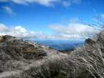
King's Waterfall Hike - Arthur's Seat State Park (75 km S).
Access: Moorooduc Freeway, Arthur's Seat Summit Rd, Purves Rd, Seamist Drive. Walk starts/finishes at Park gate at end of
Seamist Drive. Follow signed Two Bays Walking Track to turnoff signposted to King's Falls Track. Proceed to junction
with Circuit Walk - turn right - continue a short distance to a Lookout. Return to start. This walk provides superb
views of the ocean along Two Bays Track, and the Falls Track sector descends in to the rugged Gorge.
Good views of the Gorge from the Lookout. (4 km, steep
in parts, 1 hr, December 2006).
Photo Album | Map
Kings Falls Circuit Walk (80 km S). Access: Moorooduc
Freeway, Arthurs Seat Summit Rd, Purves Rd, Waterfull Gully Rd. Signposted walk starts at small carpark. Splendid views across
the Gorge from two Lookouts, lush green fern gullies
and woodland. Interpretative signs describe interesting features of the area.
(2 km, one hour, December 2006) (Note: This Walk can be done as an extension of the longer hike described
on this page)
Photo Album | Map
McKellar Track - Arthur's Seat State Park (75km S). Access:
Moorooduc Freeway, Arthur's Seat Summit Rd. This is a relatively short loop walk. Start
and finish at the Information Rotunda in the Seawinds Gardens, at Arthur's Seat Summit. The
signposted Track passes through interesting regrowth bushland which was badly
damaged by the January 1997 fires. Explore the Seawinds Gardens, the Bay and Northern Lookouts, and the Indigenous Plantation.(2
km, easy, one hour, December 2006)
Photo Album | Map
Lookout Hill Circuit Walk - Arthur's Seat State Park (75 km S).
Access: Moorooduc Freeway, Arthur's Seat Summit Rd, Eaton's Rd, Lookout Hill Rd. Loop walk starts from carpark at end of Lookout
Hill Rd. It passes through interesting bushland, with nice
views of Dromana, the coastline, and across the farming region of the Peninsula. The
views are partially obscured by regrowth. (2 km, easy, one hour, December 2006)
Photo Album | Map
Arthur's Seat Summit Circuit Track (75 km S.) Access: Moorooduc
Freeway, Arthur's Seat Summit Rd, to main carpark at Summit Lookout. Follow signed track through bushland to Seawinds Gardens.
Glorious views of Bay from Northern, Flinders and Bay Lookouts. Sculpture Garden, Pond,
Rock Gardens, Boardwalk, Flinders Monument. Return via same route. (3 km, one hour, October 2010)
Photo Album | Map

