|
|
 |
|
|
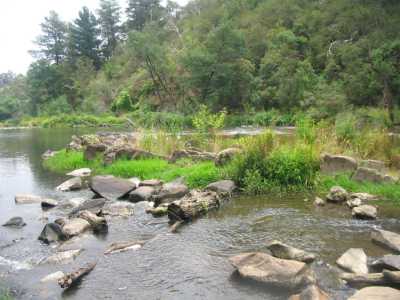
| Yarra River - Warrandyte - March 2007 |
Stane Brae Walk (25 km E). Access: Jumping Creek
car park, proceed on fire access track (gated), locally known as Freeland Rd, turn right at a picnic table adjacent to a sign
marked "Nature Walk", continue past the table on a foot-track, turn into Freeland Rd, turn right, continue to the river.
Inspect the old stables (now a picnic area and overnight shelter) and plantings. Follow a jeep
track on open grassland from the stable area, reaching the Stane Brae Track, then to the river, canoe landing, and small beach.
Return to Jumping Creek car park. Good views of the surrounding hills and farms,
and along the river. A large mob of Eastern Grey Kangaroos resides in the area! (6 km, July
2009, 2 hrs).
The Common Circuit Walk. (25 km E). Access:
Ringwood to Warrandyte Rd, Johanson's Rd, Haslam's Track to small car park. Enter the Park, proceed parallel to Haslam's Track,
continue along signposted Bridle Track, then on South Tk, Firebreak Tk, to Central Tk, then back to car park.There are
other tracks in the Park, offering several options. The Common
is interesting remnant bushland, with nice views towards Mt. St. Leonard from the ridge.
It is home to mobs of Eastern Grey Kangaroos! (3 km, undulating, May 2009, 1 hr).
Pigeon Bank Creek Track (25 km E). Access: Warrandyte-Kangaroo
Ground Rd, Osborne Rd, Koornong Crescent, to small car park at Warrandyte SP sign. Follow gated jeep track, go past firebreak
on left, then ascend to the cliff top. Locate foot-track at right, descend to the rocky ledge above the river. This is Blue
Tongue Bend. Return to car park. Very good views from the cliff top of the River. Explore
the old Track which crosses the dry Pigeon Bank Creek and ends at Menzies Rd.) (4 km, 1 hr, January 2007)
Mt Lofty Circuit Walk (35 km E). Access: Jumping
Creek Rd, Lower Homestead Rd, to small car park just before the Canoe Launching area. Start walk at the locked gate
on the fire access track. Follow track up, reaching an information board and map. Continue to the summit, where a picnic table
and seat is located in the open. Descend to the original track, continue until a wide jeep-track is reached on the right, follow
this down to the river, passing a seat. A picnic table is there. Locate and follow the foot-track back to the car-park along
the river bank. Eastern Grey Kangaroos live in this part of the Park! Excellent views in
all directions of the Upper Yarra Valley, the Yarra, and the surrounding hills. (4 km, one hr,
July 2009)
Mt Lofty Explorer. (35 km E) Access: Jumping Creek Rd,
Lower Homestead Rd, to small car park just before the Canoe Launching area. Start walk at the locked gate on the
fire access track. Follow track up, reaching an information board and map. Continue to the summit, where a picnic table and
seat is located in the open. Descend to the original track, scramble down open country past residfent kangarooos, meet
river track then back to car park. (This is a shorter variation of the "Mt. Lofty Circuit Walk"). Excellent
views in all directions of the Upper Yarra Valley, the Yarra, and the surrounding hills. (4 km, October 2006, 1 hr)
Photos | Map
Koornong Walk (25 km E). Access: Warrandyte-Kangaroo
Ground Rd, Osborne Rd. Park at clearing at gate, with State Park sign. Follow fire access track, to a junction, continue
along foot-track adjacent to Yarra river bank. There are many good views of the river and
cliffs along this track - the opposite bank is the Blue Tongue Bend area. (3 km, easy,
1 hr, January 2007)
Blue Tongue Bend Hike (via Stan Brae Track). (25
km E). Start at Jumping Creek picnic ground. Follow the signposted Nature Trail, along the fire access track. A
junction is reached, at a picnic table. Follow the partly overgrown foot-track past the table (this is a shortcut) to the
Stane Brae fire access track. Continue left, descend to the original Blue Tongue Bend track.
Continue to end, at the Yarra. Return the same way. Good views from the ridge top across to
Stane Brae. (5 km, stony, steep, 1.5 hr, July 2009). (Please see other walks
to Blue Tongue Bend!)
Wonga Park North Circuit Walk (30 km E). Access:
Jumping Creek Rd, Reserve Rd. Start at the carpark at the canoe launching ramp at end of Reserve Rd.. Follow the rough
track along the river bank past the "Tarzan" swimming rope. This track ends about 1 km at the bottom of an impassable overhanging
rock face, at the northern perimeter of the Warrandyte State Park. Return the same way, but take the right (south) fire track
at junction. Ascend this steep track until a gate is reached at Reserve - take the adjacent foot-track back to the car park.
This region has many disused and overgrown jeep tracks which should be avoided. Good views along the river. (4 km, one hour, December 2006)
Warrandyte River Reserve Walk (30 km E). This
walk starts and finishes at the back of the Warrandyte Police Station. It follows the shared walking/cycling track to the
east, along the southern banks of the Yarra, under the bridge, where it ends. Return, using the lower level foot-track at
the river's edge, to past the Police Station, to the westerly picnic ground and return to start. Very
good views of the river and resident ducks! (4
km, 1 hr, December 2006, flat)
Photo Album | Map
Wetlands Trail (Chirnside Park District) (Adjoining Warrandyte State Park) (30 km E).
This is a relatively unknown walk. It passes along the Yarra River bank, next to the huge Heritage Country Club
Golf Course. Western access is over a high stile, and through a gate (closed at sunset) at the Canoe
Launching Ramp, at end of Lower Homestead Rd. It is a gravel pathway, with distance markers every 200 m, and meanders
through bushland, with excellent views of the river, the Christmas Hills,
the Wetlands, (visit the Birdhide), and water-birds. Return via the foot-track next to the river. (2
km, August 2008, one hour).
Jumping Creek Track (25
km NE). Access: Jumping Creek Reserve, turn-off at Jumping Creek Rd. The walk starts and finishes at the barbecue picnic area, about 500m from Jumping Creek Rd. Follow
the track down the hill through interesting ti-tree forest until the main carpark is reached, passing the junction with the
Black Flat Track. Proceed left for about 250m until the track ends at the river, with good
views. The walk to Blue Tongue Bend starts here (see description elsewhere on this page). Return
the same way, or along the access road, back to the barbecue area. Supplies of chopped wood are provided by Parks
Vic for the barbecue! (1.5 km, 45 mins, October 2006)
River Trail (45 km NE).
Access from Maroondah Highway - Croydon North, turn north at Victoria Rd, continue to end, adjacent to Croydon golf course,
to a small picnic gropund, canoe launch ramp and car park, on the Yarra River banks. The walk is signposted "Mt
Lofty Trail". Proceed for about 1 km until the Lookout is reached,
then return. The track actually continues (rough) around the base of Mt.Lofty, eventually linking with the "Mt Lofty
Walk". Back at the picnic ground, climb over the stile and continue for about 1 km to the junction of
the Olinda Creek and Yarra River. Return to start. The walk offers very pleasant views of
the Yarra River and the adjacent hills. Fishing is popular! (3
km, September 2006)
Gold Heritage Walk. (20 km E). Start at Gold Memorial Carpark, off Gold Memorial Rd. Cross Creek
on stepping stones, continue along Wildcat Gully Track. Turn left at unsigned foot-track at boardwalk.
Ascend track past old mine relics to signpost "Gold Heritage
Walk". Follow this track right, past interpretative signs and old mining shafts to the summit of Fourth
Hill. Continue to the left, follow Johnson's Track, descend and meet with the previous Gold Heritage Walk signpost. Return
to the start. Care is needed on Johnson's Track, which is indistinct in parts. (1 hr, 3 km, July 2009)
Blue Tongue Bend. (25 km). Circuit Walk, start and finish at Jumping Creek Reserve Picnic Ground. Follows the Yarra River to the Bend,
superb views of the river, then continues inland up, along and down steep ridges - good
views across the Gorge. (6 km, 2 hrs, August 2008)
Mt. Lofty. (45 km). Jumping
Creek Rd, Lower Homestead Rd, Reserve Rd, to Witton's Reserve car park. Easy walking along formed track
for first sector, adjacent to the Yarra River with good views of the water, several nice picnic stops. Steep final 1 km
to summit along fire access track, spectacular views across Yarra Valley
towards Dandenong Ranges and Yarra Ranges. Return to start. (6 km, 2 hrs, May 2006)
Fiddler Gully and Wildcat Tracks Circuit. (25 km E).
This walk is in the old goldmining region. Start/finish at small car park in Gold Memorial Rd. Cross Anderson Creek, ascend
Wildcat Track, turn right into Wildcat Link Track, continue to end of track at Webb Street. Turn right through gate into Fiddler
Gully Track, descend steeply to (dry) creek bed, follow track to another gate at Webb St.Walk back to car park. An optional
short diversion is along Dead End Track and back, signposted on Webb St.Interesting regrowth
bushland, old mine-shafts, mullock heaps. (6 km, 2 hrs, January 2007).
Photos | Map
Bridle and Pigtail Tracks Circuit. (25 km E). This
walk is in the Warrandyte Forest Reserve. Access: Warrandyte Village, Webb St, to small car park opposite the entrance gate
to Fiddler Gully Track.Turn left into Bridle Track (also known as Boundary Track). Descend steeply, crossing dry creek bed,
turn right at signposted Pigtail Track. Climb uphill, reaching starting point. Views towards
Mt.Lofty from the ridge top. (4 km, 1 hr, January 2007)
Photos | Map
Jumping Creek to Black Flat Walk (25 km E). Start/finish at Jumping Creek Picnic Ground/carpark. Track goes to the left - proceed
to the junction with the Black Flat Nature Trail and return. Excellent views of the Yarra.
Stony and steep in parts. (6 km, November 2007, 2 hrs).
Photos | Map
Yarra Brae Trail (Bridle Trail). (25 km E). This is
a LONG TOUGH walk and should not be undertaken in very hot or wet condtiions. Access: Jumping Creek Rd, Clifford Rd, to small
car park outside of the Clfford Park Scout Centre. Walk back down Clifford Rd, turn right through gate into Park entrance
- this is the Bridle Track. Continue to the end, a large open clearing on the Yarra banks. This is Yarra Brae. Return
to start. Splendid views of the surrounding hills and across to the Kinglake region. There
are good rapids at this Brae! (12 km, hard, steep, stony, 3 hrs, February 2007).
Photos | Map
Norman Reserve Walk. (25 km E). Warrandyte, Research-Warrandyte
Rd, Bradley's Lane, to signed car park at Norman's Reserve. Proceed to river, opposite Pound bend Tunnel . Follow
foot-track along river bank, reaching the unusual rock formations in the river, explore the rocks, then return. Bushland, excellent views of the river and the rock formation. (4 km, 1 hr, Feb 2009)
Photos | Map
Norman's Reserve Walks. (15 km E). Warrandyte, Research Rd, Bradley's
Lane, to gated Norman Reserve. There are two tracks - northern and southern. The north tk follows the Pound Bend loop to the
rapids. The south tk follows the Yarra proper, opposite the township, passing an observation platform and seat. Good river scenery, rapids. Beware of wasps and snakes! (6 km, 2 hrs, December 2007).
Photos | Map
Whipstick Gully Circuit. (15 km E). Warrandyte, Whipstick
Gully Rd, to picnic ground/car park. Ascend signed track, reaching Bruce Bence Trail, follow trail downhill back to car park.
Many gold mining relics, old shafts and diggings. (3 km, February
2008, 1 hr).
Photos | Map
Black Flat Circuit. (25 km E). Ringwood-Warrandyte
Rd, small car park on Tills Drive, signed Black Flat Reserve. Follow signed circuit track, reaching junction with Nature
Trail. Follow this trail along river bank back to car park. Interesting region with old mine
shafts, diggings, relics. (2 km 1 hr, Sep 2008)
Photos | MapWayne's Track to Mt Lofty Summit.
(25 km E). Jumping Creek Rd, Reserve Rd, to carpark at canoe launching ramp. Cross creek, then climb unsigned Wayne's
Track to Mt Lofty Summit and return. This is a very steep climb! Excellent views across the
Park, and panoramas to Mt Dandenong, Mt St Leonards, Mt Donna Buang and Mt Monda. (3 km, 1 hr, December
2007).
Photos | Map
Pound Bend Walk (20km E). Everard Drive, Pound Bend Picnic reserve
car park. Follow trail along river past the Park Ranger's Depot, to its end at a large open paddock. This is managed by Parks
Vic. Pass through old fence, then follow a foot-track along the river bank for about 1 km and return. Good
views of river, many footbridges, bushland, kangaroos, birds. (5 km, 1.5 hrs, July 2009, 2009).
Photos | Map
Blue Tongue Bend. (25 km). Start and finish at Jumping Creek Reserve Picnic Ground. Follows the Yarra River to the Bend, superb views
of the river and Gorge. (4 km, 1..5 hrs, Feb 2009)
Map | Photo Album
Witton's Reserve Trail (25 km). Start and finish at the car park/picnic area at end of Reserve Rd. Cross the footbridge, follow the Yarra
to another picnic ground at the foot of Mt Lofty and return. Then explore the canoe launching area, follow the track
past the Tarzan's Rope swimming hole, to end of Track at cliffs.Good views of the river
and Gorge. (4 km, 1..5 hrs, Jan 2009)
Orchard and Circuit Tracks - Pound Bend (20km E). Everard Drive, Pound Bend Management Rd, to small car park adjacent to Parks Vic depot.
Go through gate, follow track downhill, turn right at a junction, then to the large area adjacent to the Yarra. This
was formerly an orchard. Continue on this track until old orchard trees are reached, where the track ends. It is not posssible
to continue any further, due to steep cliffs. Return to the track junction, then turn into another track, "Circuit Track") which
follows the fence line around the Yarra, reaching the intersection of the Pound Bend Walking Track. Follow the track uphill
past grazing kangaroos, back to car. Note: Parks Vic advises that it is not
proposed to incorporate the Orchard and Circuit6 tracks into the general trail network, but walkers are welcome to explore
the area! Excellent river scenery, kangaroos. (6 km, 1.5 hrs, July
2009)
Map | Photo Album
Bob''s Wetlands (20 km E) Warrandyte-Research Rd, Gwynn's Rd, to
locked gate at Park entrance. Enter bushland next to gate, then proceed down continuation of Gwynns' Rd to the Yarra.
Follow jeep track westerly past Bob' s Wetlands, reaching an abandoned windmill. Return the same way, with a detour around
a former farm, old outbuildings, and remains of cattle loading ramp. Many frogs in the Wetlands! Old
wooden walkway to the windmill, good views across the river to Pound Bend Reserve and the Tunnel. (4 km, April 2010,
1.5 hrs)
|
|
|
|
Distances to the start of walks, from Melbourne, are in brackets against
their descriptions
|
|
|
|

