|
|
 |
|
|
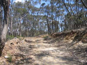
| Long Forest - Gravelly Track |
DAYLESFORD REGION
Blue Mountain Summit. (100
km W). Western Highway, Daylesford, Trentham, Newbury, to small car park at Amelia Lane. Follow Amelia Lane, then Tower
Rd, to summit and return. Old relics at Amelia Mine, bushland, former logging area, bushland.
Excellent views from summit. The Firetower is not public access. (9 km, 2 hrs, December 2007).
Photos | Map - VicRoads
BACCHUS MARSH REGION
Long Point Circuit Walk - Long
Forest Nature Conservation Reserve. (50 km W).
Access: Western Highway, Long Forest Rd, turn left at Canopus Circuit, to small car park at a gate. Walk starts/ends here.
Proceed along Long Point Track, passing the Information Board. Continue right past junction with Comadai Track, descend to
a saddle. Pyrites Creek Valley is in the left. Locate a foot-track down this Valley, passing a seat. Continue to
the creek bed, with reeds, viewing rocky
cliffs. Go back past seat to Long Point Track. Retrace route, then turn left along the
rocky Steep Track. Return to car park. Interesting rock outrocks in the Pyrites Creek Gorge.
(Note: This walk should not be undertaken after periods of heavy rain, or in very hot weather).
(6 km, steep in parts, 2 hrs, November 2006).
Djerriwarrah and Bermagui Walking Tracks - Long Forest Nature Conservation Reserve.. (50 km W) . Access: Western Highway,
Long Forest Rd, to small car park on east. Pass through gate, continue along and down the ridge to the creek flats. Return
to junction marked "Bermagui Track", follow this track to the gorge viewpoint. Return to car park. Spectacular views of the gorge. (4 km, October 2006, 1 hr).
Happy Valley Track - Long
Forest Nature Conservation Reserve. (50 km west). Access: Western Highway, Long
Forest Rd. Walk starts/finishes at the small car park. Proceed past information board, passing old farm machinery and dams.
At an unsignposted track junction, veer right, continue steeply downhill (very rough, steep and rocky). At the bottom,
note the orange track marker. This is the Box Flat on the Coimadai
Creek Gorge, and is the end of the track. It is possible to scrub-bash and explore to the west, along
the Gorge, but care is needed. Return to car park the same way. Track passes through distintive Mallee bushland, with
views across the valley and the gorge. Parks Vic advises not to attempt this walk
after heavy rain or in very hot weather. The Information Board has details of all walks in the
Forest, as well as details about flora and fauna.(5 km, 1.5 hrs, December, 2006)
Coimadai Track - Long Forest
Nature Conservation Reserve. (50 km west). Access: Western Highway,
Long Forest Rd, Canopus Circuit. Cross style at gate, pass information display, proceed along Long Point Track. Turn
left at Coimadai Track. Continue downhill until the creek is reached. Turn right at junction, this is
Comoidai Creek Track. Follow Track adjacent to creek bed, turn right at a flat open area, uphill to a seat, then meet
the Long Point Track. Continue past junction with Steep Track, return to start. Rough going at times, some
sectors steep and rocky. Remnant Mallee Forest, good views along the Coimadai Creek Gorge.
(1.5 hrs, 5 km, November 2006)
Moonah Track - Long
Forest Nature Conservation Reserve. (50 km West). Access: Western Highway,
Long Forest Rd, Moonah Rd. Signposted Track starts at small car park. Continue along ridge, then downhill to a flat area next
to Djerriwarrh Creek. This is end of the Track. Return to start. Unusual bushland forest, interesting
views along the creek gorge. (45 mins, 3 km, November 2006)
Photo Album | Map
Long Forest Explorer -
Long Forest Nature Conservation Reserve. (50 km W). Access: Western Highway,
Long Point Rd, to small carpark and gate. This circuit walk covers several tracks. Follow signed Oldhouse Track, Gravelly
Track, Mallee Track, returning to start. Good views across the Valley and Gorge. (Parks Vic advises not to attempt this walk after heavy rain or in very hot weather).(7 km, steep, stony, November 2006)
Photos | Map
Werribee Gorge. (60 km W). Western Highway, Myrniong exit, Pentland
Hills Rd, Myers Rd, to car park.Follow signed circuit track. Rocky and steep in parts. An
excellent appreciation of the rugged Gorge! (6 km, 2 hrs, July 2001)
Maps - Melways, RACV
Ingleston Gorge.
(60 km W). Western Highway, Ballan, Ironbark Forest Rd, small car park. Follow marked circuit track. Rugged country, open forest, gorge. (4 km, 2 hrs, July 2001)
Maps - Melways,
RACV
ARARAT DISTRICT
Ararat Hills - McDonald Nature Trail (200 km west).
This is a short loop trail through the McDonald Reserve. Start and finish at the car park/picnic ground at
Bridal Hill, 300m altitude. Access is from the Western Highway, just north of Ararat, turn off at
signposted Bridal Hill Track. This interpetative walk passes through old gold-mining areas, around the quaintly-named
Tub and Cradle Dam. The Park is networked with walking and 4WD tracks. Walk or drive to the Pioneer Lookout,
with great views in all directions, vistas to the Grampians, Mt Langi
Ghiran, Mt Cole, Ben Nevis, the Pyrenees, and the Mt. Buangor Plateau. (1 hour, 1.5 km, easy grade, well signed, September
2006)
BALLARAT REGION
Mt. Buninyong Summit Circuit Walk.
(128 km SW). Access: Western Highway, Ballarat, Buninyong, Mt. Buninyong Summit Rd, to car park at Crater area. Walk
starts at mapboard - follow Crater Walk, then South Walk, cross bitumen summit road, cross road, follow steep foot-track up to the bitumen summit road, then scramble up a short incline to the Lookout Tower. Climb
the Tower - enjoy the views from the observation deck. Go down! Inspect the display board and map next to the picnic shelter.
Locate the Zig Zag Track directly opposite the shelter. This is signed as part of the Great Dividing Track. Follow this Track
back to the car park. Excellent panoramic views from the Lookout Tower.
Nice views from the South Walk to the Brisbane Ranges, but are partially obsured by tall timber.There are several interpretative signs along Crater Walk. (4 km, 1.5 hours, January
2007).
Union Jack Forest Reserve - Buningyong. (128 km SW).
Access: Western Highway, Ballarat, Buninyong, Union Jack Reserve Rd, to small car park at entrance to reserve. Proceed
through regrowth forest, reaching Locomotive Mine Hill, and return. Interpretative signs describe
fauna, flora, and old mines. (4 km, one hr, February 2007)
Photo Album ! Map
Woady Yallock - Boden Water Race Trails. (130
km W). Ballarat, Glenelg Highway, Smythesdale, Doctor's Rd, to car park at junction of Wade's Lane. Follow circuit tracks to
Boden's Dam No. 1 and 2, then to the Big Dam. Tracks follow old sluices built in the 1860s. Some
tracks intersect, through interesting bushland, gullies, creeks, former logging forest, past many mine shafts.
(6 km, 2 hrs, October 2005).
Map - see brochure "Woady Yallock Goldfields Water Race
Walking Trails", Gold Museum, Ballarat
Bamganie Forest - Circuit Walk.
(100 km SW). Ballarat, Midland Highway, Meredith, Bamganie Rd, to
small car park at entrance to park. Follow circuit track past Woodbourne Creek. Old
gold mining region, echidnas, bushland. (5 km, 2 hrs, November 2004).
Photos : Map: Melways
Bungal State Forest - Lal Lal Mine Walk. (120 km SW). Ballarat,
Midland Highway, Clarendon, to car park at Lal Lal State Forest. Follow track to Champion Hill and old hut. Return
to car park, follow signed circuit track past remains of iron mine, furnaces, quarries, charcoal sites. Interesting bushland, remains of the old Lal Lal furnace. (4 km, July
2005)
Photos | Map - Melways
Enfield State Park - Circuit Walk. (137
km SW). Ballarat-Colac Rd, Misery Creek Rd, to Surface Point picnic
ground. Follow signed Circuit Walk. Rugged bushland, wallabies, kangaroos, relics of the gold
era of the 1850s, creek crossings, Chinese gold mining memorial. Note: This walk is steep in many parts
and the track is indistinct in places. The major junctions are signed, but a good map is helpful! (5 km, 2 hrs, May
2007)
Enfield State Park - Grevillia Circuit Walk. (137 km
SW). Ballarat-Colac Rd, Misery Creek Rd, to small car
park at junction with gated Grevillia Track. Follow this circuit track, then along West Dozed Break Track to Misery Creek
Rd, and return to car park. Excellent bushland environment, nice views from ridge to the south.
Warning: This walk is very steep in parts, and should not be undertaken after
heavy rain. (6 km, 2 hrs, June 2007)
Photos | Map
Rainbow Bird Trail
This recently created (2007) 35 km Trail runs from Scarsdale in the north, south west to Dereel,
linking many places of historical and scenic interest. It follows sealed and unsealed roads and fire management tracks.
It is a project of the Break O'Day and Forest Environment Group (BEN),
a member of the Ballarat Environment Network (BEN).
The Trail is shown in blue on the following live map and can be accessed at a number
of points. Entry points offering parking, toilets, and picnic facilities are located at Scarsdale, Berringa and Dereel.
View Larger Map
Rainbow Bird Trail - Jubilee Mine to Staffordshire Reef Sector. (130
km SW).. Ballarat, Glenelg Highway, Scarsdale,
Browns Rd, Jubilee Rd, to car park at Jubilee Mines Historical Reserve. Proceed on 4WD Jubilee Track past Jubilee Reservoir,
navigating via the Rainbow Bird Trail marker bollards (green), reaching junction with Donald McLean's Rd. Turn west along
this unsealed road, past old mine shafts on the south, to the transmission line firebreak and return the same way.
Trail goes through the Jubilee Mines Historical Precinct and reserved forest, passing gold mining
relics, shafts and tailing mounds.(10 km, 3 hrs, August 2007).
Photos | Map - see RACV Country Directory
Rainbow Bird Trail - Moonlight Reservoir Sector.
(130 km SW). Ballarat, Glenelg Highway, Scarsdale, Berringa-Derwent Jacks Rd, to junction with Berringa-Mt Clear
Rd. Locate the Rainbow Bird Trail marker, go north along a rough 4WD vehicle track, known as Moonlight Track, pass and
explore the Moonlight Reservoir site, park at a small clearing about 1 km further on, next to another Rainbow Bird Trail
marker. Follow this track north, passing several Rainbow BirdTrail markers, reaching unsealed Donald McClean's Rd - turn around
here and return to car. Interesting pretty bushland, old gold-mining region, Eastern Grey
Kangaroos, wildflowers, wattle.(4 km, 1 hr, September 2007).
Photos | Map - refer to RACV Country Directory.
Rainbow Bird Trail - Golden Lake Rd Sector. (130
km SW). Ballarat, Glenelg Highway, Scarsdale, Browns Rd, Jubilee Rd, to small car park at Greenwood's Lane,
1 km north of the Jubilee Mine Historical Precinct. A Rainbow Bird Trail marker is at this unsigned road. Follow Greenwood's
Lane, then on to Golden Lake Rd, crossing the Woady Yalloak River bridge, into Casey Rd, to the Skipton-Ballarat
Rail Trail. Return to start. This sector of the Trail crosses the alignment of the old Cressy-Newtown railway, which
as operational from 1911 until its closure in 1953. Interesting pretty bushland, rural scenes,
farms, Nimmon's Bridge in the distance, old gold-mining region, Eastern Grey Kangaroos, wildflowers, wattle.
This is a wonderful walk! (12 km, 3 hrs, October 2007)
Photos | Map - refer to RACV Country Directory.
Rainbow Bird Trail - Scarsdale to Casey Rd Sector. (130 km SW). Ballarat,
Glenelg Highway, to Scarsdale Community Park. Follow railtrail to Casey Rd and return.
Pleasant farmland, rolling hills, Nimmon's Bridge, good views across Woady Yallock River valley. (12
km, 3 hrs, December 2007)
Photos | Map - refer to RACV Country Directory.
Enfield State Park -
Spring Creek Circuit Walk. (137 km SW). Ballarat-Colac Rd, Misery Creek
Rd, to small car park at junction with Orchid Track. Follow this track to Spring Creek Track, then along West Bulldozed
Track, then along Discovery Track and Orchid Track to car park. Rugged forest, many
old mining shafts. Track is steep in parts. (5 km. 1.5 hrs, June 2007)
Photos | Map
Mt. Beckworth. (140 km W). Ballarat. Clunes, Mountain
Creek Rd to car park. Follow track to summit and return. Excellent views, open woodland.
(6 km, 2 hrs, August 2005).
Maps - Melways, RACV
Mt. Greenoch.
(140 km W). Ballarat, Cunes, then 12 km north on Marborough Rd to small car park. Extinct volcano. Ascend the grassy
slopes, past grazing cattle, reaching the first peak. Return the same way. Excellent views,
open country, rock outcrops. (2 km, 1 hr, August 2005).
Maps - Melways, RACV
GRAMPIANS NATIONAL PARK
Mt Stapylton Summit Walk. (280 km W). A very challenging
walk in the northern section of the Park. Start/finish at Mt Zero picnic area. Superb views in
many directions, passing the spectacular red cliffs known as the Taipan Walls, past Bird Rock, to the Summit.
The final section is difficult, over exposed open rock terraces. This is a hard steep walk!
(5 km, 2 hrs, March 2007).
Map | Photos
Boronia Peak Walk. (280 km W). A strenuous climb, starting at the
National Parks Centre, Halls Gap. Follow signed Track to Summit. The final section is through a narrow chasm and on to an
exposed rock ledge, and may not be suitable for some visitors. Return to start. Splendid views
from the Summit across the Park. (6 km, 2 hrs, March 2007)
Map | Photos The Piccinniny Summit Walk. (280 km W). Halls Gap Rd,
to small signed car park near the start of the Mt. Sturgeon track. A pleasant walk
to the summit, with good views across the Victoria Valley, and towards Ararat. (3 km, 1 hr, March 2007)
Map | Photos
SERENDIP SANCTUARY
Circuit Walk. (55 km SW). Princes Highway, Little River Rd, Old
Melbourne Rd, McIntyre's Rd, to Sanctuary car park. Enter via Information Centre. Follow signposted circuit Track. Excellent open woodland environment, lakes, mobs of kangaroos, fauna displays, flocks of emus,
birdhides, other animals in enclosures. (1.5 hrs, 4 km, September 2008).Photos | Map - Melways
PADDY RANGES STATE PARK
Circuit Walk. (150 km NW). Ballarat, Sunraysia Highway, Talbot, to
main car park at entrance to Park. Follow signed Circuit Track and return. Old gold mining
area, shafts, mounds, lake, bushland. (6 km, 2 hrs, September 2005)Photos | Map
GREAT DIVIDING TRAIL
The Great Dividing Trail extends for 282 km, consisting
of four linked tracks stretching from Bacchus Marsh to the cities of Bendigo, Ballarat and to the town of Buninyong.
.
Further tracks are proposed, extending to Mt Macedon and the Grampians.
Daylesford is 40 km west of Melbourne, north of Bacchus Marsh.
The sectors are:
Lerderderg Track (Bacchus Marsh-Blackwood) 71 km
Wallaby Track
(Ballarat-Daylesford) 92 km (includes the recent extension to Buninyong - Feb 2007)
Dry Diggings Track
(Daylesford to Castlemaine) 61 km
Leanganook Track (Castlemaine-Bendigo) 58 km
In the nine month period Mar to Dec 2001, we completed some 250 km (return) of the GDTA, spread
over many single-day excursions.
In February 2002, I compiled an article and photo album of the highlights
of our GDTA adventures, which is at GDTA Walks
The GDTA is a wonderful project, with magnificent scenery, lakes, forests, hills, gorges, creeks and heritage of
the Goldmine Era.
GREAT OTWAY NATIONAL PARK
Apollo Bay is the base for these walks, 186 km SW from Melbourne.
Great Ocean Walk - Cape Otway to Station Beach Sector. Apollo Bay,
Cape Otway Lighthouse Rd, to car park at Lighthouse precinct. Follow signposted Great Ocean Walk along the cliff tops to Station
Beach, pass Rainbow Falls, and return. Magnificient coastal scenery. (4 km,
1.5 hrs, May 2005)Photos | Map
Great Ocean Walk - Blanket Bay to Parker Inket Sector. Apollo Bay, Great
Ocean Rd, Cape Otway Lighthouse Rd, car park at Blanket Bay Track gate. Follow coastal track to Parker Inlet. Return
via Blanket Bay Track.Superb coastal views and scenery. (8 km,
2 hrs, May 2005)
Shelly Beach Track. Apollo Bay, Great Ocean Rd, Shelly Beach car park.
Follow track to beach and return. Very good bushland environment and coastal views.
(2 km 1 hr, May 2005)
Photos | Map
The Fly Treetop Walkway. Apollo Bay, Great Ocean Rd, Lavers Hill, to car
park. Short walk to entrance (admission fee). Follow signed elevated circuit walkway. Beautiful
rainforest from above the canopy. (2 km, 1 hr, May 2005)
Maits Rest Rainforest Walk. Apollo Bay, Great Ocean Rd, to signed turnoff
to the Rainforest car park. Follow signed circuit track on raised boardwalk through splendid
rainforest. (1 km, 45 mins, May 2005) Photos | Map
|
|
|
|
Distances to the start of walks, from Melbourne, are in brackets against
their descriptions
|
|
|
|

