THE EVOLUTION OF THIS RESEARCH PROJECT
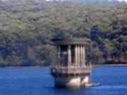
The Silvan
Reservoir precinct has always fascinated me! I first visited the area in 1958, in my first car (see pictures above!), and
in the decades which followed, I have made countless visits to the area, as a starting point for many interesting hikes in
the adacent Silvan and Olinda Forests.
In 2010, I came across rusting steel and concrete infrastructure, partly hidden in bushland next to the overflow car-park.
This fascinated me,and my research indicated that it is the remains of the original Aerial Ropeway system which carried materials from the Mt Evelyn railway siding to the construction site.
In 2010, I also discovered considerable documentation about the proposal in 1933 to build a Second Reservoir nearby. This was abandoned due to community concerns - it would have inundated most of the forest along
the Lyrebird Creek Gully.
Mainly for my own interest, I decided to document my research and findings about the history and development of the Reservoir,
Indeed, a lot of this is readily available in fragmentary form in various old print publications and monograms, on
the Internet, and at historical societies.
The digitisation of old newspapers has opened up a huge new world for heritage research, and I have used material gleaned
from the Argus and Age newspapers of the time.
I have brought together what I believe to be the salient points in a
chronological time sequence, accompanied by images and maps.
Rather than allow my research work to be hidden from the outside world, I decided to publish it on-line.
It is also held privately in digital media for future use!
I hope you find the Project informative and useful.