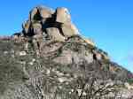
Bright Pictorial Heritage 1850 to 2011

Huggin's Lookout

Home
About this Project
Brief History of Bright
Historical Timeline
Old Tobacco Sheds and Gold Museum
Boys' Camp
Bright Cemetery
Courthouse and Lockup
Beautiful Trees in Bright
Bushfires
Memorial Arboretum
Gold Mining
Canyon Gold Sluicing Site
Freeburgh and Germantown
Forestry
Baker's Gully Reserve
Bright Railway 1890 to 1983
Early Horseraces
Early Miniature Car Races
Huggin's Lookout
Clear Spot, Apex, Tower Hill Lookouts
Walking Tracks
Wandiligong
Porepunkah
Maps
References and Bibliography

1890brighthuggins.jpg
1890 Bright from Huggin's Lookout

HUGGIN'S LOOKOUT

This lookout overlooks Bright from the south, and is reached from unsealed Baker's Gully Rd, about 3 km, starting at the end of Cobden St.
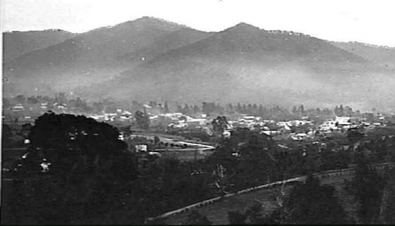
An observation platform offers magnificent views across the town to Apex Hill and Mt Porepunkah, and east towards Harrietville.
 
An alternative route is up Huggin's Rd from the east end of the town, off Coronation Drive. A walking track goes direct to the Lookout, starting at the end of Deacon Avenue.


1870brighthuggins.jpg
1870 Bright from Huggin's Lookout

1940brighthuggins.jpg
1940 Bright from Huggin's Lookout

brightnd.jpg
1900 Bright from Huggin's Lookout

1910viewofbright.jpg
1910 Bright from Huggin's Lookout

hugginsdec75.jpg
1975* December - Huggins Lookout

hugginsdec5big.jpg
1975* December - Huggins Lookout

huggins5dec2010.jpg
2010* December - Huggins Lookout

huggins4dec2010.jpg
2010* December - Huggins - new observation deck

huggins3dec2010.jpg
2010* December - Huggins

huggins2dec2010.jpg
2010* December - Huggins

hugginsrecent.jpg
2010* December - Huggins access road

Comments welcome, to  Bob Padula