|
|
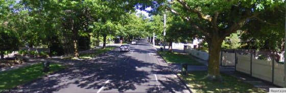
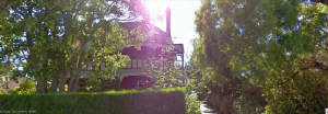
| 2013 - east end of Mont Albert Rd - looking west |
|
|
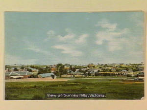
| 1908 - view of Surrey Hills district |
OVERVIEW
This Chapter looks at the early development of the eastern section of Mont Albert Rd, between the Railway Line and
Elgar Rds.
The main reason for examining this area is simply because the
author has lived in this strip since 1959, and has discovered many interesting features from interviews with past and present
residents!
The opening of Mont Albert Station in 1890 heralded large-scale
building of residential properties centred along the eastern section of Mont Albert Rd and adjacent streets, starting
at the railway line.
Across Surrey Hills, several Estates and large property
holdings were subdivided to make way for what were advertised as "Beautiful Villa Allotments with Views to the Mountains".
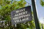
Housing development was supported by the opening of the first stores in
the Mont Albert shopping centre, appearing in the mid-1910s - the first shops in Hamilton St were at no. 3 (1900), no.5 (1912),
and no. 9 (Nelson's Laundry, 1912). Two other shops had started in 1913 at nos. 17 and 19, next to the station.
ALLOTMENT SIZES
Most
of the Surrey Hills district had been surveyed by 1880, and streets had been laid out, in preparation for the anticipated
large-scale subdivision and residential development when the Railway was opened in 1882.
Streets and individual properties
were generally one chain (62 feet) in width. Depths varied, and blocks up to 500 ft depth were not unusual.
The Government regularized residential block sizes in the 1880s, when the concept of the "quarter acre block"
was introduced across Melbourne.
Most properties
had "night clearance" laneways running along the back. Many of these are now Heritage Places, some built from bluestone. Some
are now "walkways". In the East End, one of the longest surviving laneways runs between Mont Albert Rd and Windsor Crescent,
behind View St, next to no. 402.
STREET NAMES Inu
the Whitehorse district, many streets are named after English Counties, and include Essex, Surrey and Devon. There are
many streets named after British Queens, Kings, Dignitaries, Statesmen, the Clergy. and Prime Ministers, such as
Windsor, Charles, Gladstone, St George's, Balmoral, Albert, St John's and St James, Another group of streets are named after English trees - Elm, Pine. Beech, Oak and Chestnut. In common with other municipalities
across Melbourne, changes to street names were commonplace in the early 1900s, and new streets were built. Many of the original
names set out in the early planning schemes were abandoned. Proposals for changes of names were often submitted by landowners to the Councils for endorsement. In the area around eastern
end of Mont Albert Rd, name changes included: Churchill Grange - running between
Mont Albert Rd and Windsor Crescent - renamed in 1917 to Grange St.
Pine St - running between Mont Albert Rd and Windsor Crescent - this was renamed
to View St in 1917, to link up with the existing View St running between Mont Albert Rd and Serpentine
St
Rowland St - this was a new street, running north from Mont
Albert Rd to Serpentine St, built in 1922, when the Black's Estate was being subdivided. Mont Albert Rd Extension - this was
built in the 1930s and ended at the western boundary of the Brickworks. Early maps of the 1880s show Mont Albert Rd continuing easterly
on land which would become the future brickworks area to Thurston St, then in a curve to Carrington Rd, near the Box
Hill station railway yards. Windsor Crescent. The eastern section of Windsor Crescent, extending from St Georges
Avenue to Elgar Rd was originally known as Station Rd, and renamed in 1917. Laurencia Court. This is a "stub"
street off the north side of Mont Albert Rd. It was built in 1968 on the site of a demolished house numbered no. 437.
Now, there is no "number 437"! Streeton Court. This is another "stub" street, off the south side of Mont Albert
Rd, built in 1968, on land which was originally no. 420, the site of a demolished house George St. This was renamed to Gladstone
St post-1922 STREET
TREES
The beautiful trees which now line the eastern end of Mont Albert Rd were planted
in 1936. Trees in the streets surrounding Surrey Hills station were planted in the early 1900s, as an
initiative of the Surrey Hills Progress Association.
|
| 2013 - "Lugano" |
|
| 1893 - 'Lugano" |
|
|
|
| 1887 - St George's Church |
FIRST
HOUSES In 1886, the Surrey Hills/Mont Albert locality was mostly bushland, with muddy tracks. Most
of the natural forest had been cut down and cleared from the 1850s.
South Side
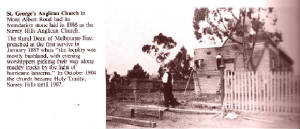
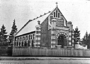
The first structure on the south side was the Surrey Hills Anglican
Church, built in 1886 - in 1908 it became Holy Trinity Surrey Hills, and subsequently St George's Anglican Church. It
was sold in the 1990s and was refurbished and converted into apartment units.
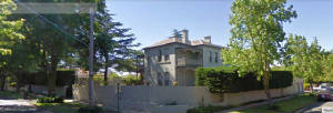
The
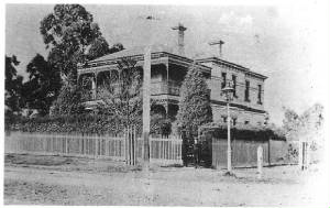
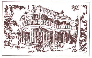
first residential houses in the strip were built in the 1890s. Only one survives, known as "Lugano", at 224 Mont Albert
Rd. This is a prominent double storey mansion, on a large block, built in 1893, with a tennis court. Other houses in
adjacent streets appeared in the same era.
North
Side
In 1910, only three houses existed between Salisbury Avenue and Elgar Rd. In the 1880s, prior to subdivision, vacant
land north of Mont Albert Rd, extending from Elgar Rd in the east to the railway reservation was owned by the Surrey
Hills Investment Company. The last large subdivision of vacant land on the eastern part of Mont Albert Rd was in 1915,
when the strip between Rowland St and Elgar Rd, and Rowland St itself, were auctioned At 12 Stanhope St. off Mont Albert Rd, there is an elegant two-storey property recorded by
the National Trust, known originally as "Elourea", then "Lydswood", built in 1892. Whilst not within the primary
study area, it is worth noting that the first structure west of the railway line on the north side of Mont Albert Rd was the
Holy Redeemer Church, built in 1902, at no 311, and survives to this day. HOUSE NUMBERING The present house numbering scheme on the strip started in 1927. Prior to then, house numbers started at Union Rd. Numbers on the south side were from 2
to 98, and on the north side from 1 to 99, House
numbers on the western side from Burke Rd to Union Rd, were from no. 1 to no. 299, and located in Camberwell, Canterbury,
Balwyn and Surrey Hills. In
1927, numbers were changed, and followed the sequence 310 to 422 (south side) and 299 to 443 (north side) It is unknown as to why the numbering ceased at Union Rd, perhaps associated with the
establishment of Box Hill as a city in 1926.
|
| c1900 - Holy Redeemer Church |
|
| 1892 - "Elouera" ("Lydswood") |
|
| 2013 - "Lydswood" |
|
|
|
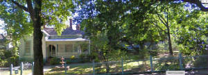
| 2013 - 1880s house at 53 Windsor Crescent |
BUILDINGS ON SOUTH SIDE Ghost
Streets
The MMBW sewerage plan of 1910 shows two "Ghost" streets"" running between Mont Albert Rd and Blenheim
Ave. These were laid out and designated John, and William Sts, but were never constructed. John St was planned on land
which was located at the site of present-day no 406, opposite what would become Rowland St. William St was to be
on land which became present-day no. 420, and later it became Streeton Court in 1968. The
land bordered by View St, Mont Albert Rd, Elgar Rd and Windsor Crescent was part of the large WIndsor Park Estate. The land between present-day Mont Albert Rd, View St, Elgar Rd, and Blenheim Ave was
owned by a Mr Magine, according to an 1880s map of the district. Blacksmith
Around 1900, a blacksmith operated from the cnr of Mont Albert Rd and Leopold Crescent. This later became
a woodyard, and then Leo Green took it over in the early 1950s when it became a car service workshop and petrol station. This survived into the 1980s when the property was sold for new apartments. State
Savings Bank This began in 1930 opposite the Hamillton St
shopping strip. It ceased in the 1990s and the building was refurbished as residential apartments.
BUILDINGS
ON NORTH SIDE
Mont Albert Veterinary Surgery
This started in 1924 from 443
Mont Albert Rd, and survives to the present day from the same location.
Black's Dairy This operated from
the early 1900s until 1926, from open paddocks behind what is now 425 Mont Albert Rd on the north side, near
Rowland St, and became a property within Black's Estate. As most
transport of the day was horse drawn, chaff, the basic constituent of horse feed, was an important commodity. The Murphy Hay
and Corn Store in Burwood Rd, Auburn, drew readily on its country connections for this and other supplies.
Soon
it was supplying chaff to many of the dairy cart-horses in the area like Balloch's bakery and, beyond to 'country' areas like
Mont Albert and Box Hill where Black's Dairy was one of Murphy's best customers.
It took a whole day to take a load
of chaff (about 40 bags) to Box Hill and to come back. Black's
Dairy had a herd of cows in paddocks, and delivered milk across the Surrey Hills district. .
|
|
|
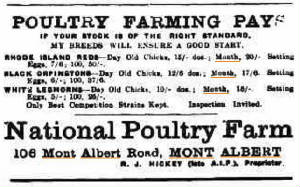
| 1917 - advert for National Poutry Farm - 106 (412) Mont Albert Rd |
OTHER
National
Poultry Farm - 412 Mont Albert Rd (old number 106)
This enterprise
started in 1917 and operated under the management of Mr. Hickey, formerly AIF, until closure in 1919. It advertised every
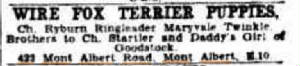
week in the Box Hill Reporter. Dog Sales - 433 Mont Albert
Rd This was a thriving business selling various varieties of dogs and puppies and operated
from 1936 until its closure in 1947.
|
| 1941 - advert for fox terriers, 433 Mont Albert Rd |
|
|