|
|
|
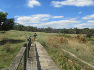
| Challenge Valley March 2017 (author) |
HISTORY The
large open paddock adjacent to the western side of Power Rd between Churchill Park Drive and Baden Powell Drive was an
important area for the 64/65 Jamboree.
The northern section was known as "Challenge Valley", where activity-based events and activities were
held as "Challenges". The centre section was known as "The Lea" ("Meadow"). supporting the Jamboree Display Area. An access
road once led from Power Rd to The Lea, which continued to Baden Powell Drive. No trace remains of this roadway, but an old
gate still exists off Baden Powell Drive. The southern section extended from The Lea to what is now the junction of Power
Rd and Baden Powell Drive. In this area were the Jamboree Bus Pickup, the Public Bus Pickup Turntable and Public Car Park.
Following the Jamboree, the area was neglected
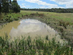
and the Lea area became a council tip in 1982. In 1990 it was taken over by Melbourne
Water as a Retarding Basin and is now heavily infested with blackberries and scrubby
plants.
Channel A watercourse passes under a bridge in Power Rd, near the entrance to the Sydney Pargeter Recreation Reserve.
This piped channel, now with very little flow, carries water from a high point in the Woodland Reserve area
next to the Brady Rd Picnic Ground, and follows the downwards slope through Challenge Valley, joining Power Rd.
It then continues as an open channel through the parklands adjacent to the Reserve,
where it then enters a further pipe, under the supporting driveway.
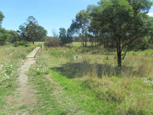
A walking
track, known as the "Wetland Walk" passes through the Challenge grassland, starting from the junction of
Brady Rd and Baden Powell Drive. It crosses the watercourse on a boardwalk and a bridge. There is also a second access track
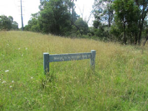
to the wetland, starting near the entrance to the soccer complex, signed as "Wonga Track to Wetland Walk".
|
|
| Locality map (2017, Landvic) |
|
| Challenge Valley - Wonga Track entrance (Mar 2017, author) |
(above) Map (Landvic 2017) showing the route of the watercourse running through Challenge
Valley
|
|
| Challenge Valley - the Dam (March 2017, author) |
|
| Challenge Valley - Wetland Walk (March 2017, author) |
|
|
 |
|
|
|
|
|
|
|
|
|


