|
NOTE! This Chapter does NOT include the 7th
Australian Scout Jamboree, held in Dec 1964/Jan1965 in Police Paddocks. Readers are invited to visit the pages dedicated
to the Jamboree, by clicking the link(s) in the Navigation Panel.
|
|
|
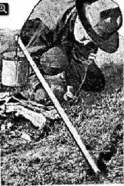
| Boy Scout at Dandenong Camp in 1910 (Weekly Times) |
THE DANDENONG CAMP
In
1910, a scout camp was held in Police Paddocks. This was a three-day event
over the New Year weekend, with attendance of some 800 scouts from Dandenong and nearby suburbs. Access was by foot, some 3 miles from Dandenong railway
station.
Senior
scouts visited the site prior to the camp, setting up tents and basic facilities, delivered by horse and cart.
No later media reports were found, suggesting that this was the only large camp ever held at this site.
Here is
an extract from an article in the Weekly Times of January 8, 1910, which reported the event:
"The first massed camp of the Imperial Boy Scouts, Victorian section,
was held in the Police Paddock at Dandenong from 1st to 3rd January, 1910.
Over
800 boys arrived on New Year's Eve by special train. They marched
over the three miles of dusty roadways by what light the moon gave - a body of sturdy juveniles,
fine warriors In embryo.
For the first part of the march the boys were kept strictly to military
"foot-sacking," then they were allowed to march at ease. They went swinging along merrily, beguiling the time with songs.
Very brave and picturesque they looked." |
|
|
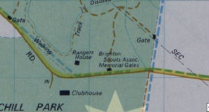
| Location of the Memorial Gates, in 1974 (Melways) |
SCOUT CAMP IN CHURCHILL NATIONAL PARK
A Scout Campsite was opened in 1940, on land leased at the extreme eastern end
of the National Park. A graded track and water supply pipeline were constructed.
In memory of the 31 scouts from the Brighton district, who died In the 1939-45 war,
a set of wrought-iron Memorial Gates was opened and dedicated on November 8, 1947. These swung on granite pillars
at the entrance to the campsite. Crushed stone for the Gates was obtained locally.
The names of the fallen soldiers were inscribed on
the pillars.
The 33 acres (13 hectares) site, was presented to the Brighton District Boy
Scouts' Association to provide camping holidays for the 700 scouts in the Brighton district.
Areas were allotted to each one of the 14 Scout groups in
the Brighton district. An open-air chapel, similar to the one at Gillwell Park (Gembrook), was erected subsequent to the opening, as a memorial to
the late Mr. C. H, Irish, a former district secretary for many years. Groups from the 2300 scouts between Port Melbourne and Hampton visited the
camp from time to time. In 1940, the site was reached
from the east (originating from what is now Hallam North Rd), which ultimately became Churchill Park Drive. There
was no vehicular road from the west at that time.
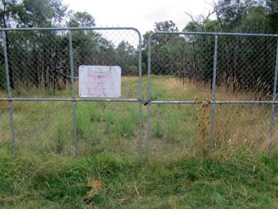
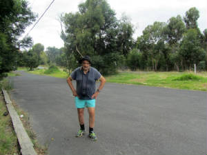
The entrance to the
site, at the eastern edge of the Park, was on Boundary Rd (now Churchill Park Drive). A visit by the author in March
2017 revealed no sign of the Memorial Gates - the entrance is now blocked by a high locked cyclone-wire fence
and gates, with a sign advising "Fire Management Track". This track passes through the former campsite (no
trace is visible) and ends about 200 metres inside the Park, at Syphon Walk.
The
gated access is known as Stonemason's Track.
The site and gates were destroyed
in the Lysterfield Bushfire in January 1973.
The Argus reported on Oct 30, 1940, that a three-day camp had been held
at the site.
|
| Locked entrance to the Scout Camp site, (author, March 2017) |
|
|
|
| Robinson Scout Reserve - old notice board at car park (author, Mar 2017) |
|
| Car park at former Robinson Scout Reserve (author Mar 2017) |
|
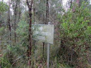
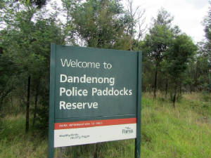
| Sign at Power Rd, next to Robinson Reserve (author, Mar 2017) |
|
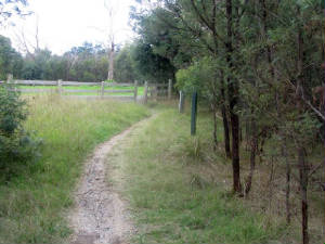
| Robinson Track (author, Mar 2017) |
ARTHUR G. ROBINSON BOY SCOUTS RESERVE
This
fenced Reserve was an outcome of the 1964/65 Jamboree, and occupied land bounded by Churchill Park Drive, Power Rd, and the
western edge of the Churchill Park Golf Club. The Reserve was destroyed by bushfires in 1973 and is now overgrown with
thick bush; a walking track passes through it starting at a small car park next to a locked gate on Churchill Park Drive,
opposite the main access gate to the Park, ending at Power Rd (opposite Landsdowne Rd). It was originally the area assigned
as the "Rover and Services Camp" during the Jamboree. An old vandalized Information Board remains,
near the car park.
The car park was built in 1963, but its purpose is unknown, possibly as an access area for the
Rover Camp.
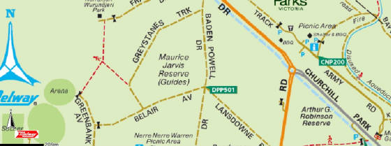
(Above) 2017 map showing location of the former Arthur G. Robinson Scout Reserve
(Landvic)
|
|
|
| Location of Jarvis camp |
MAURICE JARVIS RESERVE (Kooronga Camp Girl Scouts Australia)
This
is a large fenced area bounded by Baden Powell Drive, Belair Avenue and Greystanes Crescent.
It was set up in 1965 after the Jamboree, and contains several buildings and an outdoor chapel. Access is via a
private driveway off Baden Powell Drive and the centre is occasionally used for Guides activities. Notice Boards are
located in bushland off Graystanes Track and Belair Avenue.
|
|


