Dandenong Police Paddocks and Churchill NP - Pictorial Heritage 1837 to 2017

1964-1965 Jamboree - Information

Home
History
History of Melbourne
Geomorphology
Early Settlement
1837 Native Police Corps 1837-1838, 1843-1853
Westernport Aboriginal Protectorate 1840-1843
1840 Tirhatuan Land
1853 Victoria Police Horse Stud Depot 1853-1930
1893 Belgrave-Dandenong Pipeline
1912 Scoresby Tramway
1920s Churchill National Park - the Lagoon
1941 Churchill National Park
1915 - Dandenong Aqueduct
1946 Heany Park Lake
1942-1946 Rowville Military Camp
1964-1965 Jamboree - Information
1964-65 Jamboree - The Site
1964-1965 Jamboree Site Plan
1964-65 Jamboree - the Logistics!
1964-65 Jamboree - Around the Camp
1964-1965 Jamboree Action (Part 1)
1964-1965 Jamboree Action (Part 2)
1964-65 Jamboree Action (Part 3)
1964-1965 Jamboree Actions (Part 4)
1964-65 Jamboree Visitors' Days
1964-65 Jamboree - Religious Observances
1964-65 Jamboree Internal Roadways
1964-65 Jamboree Roadways - Baden Powell Drive
1964-65 Jamboree Roadways - Clifford Park Drive
1964-65 Jamboree Roadways - Frankston Drive
1964-65 Jamboree Roadways - Belair Avenue
1964-65 Jamboree Roadways - Greenbank Avenue
1964-65 Jamboree Roadways - Greystanes Crescent
1964-65 Jamboree Roadways - Lansdowne Rd
1964-65 Jamboree Movie Show!
Woodland Walk and Lagoon
Road History - Police Rd
Road History - Brady Road
1964-65 Jamboree - Shopping and Exhibition Area
Road History - Stud Rd Precinct
Southern Police Paddocks Land
Road History - Churchill Park Drive
Road History - Gladstone Rd
Road History - Heatherton Road
Road History - Power Road
Scout Camps and Reserves
Melbourne Water Retarding Basin
Narrandjeri Wurundjeri Park
Walking Tracks
Proposals and Plans
Epilogue
Suggestions for Investigation and correction
About the Author
About the Author
References

Note to readers: There are several Chapters devoted to the Jamboree! The Links in the Navigation Panel (at left) will take you directly to the relevant chapter.

jamboree-aerial-view.jpg

Aerial photo of Jan 1, 1965, showing "Jamboree City". The open area at centre is the "Shopping Mall" - the cluster of huts at the bottom are the Exhibition Area and the radio station (yellow arrow). The long road at right is Power Rd, Baden Powell Drive is parallel to it. Churchill Park Drive runs horizontally near centre. Churchill National Park is at top. High Voltage Power Lines cross the NP.

The cleared area at right is "Challenge Valley".

jamboree-map.jpg

(Above) Map created by the author (2017) showing the official boundaries of the Camp.

jamboree-arriving.jpg

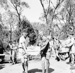
(Above) Scouts arriving at the Camp, along Baden Powell Drive. The view is to the south  (SLV)

jamboree-1964d.jpg
Bringing in the Supplies! (SLV)

OVERVIEW
A large  area of the Police Paddocks Reserve was the site of the 7th Australian Scout Jamboree, held from Thursday December 31 1964 to Sunday January 10, 1965.

It was variously and popularly known as the "Rowville Jamboree", or the "Dandenong Jamboree" or the "Challenge Valley Jamboree".

The Boy Scout Associations in forty countries, most of them in Asian and the Pacific, were represented, with about 15,000 scouts attending.  

Each of the Australian boys attending the camp  made a contribution of five shillings each towards a Brother Fund to help finance the fares of South-East Asian Scouts to the Jamboree,.

New South Wales sent a contingent of 5,000 boys

It was stipulated that boys had to be 13, and each must have spent at least ten nights under canvas in preparation for the Jamboree.

The Jamboree City had its own hospital, dentist, radio station, shopping centre, telephone exchange, banks post office, canteens, Chapels, dry cleaners, fire station, Scout Shop, Tourist Bureau and photographic shop.


jamboree-1964c.jpg
Ceylon Contingent (SLV)

jamboree-64g.jpg
Overseas scouts (SLV)

Click on any image to display a full-sized view!